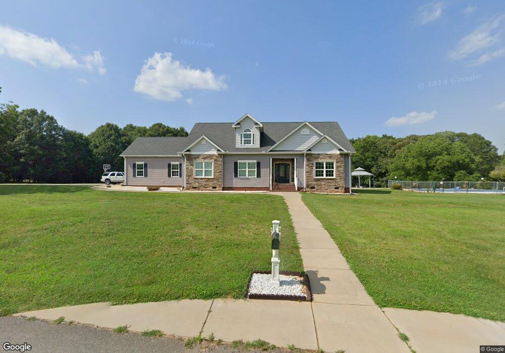
243 Thrift Rd Shelby, NC 28152
Estimated Value: $398,000 - $602,000
--
Bed
--
Bath
2,854
Sq Ft
$173/Sq Ft
Est. Value
About This Home
This home is located at 243 Thrift Rd, Shelby, NC 28152 and is currently estimated at $492,406, approximately $172 per square foot. 243 Thrift Rd is a home located in Cleveland County with nearby schools including Marion Intermediate School, Shelby Middle School, and Shelby High School.
Ownership History
Date
Name
Owned For
Owner Type
Purchase Details
Closed on
Aug 13, 2014
Sold by
Wilson Roger Keith and Wilson Myra
Bought by
Wilson Roger Keith and Wilson Myra
Current Estimated Value
Purchase Details
Closed on
Feb 29, 2012
Sold by
Wilson Roger Keith
Bought by
Wilson Roger Keith
Purchase Details
Closed on
Nov 3, 2010
Sold by
Wilson Mary Thrift and Wilson Mary Luella
Bought by
Bridges John D and Bridges Barbara S
Create a Home Valuation Report for This Property
The Home Valuation Report is an in-depth analysis detailing your home's value as well as a comparison with similar homes in the area
Home Values in the Area
Average Home Value in this Area
Purchase History
| Date | Buyer | Sale Price | Title Company |
|---|---|---|---|
| Wilson Roger Keith | -- | None Available | |
| Wilson Roger Keith | -- | None Available | |
| Bridges John D | -- | None Available |
Source: Public Records
Tax History Compared to Growth
Tax History
| Year | Tax Paid | Tax Assessment Tax Assessment Total Assessment is a certain percentage of the fair market value that is determined by local assessors to be the total taxable value of land and additions on the property. | Land | Improvement |
|---|---|---|---|---|
| 2025 | $2,928 | $564,045 | $36,653 | $527,392 |
| 2024 | $2,744 | $429,166 | $33,502 | $395,664 |
| 2023 | $2,730 | $429,166 | $33,502 | $395,664 |
| 2022 | $2,730 | $429,166 | $33,502 | $395,664 |
| 2021 | $2,744 | $429,166 | $33,502 | $395,664 |
| 2020 | $2,013 | $303,958 | $33,502 | $270,456 |
| 2019 | $2,013 | $303,958 | $33,502 | $270,456 |
| 2018 | $2,012 | $303,958 | $33,502 | $270,456 |
| 2017 | $1,962 | $303,958 | $33,502 | $270,456 |
| 2016 | $3,718 | $303,958 | $33,502 | $270,456 |
| 2015 | $2,813 | $243,529 | $33,502 | $210,027 |
| 2014 | $1,304 | $111,305 | $20,517 | $90,788 |
Source: Public Records
Map
Nearby Homes
- 114 Tanya Ln
- 124 Tanya Ln
- 1900 E Dixon Blvd
- 0 Pinecrest Dr
- 122 Pinecrest Dr
- 123 Pinecrest Dr
- 329 Aniston Ln
- 2338 Hoey Church Rd
- 0 Oates Dr
- 313 Kellom Dr
- 1108 Borders Rd
- 2111 Windermere Ln
- 4022 Lynn Cir
- 1813 Isaac Place
- The Weston Plan at Kings View
- The Linfield - II Plan at Kings View
- The Jacobs Plan at Kings View
- The Jackson Plan at Kings View
- 217 Lake George Dr
- 1805 Isaac Place
- 245 Thrift Rd
- 236 Thrift Rd
- 220 Thrift Rd
- 228 Thrift Rd
- 2046 E Marion St
- 2009 E Marion St Unit 1
- 2015 E Marion St Unit 1
- 2015 E Marion St
- 2107 E Dixon Blvd
- 2001 E Marion St
- 1932 Kendrick Cir
- 200 Nancy Dr
- 1926 Kendrick Cir
- 203 Nancy Dr
- 1936 Kendrick Cir
- 1922 Kendrick Cir
- 1929 Kendrick Cir
- 204 Nancy Dr
- 205 Nancy Dr
- 1919 Kendrick Cir