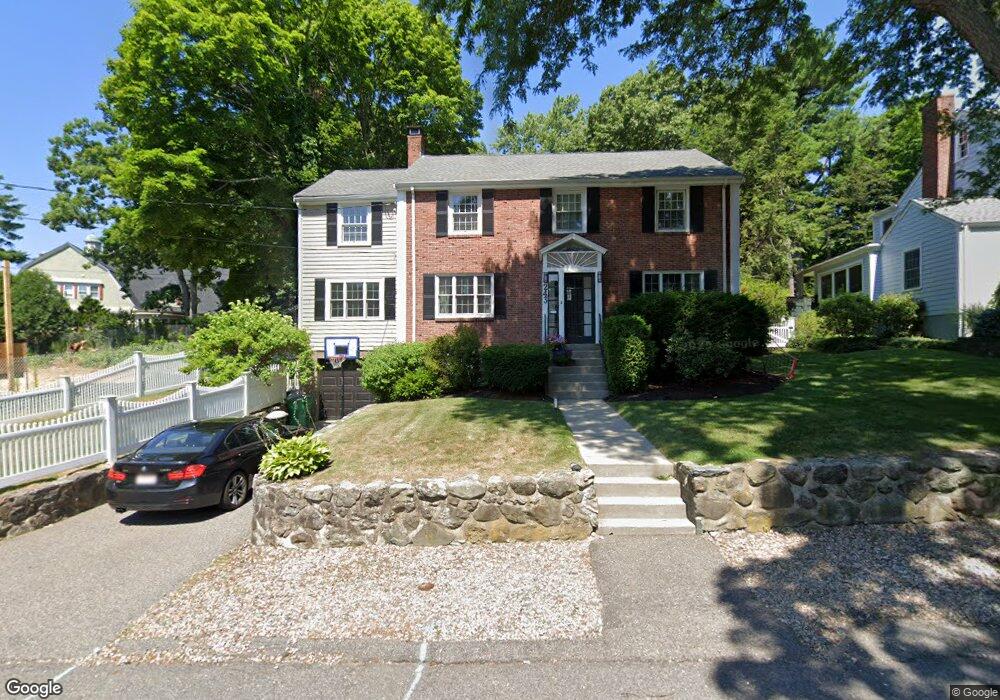
243 Upland Rd Newtonville, MA 02460
Newtonville NeighborhoodEstimated Value: $1,889,455 - $2,430,000
4
Beds
4
Baths
2,404
Sq Ft
$860/Sq Ft
Est. Value
About This Home
This home is located at 243 Upland Rd, Newtonville, MA 02460 and is currently estimated at $2,068,614, approximately $860 per square foot. 243 Upland Rd is a home located in Middlesex County with nearby schools including Cabot Elementary School, F.A. Day Middle School, and Newton North High School.
Ownership History
Date
Name
Owned For
Owner Type
Purchase Details
Closed on
Aug 31, 2009
Sold by
Adelman Steven A and Adelman Pamela J
Bought by
Pavlides Costas and Pavlides Lisa
Current Estimated Value
Purchase Details
Closed on
Jul 28, 1993
Sold by
Gauch John and Gauch Susan
Bought by
Adelman Steven A and Adelman Pamela
Purchase Details
Closed on
Jan 13, 1989
Sold by
Stanzler Paul E
Bought by
Gauch John
Create a Home Valuation Report for This Property
The Home Valuation Report is an in-depth analysis detailing your home's value as well as a comparison with similar homes in the area
Home Values in the Area
Average Home Value in this Area
Purchase History
| Date | Buyer | Sale Price | Title Company |
|---|---|---|---|
| Pavlides Costas | $790,000 | -- | |
| Adelman Steven A | $432,500 | -- | |
| Gauch John | $360,000 | -- |
Source: Public Records
Mortgage History
| Date | Status | Borrower | Loan Amount |
|---|---|---|---|
| Open | Gauch John | $703,000 | |
| Closed | Gauch John | $70,700 | |
| Closed | Gauch John | $652,000 |
Source: Public Records
Tax History Compared to Growth
Tax History
| Year | Tax Paid | Tax Assessment Tax Assessment Total Assessment is a certain percentage of the fair market value that is determined by local assessors to be the total taxable value of land and additions on the property. | Land | Improvement |
|---|---|---|---|---|
| 2025 | $16,514 | $1,685,100 | $1,234,400 | $450,700 |
| 2024 | $15,967 | $1,636,000 | $1,198,400 | $437,600 |
| 2023 | $15,158 | $1,489,000 | $917,100 | $571,900 |
| 2022 | $14,504 | $1,378,700 | $849,200 | $529,500 |
| 2021 | $2,052 | $1,300,700 | $801,100 | $499,600 |
| 2020 | $2,044 | $1,300,700 | $801,100 | $499,600 |
| 2019 | $2,203 | $1,262,800 | $777,800 | $485,000 |
| 2018 | $12,638 | $1,168,000 | $701,400 | $466,600 |
| 2017 | $5,393 | $1,101,900 | $661,700 | $440,200 |
| 2016 | $11,719 | $1,029,800 | $618,400 | $411,400 |
| 2015 | $11,173 | $962,400 | $577,900 | $384,500 |
Source: Public Records
Map
Nearby Homes
- 127-129 Withington Rd Unit 1
- 3 Cedar St
- 300 Cabot St
- 34 Morton Rd
- 44 Blake St Unit 2
- 110 Harvard St Unit A
- 887 Commonwealth Ave
- 10 Washington Park
- 10 Washington Park Unit 2
- 10 Washington Park Unit 1
- 22 Walnut Place Unit 1
- 61 Lakeview Ave
- 48 Harvard St Unit 1
- 1004 Centre St
- 911 Washington St
- 935 Washington St Unit 8
- 60 Chapin Rd
- 957 Washington St Unit 1
- 123-125 Mount Vernon St
- 123 Mount Vernon St Unit 2