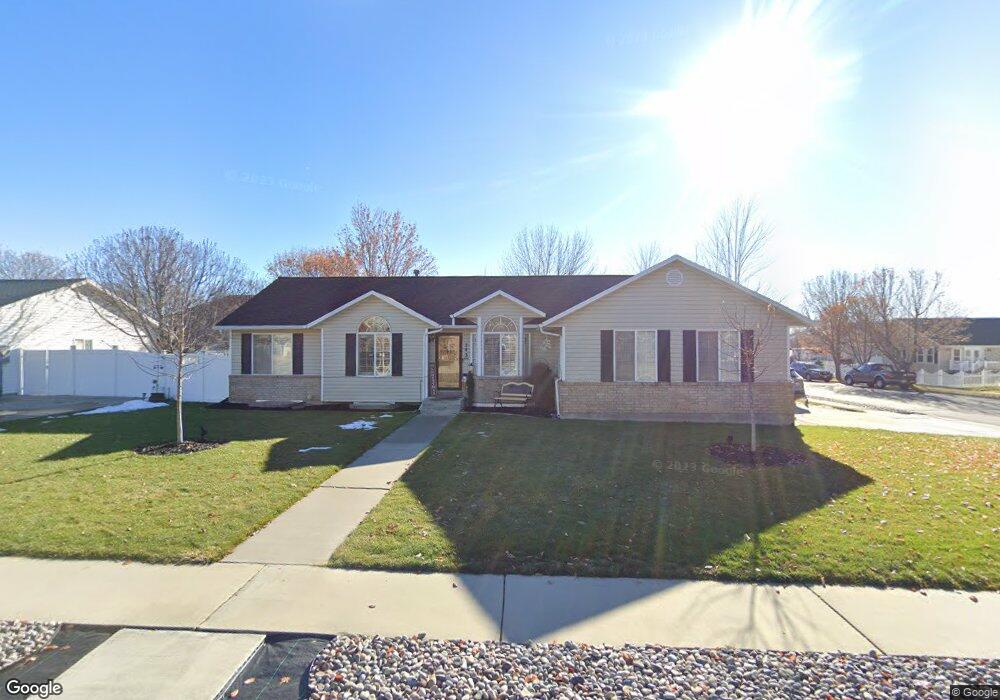
243 W 1450 N American Fork, UT 84003
Estimated Value: $580,000 - $727,000
3
Beds
2
Baths
2,890
Sq Ft
$222/Sq Ft
Est. Value
About This Home
This home is located at 243 W 1450 N, American Fork, UT 84003 and is currently estimated at $641,241, approximately $221 per square foot. 243 W 1450 N is a home located in Utah County with nearby schools including Legacy Elementary School, American Fork Junior High School, and American Fork High School.
Ownership History
Date
Name
Owned For
Owner Type
Purchase Details
Closed on
Mar 21, 2024
Sold by
Swanson Peggy
Bought by
Swanson Peggy
Current Estimated Value
Home Financials for this Owner
Home Financials are based on the most recent Mortgage that was taken out on this home.
Original Mortgage
$40,000
Outstanding Balance
$39,352
Interest Rate
6.77%
Mortgage Type
Credit Line Revolving
Estimated Equity
$601,889
Purchase Details
Closed on
Jul 6, 1998
Sold by
Babb Stephen R and Babb Anita A
Bought by
Swanson Donald K and Swanson Peggy
Home Financials for this Owner
Home Financials are based on the most recent Mortgage that was taken out on this home.
Original Mortgage
$133,200
Interest Rate
7.03%
Purchase Details
Closed on
Sep 3, 1996
Sold by
Sparks Iva Lue and Sparks Ray Arthur
Bought by
Babb Stephen R and Babb Anita A
Create a Home Valuation Report for This Property
The Home Valuation Report is an in-depth analysis detailing your home's value as well as a comparison with similar homes in the area
Home Values in the Area
Average Home Value in this Area
Purchase History
| Date | Buyer | Sale Price | Title Company |
|---|---|---|---|
| Swanson Peggy | -- | Metro National Title | |
| Swanson Donald K | -- | -- | |
| Babb Stephen R | -- | -- |
Source: Public Records
Mortgage History
| Date | Status | Borrower | Loan Amount |
|---|---|---|---|
| Open | Swanson Peggy | $40,000 | |
| Previous Owner | Swanson Donald K | $133,200 |
Source: Public Records
Tax History Compared to Growth
Tax History
| Year | Tax Paid | Tax Assessment Tax Assessment Total Assessment is a certain percentage of the fair market value that is determined by local assessors to be the total taxable value of land and additions on the property. | Land | Improvement |
|---|---|---|---|---|
| 2025 | $2,463 | $295,900 | $223,500 | $314,500 |
| 2024 | $2,463 | $273,680 | $0 | $0 |
| 2023 | $2,308 | $271,865 | $0 | $0 |
| 2022 | $2,521 | $293,095 | $0 | $0 |
| 2021 | $2,160 | $392,200 | $160,400 | $231,800 |
| 2020 | $2,021 | $355,900 | $143,200 | $212,700 |
| 2019 | $1,880 | $342,400 | $132,500 | $209,900 |
| 2018 | $1,796 | $312,800 | $125,300 | $187,500 |
| 2017 | $1,747 | $164,175 | $0 | $0 |
| 2016 | $1,635 | $142,780 | $0 | $0 |
| 2015 | -- | $137,280 | $0 | $0 |
| 2014 | $1,499 | $122,540 | $0 | $0 |
Source: Public Records
Map
Nearby Homes