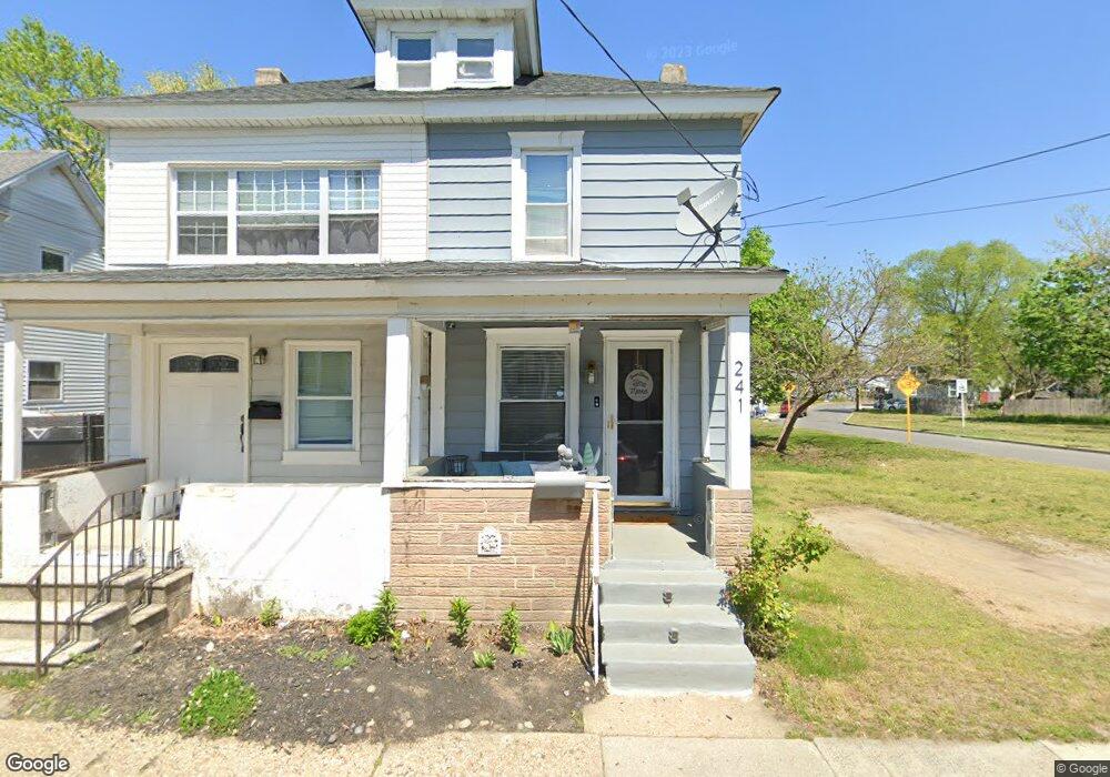
243 W Adams St Paulsboro, NJ 08066
Estimated Value: $138,000 - $208,000
3
Beds
1
Bath
1,030
Sq Ft
$175/Sq Ft
Est. Value
About This Home
This home is located at 243 W Adams St, Paulsboro, NJ 08066 and is currently estimated at $180,667, approximately $175 per square foot. 243 W Adams St is a home located in Gloucester County with nearby schools including Billingsport Elementary School, Loudenslager Elementary School, and Paulsboro High School.
Ownership History
Date
Name
Owned For
Owner Type
Purchase Details
Closed on
May 27, 2022
Sold by
Edward Ethridge
Bought by
Lost Properties Llc
Current Estimated Value
Purchase Details
Closed on
Oct 9, 2015
Sold by
Helston Investments Llc
Bought by
Ethridge Edward M
Purchase Details
Closed on
Feb 28, 2011
Sold by
Hamilton Karen
Bought by
Helston Investments Llc
Create a Home Valuation Report for This Property
The Home Valuation Report is an in-depth analysis detailing your home's value as well as a comparison with similar homes in the area
Home Values in the Area
Average Home Value in this Area
Purchase History
| Date | Buyer | Sale Price | Title Company |
|---|---|---|---|
| Lost Properties Llc | $47,000 | Homestead Title | |
| Lost Properties Llc | $47,000 | Homestead Title | |
| Ethridge Edward M | $25,000 | Fidelity Title Abstract Co | |
| Helston Investments Llc | -- | None Available |
Source: Public Records
Tax History Compared to Growth
Tax History
| Year | Tax Paid | Tax Assessment Tax Assessment Total Assessment is a certain percentage of the fair market value that is determined by local assessors to be the total taxable value of land and additions on the property. | Land | Improvement |
|---|---|---|---|---|
| 2025 | $2,922 | $66,400 | $11,500 | $54,900 |
| 2024 | $2,409 | $66,400 | $11,500 | $54,900 |
| 2023 | $2,409 | $54,800 | $11,500 | $43,300 |
| 2022 | $2,365 | $54,800 | $11,500 | $43,300 |
| 2021 | $2,319 | $54,800 | $11,500 | $43,300 |
| 2020 | $2,305 | $54,800 | $11,500 | $43,300 |
| 2019 | $2,233 | $54,800 | $11,500 | $43,300 |
| 2018 | $2,105 | $54,800 | $11,500 | $43,300 |
| 2017 | $2,096 | $54,800 | $11,500 | $43,300 |
| 2016 | $1,997 | $54,800 | $11,500 | $43,300 |
| 2015 | $1,985 | $54,800 | $11,500 | $43,300 |
| 2014 | $2,236 | $66,400 | $15,500 | $50,900 |
Source: Public Records
Map
Nearby Homes
- 227 W Buck St
- 1043 Penn Line Rd
- 269 W Broad St
- 129 W Washington St
- 122 W Washington St
- 140 142 W Jefferson St
- 335 W Buck St
- L18 20 W Broad St
- 344 W Washington St
- 28 W Jefferson St
- 21 W Adams St
- 11 W Washington St
- 1519 Pine St
- 1534 Pine St
- 46 Roosevelt St
- 28 E Adams St
- 27 29 E Adams St
- 53-55 Roosevelt St
- 255 Elizabeth Ave
- 106 E Adams St
- 241 W Adams St
- 245 W Adams St
- 1047 Penn Line Rd
- 255 W Adams St
- 1014 Hoffman Ave
- 1012 Hoffman Ave Unit 1014
- 254 W Adams St
- 250 W Adams St
- 1035 Penn Line Rd
- 242 W Adams St
- 266 W Adams St
- 227 W Adams St
- 238 W Adams St
- 1031 Penn Line Rd
- 225 W Adams St
- 1003 Hoffman Ave
- 237 W Washington St
- 1000 Hoffman Ave
- 257 W Washington St
- 272 W Adams St