2430 Lone Oak Rd Unit 1 Houston, TX 77093
Estimated payment $857/month
Highlights
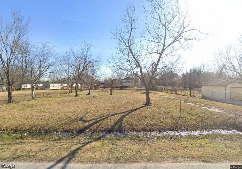
- 0.41 Acre Lot
- Fenced
- Patio Home
About This Lot
Don't miss out on the opportunity to build your new home, minutes away from Downtown Houston and IAH. This Vacant lot is now available for your new home. Located near Highway 59, it is conveniently situated within minutes of shopping, downtown Houston, IAH Airport, and other amenities.
Property Details
Property Type
- Land
Est. Annual Taxes
- $940
Lot Details
- 0.41 Acre Lot
- Fenced
- Cleared Lot
Home Design
- Patio Home
Schools
- Scarborough Elementary School
- Patrick Henry Middle School
- Sam Houston Math Science And Technology Center High School
Utilities
- Phone Available
- Cable TV Available
Community Details
- Woodsdale Subdivision
Map
Home Values in the Area
Average Home Value in this Area
Tax History
| Year | Tax Paid | Tax Assessment Tax Assessment Total Assessment is a certain percentage of the fair market value that is determined by local assessors to be the total taxable value of land and additions on the property. | Land | Improvement |
|---|---|---|---|---|
| 2025 | $923 | $52,500 | $52,500 | -- |
| 2024 | $923 | $52,500 | $52,500 | -- |
| 2023 | $923 | $52,500 | $52,500 | -- |
| 2022 | $976 | $52,500 | $52,500 | $0 |
| 2021 | $1,036 | $52,500 | $52,500 | $0 |
| 2020 | $1,078 | $52,500 | $52,500 | $0 |
| 2019 | $1,125 | $52,500 | $52,500 | $0 |
| 2018 | $750 | $35,000 | $35,000 | $0 |
| 2017 | $750 | $35,000 | $35,000 | $0 |
| 2016 | $750 | $35,000 | $35,000 | $0 |
| 2015 | $749 | $35,000 | $35,000 | $0 |
| 2014 | $749 | $35,000 | $35,000 | $0 |
Property History
| Date | Event | Price | List to Sale | Price per Sq Ft |
|---|---|---|---|---|
| 03/14/2026 03/14/26 | For Sale | $149,900 | -- | -- |
Purchase History
| Date | Type | Sale Price | Title Company |
|---|---|---|---|
| Warranty Deed | -- | First American Title | |
| Special Warranty Deed | -- | Netco |
Mortgage History
| Date | Status | Loan Amount | Loan Type |
|---|---|---|---|
| Previous Owner | $56,392 | Stand Alone First |
Source: Houston Association of REALTORS®
MLS Number: 41531907
APN: 0630530000056
Disclaimer: Certain information contained herein is derived from information provided by parties other than Homes.com. All information provided is deemed reliable, but is not guaranteed to be accurate and should be independently verified.
![]() Copyright 2026, Houston REALTORS® Information Service, Inc.
Copyright 2026, Houston REALTORS® Information Service, Inc.
The information provided is exclusively for consumers’ personal, non-commercial use, and may not be used for any purpose other than to identify prospective properties consumers may be interested in purchasing.
Information is deemed reliable but not guaranteed.
- 2502 Lone Oak Rd
- 2506 Lone Oak Rd
- 2414 Lone Oak Rd
- 2512 Lone Oak Rd
- 2523 Lone Oak Rd
- 2527 Lone Oak Rd
- 2530 Kowis St
- 0 Kowis
- 2636 Lone Oak Rd
- 2629 Kowis St
- 2237 Cromwell St
- 2522 Kowis St
- 2311 Warwick Rd
- 1728 Little York Rd
- 2315 Langley Rd
- 2909 Rosemary Ln
- 2306 Langley Rd
- 2304 Langley Rd
- 2332 Margaret St
- 3007 Trenton Rd
- 2817 Rosemary Ln
- 2444 Margaret St Unit A
- 2505 Deutser St
- 10316 Aldine Westfield Rd
- 2429 Parker Rd
- 2427 Parker Rd
- 3531 Cedar Hill Ln Unit 2
- 2501 Parker Rd
- 1114 Cresline St
- 12501 W Hardy Rd
- 3709 Gager St Unit 2
- 3709 Gager St Unit 1
- 513 Mayford St
- 1014 Roxella St Unit A
- 1014 Roxella St
- 11418 Carla St
- 3824 Topping St
- 10221 Silvercrest St
- 417 Stonework Oaks Ln
- 405 Stonework Garden Ln

Ask me questions while you tour the home.