Estimated Value: $287,000 - $458,534
3
Beds
2
Baths
1,896
Sq Ft
$187/Sq Ft
Est. Value
About This Home
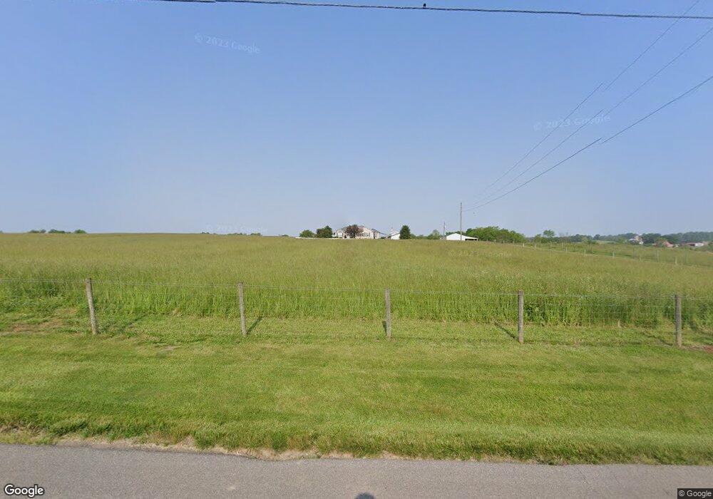
This home is located at 2430 N Jim Day Rd, Salem, IN 47167 and is currently estimated at $354,511, approximately $186 per square foot. 2430 N Jim Day Rd is a home located in Washington County with nearby schools including Bradie M. Shrum Lower Elementary School, Salem Middle School, and Salem High School.
Ownership History
Date
Name
Owned For
Owner Type
Purchase Details
Closed on
Jan 12, 2024
Sold by
Lyles R Dale R and Lyles Sherry L
Bought by
Dale Lyles And Sherry Lynn Lyles Living Trust and Lyles
Current Estimated Value
Purchase Details
Closed on
Nov 9, 2021
Sold by
Lyles R Dale R and Lyles Sherry L
Bought by
Lyles R Dale R and Lyles Sherry L
Home Financials for this Owner
Home Financials are based on the most recent Mortgage that was taken out on this home.
Original Mortgage
$200,000
Interest Rate
3.01%
Mortgage Type
Purchase Money Mortgage
Create a Home Valuation Report for This Property
The Home Valuation Report is an in-depth analysis detailing your home's value as well as a comparison with similar homes in the area
Home Values in the Area
Average Home Value in this Area
Purchase History
| Date | Buyer | Sale Price | Title Company |
|---|---|---|---|
| Dale Lyles And Sherry Lynn Lyles Living Trust | -- | None Listed On Document | |
| Lyles R Dale R | -- | None Listed On Document |
Source: Public Records
Mortgage History
| Date | Status | Borrower | Loan Amount |
|---|---|---|---|
| Previous Owner | Lyles R Dale R | $200,000 |
Source: Public Records
Tax History Compared to Growth
Tax History
| Year | Tax Paid | Tax Assessment Tax Assessment Total Assessment is a certain percentage of the fair market value that is determined by local assessors to be the total taxable value of land and additions on the property. | Land | Improvement |
|---|---|---|---|---|
| 2024 | $2,641 | $276,800 | $56,200 | $220,600 |
| 2023 | $2,341 | $255,000 | $50,100 | $204,900 |
| 2022 | $2,222 | $239,900 | $43,800 | $196,100 |
| 2021 | $1,826 | $207,000 | $40,500 | $166,500 |
| 2020 | $1,616 | $191,300 | $40,300 | $151,000 |
| 2019 | $1,625 | $195,900 | $44,700 | $151,200 |
| 2018 | $1,507 | $184,900 | $45,500 | $139,400 |
| 2017 | $1,422 | $189,400 | $49,300 | $140,100 |
| 2016 | $1,325 | $191,300 | $51,100 | $140,200 |
| 2014 | $1,226 | $193,700 | $49,100 | $144,600 |
| 2013 | $1,074 | $182,800 | $41,300 | $141,500 |
Source: Public Records
Map
Nearby Homes
- 540 Colony Dr
- 2535 E Nathans Run
- 3751 N Shell Ln
- 905 Locust St
- 501 E Homer St
- 808 Locust St
- 800 Hayes Ave
- 801 N College Ave
- 115 Nichols Ave
- 404 E Mulberry St
- 505 Riverview Dr
- 207 Southern Ave
- 102 Mahuron Dr
- 207 E Market St
- 301 E Market St
- 805 Smith St
- 406 W Mulberry St
- (Tract 2) 5484 State Road 135
- 303 W Market St
- 52 Public Square
- 1542 E Lewellen Rd
- 1828 N Jim Day Rd
- 1224 E Lewellen Rd
- 1062 E Lewellen Rd
- 1706 E Lewellen Rd
- 747 E Lewellen Rd
- 960 E Lewellen Rd
- 1500 Rc Morris Dr
- 1672 N Jim Day Rd
- 2531 N State Road 135
- 1925 N State Road 135
- 1724 E Lewellen Rd
- 1906 E Lewellen Rd
- 2279 N State Road 135
- 2381 N State Road 135
- 2365 N State Road 135
- 2219 N State Road 135
- 2235 N State Road 135
- 2063 N State Road 135
- 2129 N State Road 135