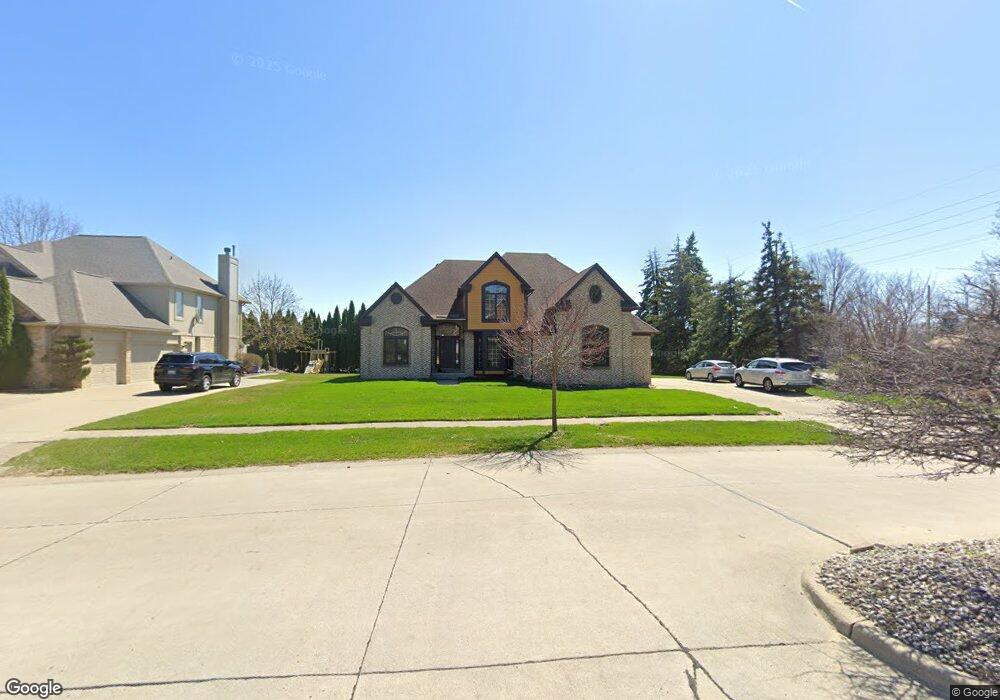
2432 Burningbush Dr Unit Bldg-Unit Sterling Heights, MI 48314
Estimated Value: $557,122 - $607,000
4
Beds
3
Baths
2,749
Sq Ft
$211/Sq Ft
Est. Value
About This Home
This home is located at 2432 Burningbush Dr Unit Bldg-Unit, Sterling Heights, MI 48314 and is currently estimated at $581,031, approximately $211 per square foot. 2432 Burningbush Dr Unit Bldg-Unit is a home located in Macomb County with nearby schools including Schwarzkoff Elementary School, Frank Jeannette Junior High School, and Adlai Stevenson High School.
Ownership History
Date
Name
Owned For
Owner Type
Purchase Details
Closed on
May 30, 2008
Sold by
Pauls Katrina
Bought by
Pataria Jasjit K
Current Estimated Value
Purchase Details
Closed on
Nov 13, 2006
Sold by
U S Bank Na
Bought by
U S Bank Na and Home Equity Loan Trust 2004-He7
Purchase Details
Closed on
Apr 7, 2006
Sold by
Chung Yang Chin and Chung Sooneung
Bought by
U S Bank Na and Home Equity Loan Trust 2004-He7
Purchase Details
Closed on
Mar 28, 2000
Sold by
Bravo Homes Llc
Bought by
Chung Yang C
Create a Home Valuation Report for This Property
The Home Valuation Report is an in-depth analysis detailing your home's value as well as a comparison with similar homes in the area
Home Values in the Area
Average Home Value in this Area
Purchase History
| Date | Buyer | Sale Price | Title Company |
|---|---|---|---|
| Pataria Jasjit K | $282,500 | Great Lakes Title Of Mi | |
| U S Bank Na | -- | None Available | |
| U S Bank Na | $350,107 | None Available | |
| Chung Yang C | $327,500 | -- |
Source: Public Records
Tax History Compared to Growth
Tax History
| Year | Tax Paid | Tax Assessment Tax Assessment Total Assessment is a certain percentage of the fair market value that is determined by local assessors to be the total taxable value of land and additions on the property. | Land | Improvement |
|---|---|---|---|---|
| 2025 | $6,476 | $275,000 | $0 | $0 |
| 2024 | $5,922 | $256,000 | $0 | $0 |
| 2023 | $5,591 | $230,100 | $0 | $0 |
| 2022 | $5,828 | $209,000 | $0 | $0 |
| 2021 | $5,708 | $204,000 | $0 | $0 |
| 2020 | $5,091 | $202,500 | $0 | $0 |
| 2019 | $5,215 | $193,500 | $0 | $0 |
| 2018 | $5,274 | $181,200 | $0 | $0 |
| 2017 | $5,039 | $176,300 | $27,500 | $148,800 |
| 2016 | $4,868 | $176,300 | $0 | $0 |
| 2015 | -- | $163,700 | $0 | $0 |
| 2014 | -- | $136,000 | $0 | $0 |
Source: Public Records
Map
Nearby Homes
- 6331 Seminole Dr
- 43229 Dequindre Rd
- 43224 Dequindre Rd
- 2931 Briarwood Dr
- 2937 E Square Lake Rd
- 6120 Evanswood Rd
- 5973 Stella
- 1917 Ravenhill Dr
- 2403 E Square Lake Rd
- 42739 Pond View Dr
- 2410 Pondview Ln
- 3569 Galaxy Blvd Unit 30
- 2741 Denise Dr
- 2326 Pondview Ln
- 2298 Pondview Ln
- 42192 Dequindre Rd
- 2684 Coral Dr
- 5982 Slate Dr
- 44258 Constellation Dr Unit 36
- 6190 Silverstone Dr
- 2432 Burningbush Dr
- 43750 Dequindre Rd
- 2450 Burningbush Dr
- 2474 Sonoma Ct
- 2441 Sonoma Ct
- 2468 Burningbush Dr
- 2423 Burningbush Dr
- 2441 Burningbush Dr
- 2985 Ranieri Dr
- 2486 Burningbush Dr
- 2459 Burningbush Dr
- 2973 Ranieri Dr
- 2477 Burningbush Dr
- 2959 Ranieri Dr
- 2496 Burningbush Dr
- 2463 Parsley Ct
- 2958 Ranieri Dr
- 2349 Haff Dr
- 43651 Dequindre Rd Unit Bldg-Unit
- 43651 Dequindre Rd