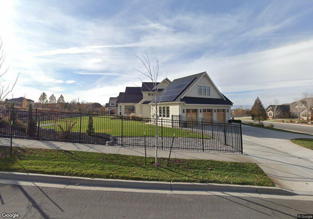
2432 S Lookout Ridge Dr W Unit 39 Mapleton, UT 84664
Estimated Value: $2,333,000 - $3,085,758
4
Beds
7
Baths
4,924
Sq Ft
$556/Sq Ft
Est. Value
About This Home
This home is located at 2432 S Lookout Ridge Dr W Unit 39, Mapleton, UT 84664 and is currently estimated at $2,735,586, approximately $555 per square foot. 2432 S Lookout Ridge Dr W Unit 39 is a home located in Utah County with nearby schools including Maple Ridge Elementary, Mapleton Junior High School, and Maple Mountain High School.
Ownership History
Date
Name
Owned For
Owner Type
Purchase Details
Closed on
Jun 1, 2016
Sold by
Wilson Investment Properties Marpleton L
Bought by
Ball Andrew
Current Estimated Value
Purchase Details
Closed on
Jan 15, 2015
Sold by
Brotherson David Daniel
Bought by
Wilson Investment Properties Mapleton Ll
Purchase Details
Closed on
May 29, 2014
Sold by
Tc At Mapleton Llc
Bought by
Brotherson David Daniel
Home Financials for this Owner
Home Financials are based on the most recent Mortgage that was taken out on this home.
Original Mortgage
$137,520
Interest Rate
4.23%
Mortgage Type
New Conventional
Create a Home Valuation Report for This Property
The Home Valuation Report is an in-depth analysis detailing your home's value as well as a comparison with similar homes in the area
Home Values in the Area
Average Home Value in this Area
Purchase History
| Date | Buyer | Sale Price | Title Company |
|---|---|---|---|
| Ball Andrew | -- | Old Republic Title | |
| Wilson Investment Properties Mapleton Ll | -- | Highland Title | |
| Brotherson David Daniel | -- | Meridian Title Co |
Source: Public Records
Mortgage History
| Date | Status | Borrower | Loan Amount |
|---|---|---|---|
| Previous Owner | Brotherson David Daniel | $137,520 |
Source: Public Records
Tax History Compared to Growth
Tax History
| Year | Tax Paid | Tax Assessment Tax Assessment Total Assessment is a certain percentage of the fair market value that is determined by local assessors to be the total taxable value of land and additions on the property. | Land | Improvement |
|---|---|---|---|---|
| 2025 | $11,862 | $1,358,600 | $533,500 | $1,934,800 |
| 2024 | $11,862 | $1,161,985 | $0 | $0 |
| 2023 | $11,744 | $1,157,750 | $0 | $0 |
| 2022 | $11,041 | $1,954,900 | $541,700 | $1,413,200 |
| 2021 | $9,538 | $1,426,000 | $338,900 | $1,087,100 |
| 2020 | $9,417 | $1,361,900 | $316,600 | $1,045,300 |
| 2019 | $5,192 | $765,800 | $266,600 | $499,200 |
| 2018 | $3,442 | $266,300 | $266,300 | $0 |
| 2017 | $2,695 | $201,200 | $0 | $0 |
| 2016 | $2,414 | $179,100 | $0 | $0 |
| 2015 | $2,320 | $171,100 | $0 | $0 |
| 2014 | -- | $135,800 | $0 | $0 |
Source: Public Records
Map
Nearby Homes
- 525 N 1550 W Unit COLUMB
- 525 N 1550 W Unit WINDSO
- 525 N 1550 W Unit HILDAL
- 525 N 1550 W Unit 1
- 3713 S White Ash Dr
- 525 N 1550 W Unit BALLAR
- 525 N 1550 W Unit CALDWE
- 525 N 1550 W Unit DREXEL
- 525 N 1550 W Unit MORGAN
- 525 N 1550 W Unit WAKEFI
- 525 N 1550 W Unit ARDEN
- 3958 S Sage Wood Ave Unit CHAMBE
- 1767 S 800 W
- 1827 Hillcrest Cir
- The Cottonwood Plan at Park Estates
- The Bonsai Plan at Park Estates
- The Juniper Plan at Park Estates
- The Cherry Plan at Park Estates
- The Magnolia Plan at Park Estates
- The Silk Plan at Park Estates
- 2432 S Lookout Ridge Dr W
- 731 W Triple Crown Dr
- 1061 S 1550 W Unit 13
- 1022 S 1550 W Unit 4
- 1022 S 1550 W
- 1017 S 1550 W Unit 12
- 1076 S 1550 W Unit 3
- 757 W Triple Crown Dr Unit 38
- 757 W Triple Crown Dr Unit 38
- 2482 S Lookout Ridge Dr Unit 40
- 742 W Triple Crown Dr Unit 33
- 2443 S Lookout Ridge Dr
- 2443 S Lookout Ridge Dr
- 2352 S Lookout Ridge Dr
- 2347 S Lookout Ridge Dr
- 768 W Triple Crown Dr
- 2503 S Lookout Ridge Dr
- 779 W Triple Crown Dr
- 2347 S Lookout Ridge Dr
- 2503 S Lookout Ridge Dr