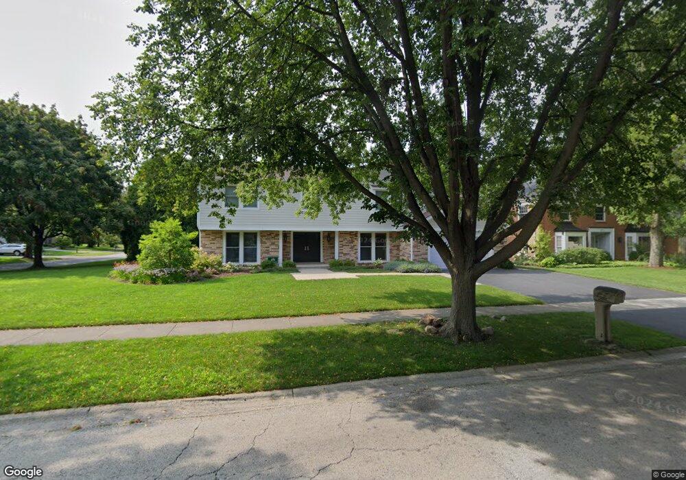
2432 The Strand Northbrook, IL 60062
Estimated Value: $938,843 - $1,157,000
4
Beds
4
Baths
3,193
Sq Ft
$330/Sq Ft
Est. Value
About This Home
This home is located at 2432 The Strand, Northbrook, IL 60062 and is currently estimated at $1,052,461, approximately $329 per square foot. 2432 The Strand is a home located in Cook County with nearby schools including Wescott Elementary School, Maple School, and Glenbrook North High School.
Ownership History
Date
Name
Owned For
Owner Type
Purchase Details
Closed on
Apr 12, 2017
Sold by
Carpenter Samuel C and Carpenter Aleatha K
Bought by
Ryan Matthew M and Ryan Sara L
Current Estimated Value
Home Financials for this Owner
Home Financials are based on the most recent Mortgage that was taken out on this home.
Original Mortgage
$395,000
Outstanding Balance
$190,416
Interest Rate
3.25%
Mortgage Type
New Conventional
Estimated Equity
$862,045
Purchase Details
Closed on
Jul 7, 2004
Sold by
Cherney Merle S
Bought by
Carpenter Samuel C and Carpenter Aleatha K
Home Financials for this Owner
Home Financials are based on the most recent Mortgage that was taken out on this home.
Original Mortgage
$629,000
Interest Rate
1.17%
Mortgage Type
Unknown
Create a Home Valuation Report for This Property
The Home Valuation Report is an in-depth analysis detailing your home's value as well as a comparison with similar homes in the area
Home Values in the Area
Average Home Value in this Area
Purchase History
| Date | Buyer | Sale Price | Title Company |
|---|---|---|---|
| Ryan Matthew M | $695,000 | Barrister Title | |
| Carpenter Samuel C | $740,000 | Multiple |
Source: Public Records
Mortgage History
| Date | Status | Borrower | Loan Amount |
|---|---|---|---|
| Open | Ryan Matthew M | $395,000 | |
| Previous Owner | Carpenter Samuel C | $629,000 |
Source: Public Records
Tax History
| Year | Tax Paid | Tax Assessment Tax Assessment Total Assessment is a certain percentage of the fair market value that is determined by local assessors to be the total taxable value of land and additions on the property. | Land | Improvement |
|---|---|---|---|---|
| 2025 | $16,234 | $92,000 | $38,586 | $53,414 |
| 2024 | $16,234 | $72,000 | $32,700 | $39,300 |
| 2023 | $15,768 | $72,000 | $32,700 | $39,300 |
| 2022 | $15,768 | $72,000 | $32,700 | $39,300 |
| 2021 | $16,289 | $66,052 | $15,696 | $50,356 |
| 2020 | $16,186 | $66,052 | $15,696 | $50,356 |
| 2019 | $15,576 | $72,585 | $15,696 | $56,889 |
| 2018 | $16,125 | $69,500 | $13,734 | $55,766 |
| 2017 | $15,808 | $69,500 | $13,734 | $55,766 |
| 2016 | $16,851 | $80,851 | $13,734 | $67,117 |
| 2015 | $15,570 | $67,650 | $11,118 | $56,532 |
| 2014 | $15,195 | $67,650 | $11,118 | $56,532 |
| 2013 | $14,986 | $67,650 | $11,118 | $56,532 |
Source: Public Records
Map
Nearby Homes
- 2571 Essex Dr
- 2431 Cobblewood Dr Unit 9
- 2050 Valencia Dr Unit 300C
- 2050 Valencia Dr Unit 405C
- 3005 Highland Rd
- 1943 Sunnyside Cir
- 102 Yale Ct Unit 34LH10
- 2090 Shermer Rd
- 3263 Doriann Dr
- 3293 Doriann Dr
- 1904 Somerset Ln Unit 48
- 3820 Kiess Dr
- 3800 Kiess Dr
- 3240 Brookdale Ln
- 2803 Wildflower Ct
- 1817 Somerset Ln Unit 24
- 1941 Kingsley Cir
- 250 Violet Ln
- 240 Violet Ln
- 1772 Lancaster Way
- 2426 The Strand
- 2437 Newport Rd
- 2440 The Strand
- 2439 The Strand
- 2431 The Strand
- 2443 The Strand
- 2432 Newport Rd
- 2420 The Strand
- 2429 Newport Rd
- 2529 Kingston Dr
- 2423 The Strand
- 2515 Kingston Dr
- 2450 The Strand
- 2541 Kingston Dr
- 2449 The Strand
- 2464 Greenview Rd
- 2580 Prince St
- 2452 Greenview Rd
- 2415 The Strand
- 2426 Newport Rd
Your Personal Tour Guide
Ask me questions while you tour the home.