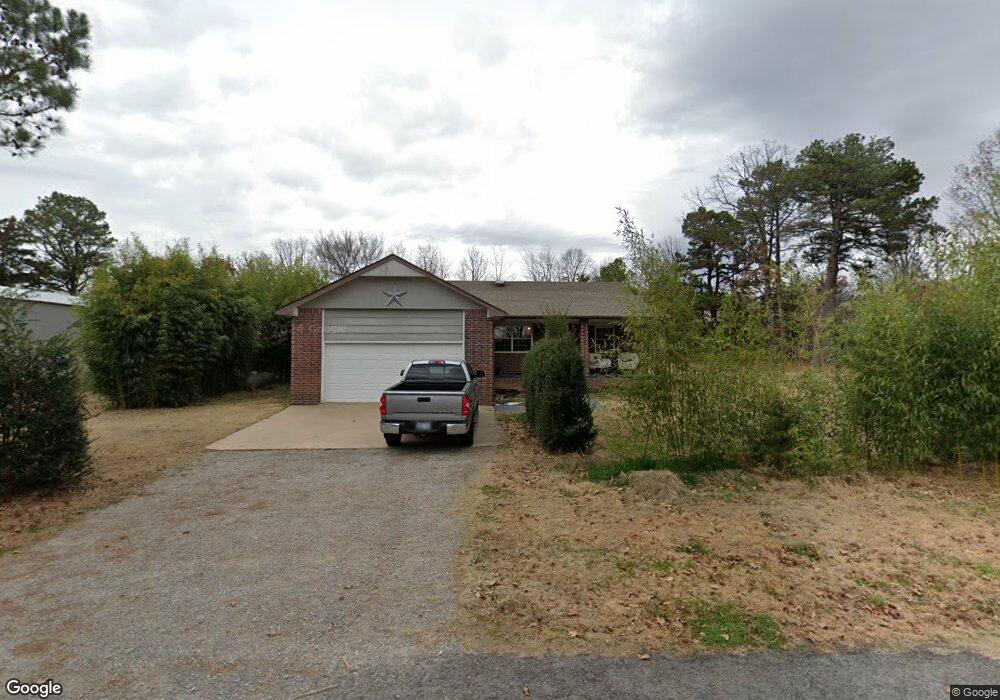
24320 E Woodland Rd Tahlequah, OK 74464
Estimated Value: $214,000 - $273,000
3
Beds
2
Baths
1,592
Sq Ft
$149/Sq Ft
Est. Value
About This Home
This home is located at 24320 E Woodland Rd, Tahlequah, OK 74464 and is currently estimated at $237,747, approximately $149 per square foot. 24320 E Woodland Rd is a home located in Cherokee County with nearby schools including Briggs Public School and Boudinot Christian School.
Ownership History
Date
Name
Owned For
Owner Type
Purchase Details
Closed on
May 31, 2012
Sold by
Catron Maria and Geasland Duane
Bought by
Geasland Maria and Geasland Duane
Current Estimated Value
Home Financials for this Owner
Home Financials are based on the most recent Mortgage that was taken out on this home.
Original Mortgage
$124,300
Outstanding Balance
$17,614
Interest Rate
3.86%
Mortgage Type
New Conventional
Estimated Equity
$220,133
Purchase Details
Closed on
Oct 31, 2000
Sold by
Tom and Spears Thomas F
Bought by
Maria Catron
Purchase Details
Closed on
Sep 18, 2000
Sold by
Tom Spears
Bought by
Tom and Spears Thomas F
Create a Home Valuation Report for This Property
The Home Valuation Report is an in-depth analysis detailing your home's value as well as a comparison with similar homes in the area
Home Values in the Area
Average Home Value in this Area
Purchase History
| Date | Buyer | Sale Price | Title Company |
|---|---|---|---|
| Geasland Maria | -- | None Available | |
| Maria Catron | $94,500 | -- | |
| Tom | -- | -- |
Source: Public Records
Mortgage History
| Date | Status | Borrower | Loan Amount |
|---|---|---|---|
| Open | Geasland Maria | $124,300 |
Source: Public Records
Tax History Compared to Growth
Tax History
| Year | Tax Paid | Tax Assessment Tax Assessment Total Assessment is a certain percentage of the fair market value that is determined by local assessors to be the total taxable value of land and additions on the property. | Land | Improvement |
|---|---|---|---|---|
| 2025 | $1,373 | $18,170 | $1,385 | $16,785 |
| 2024 | $1,373 | $17,642 | $1,345 | $16,297 |
| 2023 | $1,373 | $17,127 | $1,210 | $15,917 |
| 2022 | $1,378 | $17,127 | $1,210 | $15,917 |
| 2021 | $1,273 | $17,127 | $1,210 | $15,917 |
| 2020 | $1,269 | $17,015 | $1,202 | $15,813 |
| 2019 | $1,240 | $16,519 | $1,143 | $15,376 |
| 2018 | $1,219 | $16,039 | $1,110 | $14,929 |
| 2017 | $1,190 | $15,570 | $1,077 | $14,493 |
| 2016 | $1,160 | $15,117 | $1,046 | $14,071 |
| 2015 | $951 | $14,677 | $1,094 | $13,583 |
| 2014 | $921 | $14,250 | $1,056 | $13,194 |
Source: Public Records
Map
Nearby Homes
- 24500 E 741 Rd
- 17022 S 579 Rd
- 8147 N 544 Rd
- 0 S Cary Ln
- 25182 E 770 Rd
- 22678 Sunrise Ridge Dr
- 469581 E 815 Rd
- 16527 N Highway 10
- 81134 S 4720 Rd
- 81118 S 4725 Rd
- 0 Alder Way
- 0 Hwy 10 N Unit 2514793
- 202 Alder Way
- 206 Alder Way
- 912 Summit Ridge Ct
- 105 Summit Ridge Dr
- 14554 N 603 Rd
- 0000 E Salvation Rd
- 26986 Highway 51
- 2205 Oakridge Dr
- 2041 N Sunset Strip
- 1981 N Sunset Strip
- 1951 N Sunset Strip
- 686 Ridgeview Dr
- 1920 N Sunset Strip
- 1921 N Sunset Strip
- 1950 N Sunset Strip
- 2101 N Sunset Strip
- 16539 N 573 Rd
- 16521 N 573 Rd
- 600 Falls Cir
- 16460 N 573 Rd
- 16480 N 573 Rd
- 16477 N 573 Rd
- 1980 N Sunset Strip
- 16416 N 573 Rd
- 2000 N Sunset Strip
- 16437 N 573 Rd
- 2071 N Sunset Strip
- 16499 N 573 Rd