Estimated Value: $495,000 - $520,000
3
Beds
3
Baths
2,202
Sq Ft
$229/Sq Ft
Est. Value
About This Home
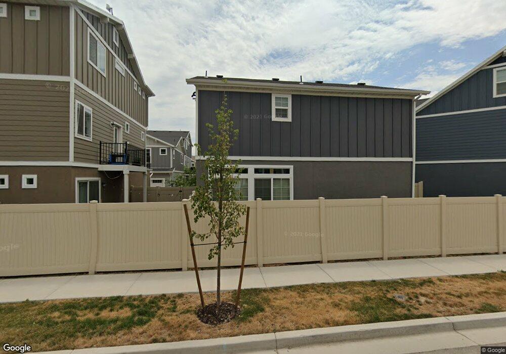
This home is located at 2433 N 3130 W Unit 451, Lehi, UT 84043 and is currently estimated at $504,195, approximately $228 per square foot. 2433 N 3130 W Unit 451 is a home located in Utah County with nearby schools including Liberty Hills Elementary School, Skyridge High School, and Ascent Academies of Utah - Lehi Campus.
Ownership History
Date
Name
Owned For
Owner Type
Purchase Details
Closed on
Mar 19, 2025
Sold by
Trang Edmund and Rawlings Adam
Bought by
Opendoor Property Trust
Current Estimated Value
Purchase Details
Closed on
Aug 25, 2023
Sold by
Zhao Xiran
Bought by
Trang Edmund and Rawlings Adam
Purchase Details
Closed on
Feb 27, 2023
Sold by
Rhodes Ammon Daniel and Rhodes Katie
Bought by
Zhao Xiran
Purchase Details
Closed on
Dec 11, 2018
Sold by
Clayton Properties Group Ii Inc
Bought by
Rhodes Ammon Daniel and Maher Katie
Home Financials for this Owner
Home Financials are based on the most recent Mortgage that was taken out on this home.
Original Mortgage
$345,387
Interest Rate
4.8%
Mortgage Type
New Conventional
Purchase Details
Closed on
Aug 10, 2017
Sold by
Boyer Holbrook Residential Llc
Bought by
Clayton Properties Group Ii Inc and Oakwood Homes
Create a Home Valuation Report for This Property
The Home Valuation Report is an in-depth analysis detailing your home's value as well as a comparison with similar homes in the area
Home Values in the Area
Average Home Value in this Area
Purchase History
| Date | Buyer | Sale Price | Title Company |
|---|---|---|---|
| Opendoor Property Trust | -- | Cottonwood Title | |
| Trang Edmund | -- | 1St Liberty Title | |
| Zhao Xiran | -- | None Listed On Document | |
| Rhodes Ammon Daniel | -- | Cottonwood Title Ins Agency | |
| Clayton Properties Group Ii Inc | -- | Cottonwood Title Ins Agency |
Source: Public Records
Mortgage History
| Date | Status | Borrower | Loan Amount |
|---|---|---|---|
| Previous Owner | Rhodes Ammon Daniel | $345,387 |
Source: Public Records
Tax History Compared to Growth
Tax History
| Year | Tax Paid | Tax Assessment Tax Assessment Total Assessment is a certain percentage of the fair market value that is determined by local assessors to be the total taxable value of land and additions on the property. | Land | Improvement |
|---|---|---|---|---|
| 2025 | $2,327 | $285,010 | $233,700 | $284,500 |
| 2024 | $2,191 | $272,745 | $0 | $0 |
| 2023 | $2,191 | $278,850 | $0 | $0 |
| 2022 | $2,289 | $282,370 | $0 | $0 |
| 2021 | $2,023 | $377,300 | $135,200 | $242,100 |
| 2020 | $1,906 | $351,500 | $125,200 | $226,300 |
| 2019 | $1,734 | $332,500 | $125,200 | $207,300 |
| 2018 | $1,207 | $120,300 | $120,300 | $0 |
Source: Public Records
Map
Nearby Homes
- 2419 N 3130 W
- 3199 W 2450 N
- 3217 W 2450 N
- 2424 N Lazy j Ln
- 2384 N Lazy j Ln
- 3301 Cramden Dr
- 2399 N 3370 W
- 3480 W Waterbury Dr
- 2669 N Turnberry Ct
- 2673 N Double Eagle Dr
- 3556 W Waterbury Dr Unit 603
- 3627 W 2330 N
- 3647 W 2280 N Unit E304
- 1958 N 3330 W Unit C204
- 3685 W 2500 N
- 3373 W 1960 N Unit O102
- 2005 W 1960 N
- 2047 W 1960 N
- 2033 W 1960 N
- 1936 N 3410 W Unit 101
- 2433 N 3130 W
- 2435 N 3130 W
- 2431 N 3130 W Unit 450
- 2439 N 3130 W
- 2437 N 3130 W
- 2417 N 3130 W
- 2421 N 3130 W
- 2441 N 3130 W
- 2413 N 3130 W Unit 420
- 2415 N 3130 W
- 3193 W 2450 N Unit 446
- 2411 N 3130 W
- 3195 W 2450 N
- 3188 W 2400 N
- 3186 W 2400 N
- 3197 W 2450 N
- 3112 W 2400 N Unit 234
- 3199 W 2450 N Unit 443
- 2389 N 3130 W Unit 417
- 2389 N 3130 W