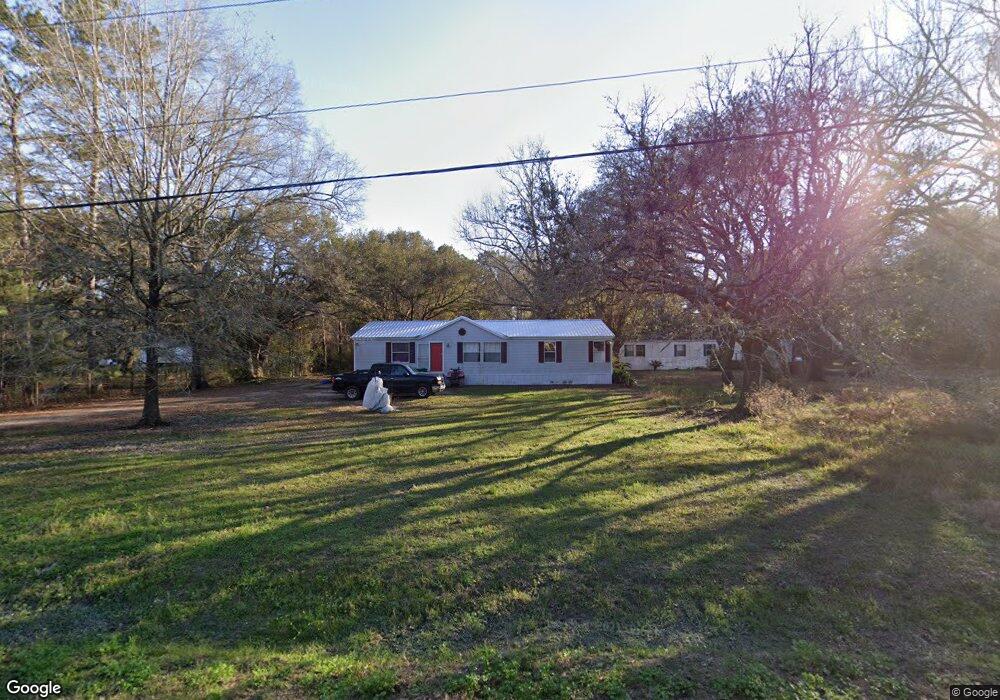
24338 Michael Rd Ponchatoula, LA 70454
Estimated Value: $137,000 - $224,000
3
Beds
2
Baths
1,722
Sq Ft
$103/Sq Ft
Est. Value
About This Home
This home is located at 24338 Michael Rd, Ponchatoula, LA 70454 and is currently estimated at $176,647, approximately $102 per square foot. 24338 Michael Rd is a home located in Tangipahoa Parish with nearby schools including Hammond Eastside Magnet and Hammond High Magnet School.
Ownership History
Date
Name
Owned For
Owner Type
Purchase Details
Closed on
Dec 30, 2011
Sold by
Fidelity Homestead Savings Bank
Bought by
Owens Lacey Darrell
Current Estimated Value
Home Financials for this Owner
Home Financials are based on the most recent Mortgage that was taken out on this home.
Original Mortgage
$46,800
Outstanding Balance
$31,576
Interest Rate
4.03%
Mortgage Type
Unknown
Estimated Equity
$145,071
Purchase Details
Closed on
Jan 28, 2005
Sold by
Balado Vance B and Balado Kimberly Holland
Bought by
Carter Mitchell T
Create a Home Valuation Report for This Property
The Home Valuation Report is an in-depth analysis detailing your home's value as well as a comparison with similar homes in the area
Purchase History
| Date | Buyer | Sale Price | Title Company |
|---|---|---|---|
| Owens Lacey Darrell | $52,000 | None Available | |
| Carter Mitchell T | $65,000 | None Available |
Source: Public Records
Mortgage History
| Date | Status | Borrower | Loan Amount |
|---|---|---|---|
| Open | Owens Lacey Darrell | $46,800 |
Source: Public Records
Tax History
| Year | Tax Paid | Tax Assessment Tax Assessment Total Assessment is a certain percentage of the fair market value that is determined by local assessors to be the total taxable value of land and additions on the property. | Land | Improvement |
|---|---|---|---|---|
| 2025 | $579 | $5,990 | $883 | $5,107 |
| 2024 | $577 | $5,990 | $883 | $5,107 |
| 2023 | $560 | $5,763 | $818 | $4,945 |
| 2022 | $560 | $5,763 | $818 | $4,945 |
| 2021 | $559 | $5,763 | $818 | $4,945 |
| 2020 | $559 | $5,763 | $818 | $4,945 |
| 2019 | $558 | $5,763 | $818 | $4,945 |
| 2018 | $560 | $5,763 | $818 | $4,945 |
| 2017 | $560 | $5,763 | $818 | $4,945 |
| 2016 | $560 | $5,763 | $818 | $4,945 |
| 2015 | -- | $5,979 | $818 | $5,161 |
| 2014 | -- | $5,979 | $818 | $5,161 |
Source: Public Records
Map
Nearby Homes
- 24411 Michael Dr
- 42848 Mike Cooper Rd
- 0 Stepp Rd
- 23558 Haven Blvd
- 24242 Verneuil Ln
- 6.40 ACRE TRACT - Cypress Ln
- 42217 Pasqua Rd
- 80 Acres Vacant Land
- 80 Acres Vacant Land None
- Lot 265 Arbor Dr
- 26.85 Acres Heritage Acres Ln
- 23547 Heritage Acres Ln
- 40545 Cypress Reserve Blvd
- 23483 Heritage Acres Ln
- 25214 Highway 190
- 42318 Blue Bay Dr
- 25050 Kah Lac Rd
- 24338 Michael Rd
- 24338 Micheal Rd
- 24330 Michael Rd
- 0 Michael Rd Unit 2363473
- 0 Michael Rd Unit 2334359
- 24354 Michael Rd
- 24308 Michael Dr
- 24308 Micheal Rd
- 24308 Michael Rd
- 24315 Michael Rd
- 24343 Michael Rd
- 24273 Michael Rd
- 24389 Michael Dr
- 24283 Michael Rd
- 24437 Michael Dr
- 24445 Michael Dr
- 24274 Micheal Rd
- 24274 Michael Dr
- 24274 Michael Rd
- 24449 Michael Dr
Your Personal Tour Guide
Ask me questions while you tour the home.