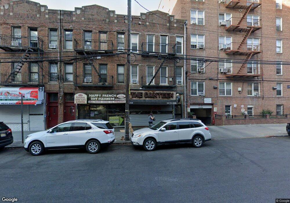
2436 Nostrand Ave Brooklyn, NY 11210
Midwood NeighborhoodEstimated Value: $1,648,176
--
Bed
--
Bath
5,040
Sq Ft
$327/Sq Ft
Est. Value
About This Home
This home is located at 2436 Nostrand Ave, Brooklyn, NY 11210 and is currently estimated at $1,648,176, approximately $327 per square foot. 2436 Nostrand Ave is a home located in Kings County with nearby schools including P.S. 193 Gil Hodges, Andries Hudde School, and Mesivta Tiferes Yisroel.
Ownership History
Date
Name
Owned For
Owner Type
Purchase Details
Closed on
Jun 23, 2016
Sold by
Nostrand Avenue Holdings Of Brooklyn Llc
Bought by
2436 Nostrand Llc
Current Estimated Value
Purchase Details
Closed on
Aug 16, 2013
Sold by
Dutton Michelle E
Bought by
Nostrand Avenue Holdings Of Brooklyn Llc
Home Financials for this Owner
Home Financials are based on the most recent Mortgage that was taken out on this home.
Original Mortgage
$385,000
Interest Rate
4.34%
Mortgage Type
Commercial
Create a Home Valuation Report for This Property
The Home Valuation Report is an in-depth analysis detailing your home's value as well as a comparison with similar homes in the area
Home Values in the Area
Average Home Value in this Area
Purchase History
| Date | Buyer | Sale Price | Title Company |
|---|---|---|---|
| 2436 Nostrand Llc | $1,250,000 | -- | |
| Nostrand Avenue Holdings Of Brooklyn Llc | $700,000 | -- |
Source: Public Records
Mortgage History
| Date | Status | Borrower | Loan Amount |
|---|---|---|---|
| Previous Owner | Nostrand Avenue Holdings Of Brooklyn Llc | $385,000 |
Source: Public Records
Tax History Compared to Growth
Tax History
| Year | Tax Paid | Tax Assessment Tax Assessment Total Assessment is a certain percentage of the fair market value that is determined by local assessors to be the total taxable value of land and additions on the property. | Land | Improvement |
|---|---|---|---|---|
| 2025 | $21,416 | $477,900 | $11,700 | $466,200 |
| 2024 | $21,416 | $402,300 | $11,700 | $390,600 |
| 2023 | $20,328 | $335,250 | $11,700 | $323,550 |
| 2022 | $18,778 | $279,450 | $11,700 | $267,750 |
| 2021 | $17,434 | $262,800 | $11,700 | $251,100 |
| 2020 | $8,569 | $328,500 | $11,700 | $316,800 |
| 2019 | $16,619 | $410,400 | $11,700 | $398,700 |
| 2018 | $16,213 | $127,471 | $2,907 | $124,564 |
| 2017 | $15,016 | $118,060 | $3,132 | $114,928 |
| 2016 | $14,094 | $109,323 | $3,073 | $106,250 |
| 2015 | $8,931 | $109,305 | $3,461 | $105,844 |
| 2014 | $8,931 | $101,362 | $3,307 | $98,055 |
Source: Public Records
Map
Nearby Homes
- 1006 E 31st St
- 1046 E 32nd St
- 3121 Avenue J
- 3206 Avenue K
- 1024 E 26th St
- 3216 Avenue J
- 2525 Nostrand Ave Unit 5S
- 2525 Nostrand Ave Unit F3
- 2525 Nostrand Ave Unit 3R
- 2525 Nostrand Ave Unit 7S
- 2525 Nostrand Ave Unit 7E
- 2525 Nostrand Ave Unit 2R
- 927 E 27th St
- 945 E 32nd St
- 3107 Bedford Ave
- 909 E 29th St Unit 3F
- 909 E 29th St Unit 3D
- 3022 Avenue I
- 1021 E 24th St
- 3402 Avenue J
- 2436 Nostrand Ave Unit 1-R
- 2436 Nostrand Ave Unit 3F
- 2424 Nostrand Ave
- 2438 Nostrand Ave
- 2440 Nostrand Ave
- 2442 Nostrand Ave
- 2450 Nostrand Ave Unit 50
- 2450 Nostrand Ave Unit 6AA
- 2425 Nostrand Ave Unit 229
- 2425 Nostrand Ave Unit 420
- 2425 Nostrand Ave Unit 714
- 2425 Nostrand Ave Unit 320
- 2425 Nostrand Ave Unit 510
- 2425 Nostrand Ave Unit 703
- 2425 Nostrand Ave Unit 219
- 2425 Nostrand Ave Unit 612
- 2425 Nostrand Ave Unit 202
- 2425 Nostrand Ave Unit 227
- 2425 Nostrand Ave Unit 327
- 2425 Nostrand Ave Unit 620