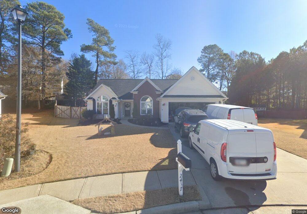
2437 Bulrush Ct Unit 1 Buford, GA 30519
Estimated Value: $346,000 - $398,000
3
Beds
2
Baths
1,629
Sq Ft
$227/Sq Ft
Est. Value
About This Home
This home is located at 2437 Bulrush Ct Unit 1, Buford, GA 30519 and is currently estimated at $369,708, approximately $226 per square foot. 2437 Bulrush Ct Unit 1 is a home located in Gwinnett County with nearby schools including Freeman's Mill Elementary School, Twin Rivers Middle School, and Mountain View High School.
Ownership History
Date
Name
Owned For
Owner Type
Purchase Details
Closed on
Aug 3, 2001
Sold by
Burnham Bldrs Lp
Bought by
Castillo George
Current Estimated Value
Home Financials for this Owner
Home Financials are based on the most recent Mortgage that was taken out on this home.
Original Mortgage
$135,750
Outstanding Balance
$51,559
Interest Rate
7.1%
Mortgage Type
New Conventional
Estimated Equity
$318,149
Create a Home Valuation Report for This Property
The Home Valuation Report is an in-depth analysis detailing your home's value as well as a comparison with similar homes in the area
Home Values in the Area
Average Home Value in this Area
Purchase History
| Date | Buyer | Sale Price | Title Company |
|---|---|---|---|
| Castillo George | $143,000 | -- |
Source: Public Records
Mortgage History
| Date | Status | Borrower | Loan Amount |
|---|---|---|---|
| Open | Castillo George | $135,750 |
Source: Public Records
Tax History
| Year | Tax Paid | Tax Assessment Tax Assessment Total Assessment is a certain percentage of the fair market value that is determined by local assessors to be the total taxable value of land and additions on the property. | Land | Improvement |
|---|---|---|---|---|
| 2025 | $3,541 | $137,160 | $23,920 | $113,240 |
| 2024 | $3,365 | $122,360 | $30,000 | $92,360 |
| 2023 | $3,365 | $122,360 | $30,000 | $92,360 |
| 2022 | $3,030 | $108,200 | $28,000 | $80,200 |
| 2021 | $2,547 | $83,040 | $20,000 | $63,040 |
| 2020 | $2,414 | $76,080 | $20,000 | $56,080 |
| 2019 | $2,360 | $76,080 | $20,000 | $56,080 |
| 2018 | $2,215 | $69,440 | $16,800 | $52,640 |
| 2016 | $1,935 | $55,520 | $12,800 | $42,720 |
| 2015 | $1,863 | $51,480 | $11,200 | $40,280 |
| 2014 | $1,894 | $52,520 | $10,000 | $42,520 |
Source: Public Records
Map
Nearby Homes
- 2461 Lance Ridge Way
- 2159 Shin Ct
- 2305 Braselton Hwy
- 2375 Matlin Way
- 1909 Lakeview Bend Way
- 2228 Lakeview Bend Way
- 0 Hog Mountain Church Road and Auburn Rd
- 2170 Peachford Ln
- 2752 Scouts Ct
- 2402 Bancroft Way
- 2152 Paces Vale Place
- 1965 Holland Park Dr NE
- 1573 Vinings Ct
- 2256 Hansford Pass
- 2233 Hansford Pass
- 1944 William Glen St
- The Carrington II Plan at The Enclave at Mill Creek
- The Emerson Plan at The Enclave at Mill Creek
- The Carrington Plan at The Enclave at Mill Creek
- 1692 Paces Vale Ct
- 2427 Bulrush Ct
- 2436 Bulrush Ct NE
- 2007 Pierce Way
- 2017 Pierce Way Unit 1
- 2436 Bulrush Ct
- 1997 Pierce Way
- 2424 Canter Brook Ct
- 2027 Pierce Way
- 1985 Morgans Run Trail
- 2426 Bulrush Ct
- 1987 Pierce Way
- 2434 Canter Brook Ct
- 2037 Pierce Way
- 2416 Bulrush Ct Unit 1
- 1975 Morgans Run Trail Unit 1
- 2004 Pierce Way
- 1994 Pierce Way
- 2045 Morgans Run Trail
- 1977 Pierce Way Unit I
- 2014 Pierce Way
Your Personal Tour Guide
Ask me questions while you tour the home.