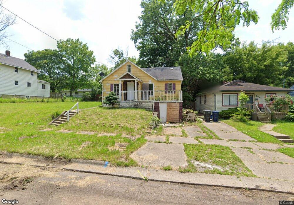
2437 Reid St Flint, MI 48503
Southwest Flint NeighborhoodEstimated Value: $43,000 - $55,000
3
Beds
1
Bath
924
Sq Ft
$53/Sq Ft
Est. Value
About This Home
This home is located at 2437 Reid St, Flint, MI 48503 and is currently estimated at $48,646, approximately $52 per square foot. 2437 Reid St is a home located in Genesee County with nearby schools including Eisenhower School, St. Paul Lutheran School, and St John Vianney Catholic School.
Ownership History
Date
Name
Owned For
Owner Type
Purchase Details
Closed on
Sep 25, 2024
Sold by
Genesee County Land Bank Authority
Bought by
Llabona Yadaimis Plasencia
Current Estimated Value
Purchase Details
Closed on
Dec 19, 2019
Sold by
Cherry Deborah L
Bought by
County Land Bank Authority
Purchase Details
Closed on
Sep 20, 2011
Sold by
Genesee County Land Bank Authority
Bought by
Cornelius William C
Purchase Details
Closed on
Dec 21, 2009
Sold by
Kildee Daniel T and Genesee County Treasurer
Bought by
Genesee County Land Bank Authority
Purchase Details
Closed on
Mar 1, 2006
Sold by
Morris Louis A and Morris Pamela
Bought by
Citifinancial Mortgage Co Inc and Associates Home Equity Services Inc
Create a Home Valuation Report for This Property
The Home Valuation Report is an in-depth analysis detailing your home's value as well as a comparison with similar homes in the area
Home Values in the Area
Average Home Value in this Area
Purchase History
| Date | Buyer | Sale Price | Title Company |
|---|---|---|---|
| Llabona Yadaimis Plasencia | $2,550 | None Listed On Document | |
| Llabona Yadaimis Plasencia | $2,550 | None Listed On Document | |
| County Land Bank Authority | -- | None Available | |
| Cornelius William C | $2,500 | None Available | |
| Genesee County Land Bank Authority | -- | None Available | |
| Citifinancial Mortgage Co Inc | $29,900 | None Available |
Source: Public Records
Tax History
| Year | Tax Paid | Tax Assessment Tax Assessment Total Assessment is a certain percentage of the fair market value that is determined by local assessors to be the total taxable value of land and additions on the property. | Land | Improvement |
|---|---|---|---|---|
| 2025 | -- | $15,400 | $0 | $0 |
| 2024 | -- | $0 | $0 | $0 |
| 2023 | -- | $0 | $0 | $0 |
| 2022 | $0 | $0 | $0 | $0 |
| 2021 | $0 | $0 | $0 | $0 |
| 2020 | $268 | $0 | $0 | $0 |
| 2019 | $601 | $7,100 | $0 | $0 |
| 2018 | $1,005 | $7,200 | $0 | $0 |
| 2017 | $1,190 | $0 | $0 | $0 |
| 2016 | $774 | $0 | $0 | $0 |
| 2015 | -- | $0 | $0 | $0 |
| 2014 | -- | $0 | $0 | $0 |
| 2012 | -- | $14,800 | $0 | $0 |
Source: Public Records
Map
Nearby Homes
- 2437 Zimmerman St
- 2464 Gibson St
- 2410 Corunna Rd
- 2310 Gibson St
- 2509 Corunna Rd
- 2124 Swayze St
- 2433 Brown St
- 2621 Swayze St
- 2618 Brown St
- 932 Bradley Ave
- 1506 Gainey Ave
- 2112 Miller Rd
- 612 Bradley Ave
- 911 Hughes Ave
- 2729 Chicago Blvd
- 2115 Radcliffe Ave
- 3018 Fielding St
- 915 Stocker Ave
- 1017 Stocker Ave
- 1820 Chelsea Cir
Your Personal Tour Guide
Ask me questions while you tour the home.