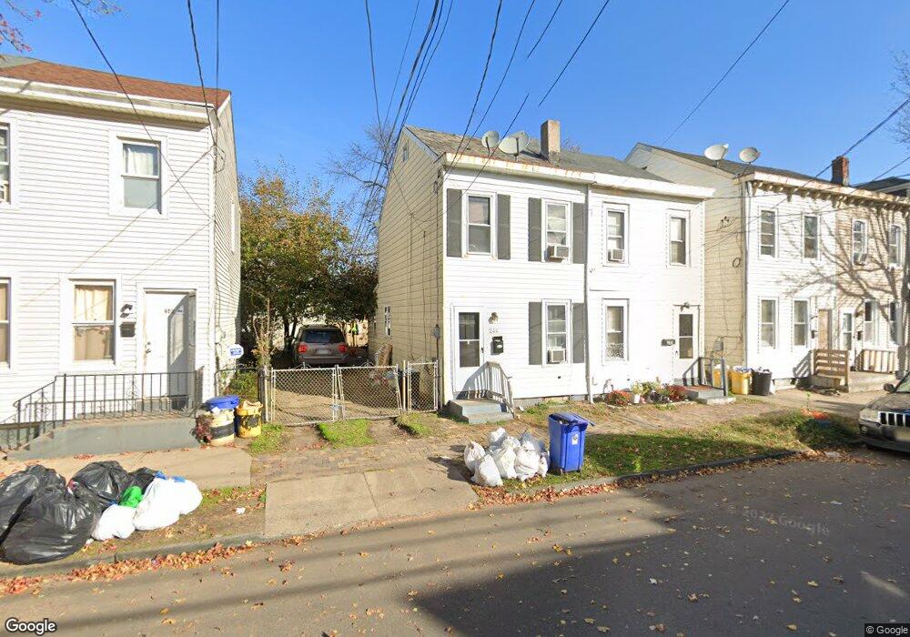
244 Cummings Ave Trenton, NJ 08611
Chambersburg NeighborhoodEstimated Value: $119,000 - $168,000
3
Beds
2
Baths
826
Sq Ft
$182/Sq Ft
Est. Value
About This Home
This home is located at 244 Cummings Ave, Trenton, NJ 08611 and is currently estimated at $150,426, approximately $182 per square foot. 244 Cummings Ave is a home located in Mercer County with nearby schools including Grant Elementary School, Washington Elementary School, and Grace A Dunn Middle School.
Ownership History
Date
Name
Owned For
Owner Type
Purchase Details
Closed on
Jul 2, 2021
Sold by
Romano Melanie J and Estate Of Christopher Romano
Bought by
Sff Investments Llc
Current Estimated Value
Purchase Details
Closed on
Aug 1, 2005
Sold by
Unmil Properties Inc
Bought by
Blue David and Romano Christopher
Home Financials for this Owner
Home Financials are based on the most recent Mortgage that was taken out on this home.
Original Mortgage
$91,800
Interest Rate
5.68%
Purchase Details
Closed on
Mar 30, 1994
Sold by
Walsh Edward
Bought by
Gallo Timothy
Home Financials for this Owner
Home Financials are based on the most recent Mortgage that was taken out on this home.
Original Mortgage
$31,000
Interest Rate
7.07%
Create a Home Valuation Report for This Property
The Home Valuation Report is an in-depth analysis detailing your home's value as well as a comparison with similar homes in the area
Home Values in the Area
Average Home Value in this Area
Purchase History
| Date | Buyer | Sale Price | Title Company |
|---|---|---|---|
| Sff Investments Llc | $75,000 | Universal Title Llc | |
| Sff Investments Llc | $75,000 | Universal Title | |
| Blue David | $102,000 | -- | |
| Gallo Timothy | $35,000 | -- |
Source: Public Records
Mortgage History
| Date | Status | Borrower | Loan Amount |
|---|---|---|---|
| Previous Owner | Blue David | $91,800 | |
| Previous Owner | Gallo Timothy | $31,000 |
Source: Public Records
Tax History Compared to Growth
Tax History
| Year | Tax Paid | Tax Assessment Tax Assessment Total Assessment is a certain percentage of the fair market value that is determined by local assessors to be the total taxable value of land and additions on the property. | Land | Improvement |
|---|---|---|---|---|
| 2025 | $2,442 | $42,100 | $10,100 | $32,000 |
| 2024 | $2,344 | $42,100 | $10,100 | $32,000 |
| 2023 | $2,344 | $42,100 | $10,100 | $32,000 |
| 2022 | $2,298 | $42,100 | $10,100 | $32,000 |
| 2021 | $2,338 | $42,100 | $10,100 | $32,000 |
| 2020 | $2,330 | $42,100 | $10,100 | $32,000 |
| 2019 | $2,293 | $42,100 | $10,100 | $32,000 |
| 2018 | $2,195 | $42,100 | $10,100 | $32,000 |
| 2017 | $2,086 | $42,100 | $10,100 | $32,000 |
| 2016 | $2,790 | $48,500 | $18,100 | $30,400 |
| 2015 | $2,781 | $48,500 | $18,100 | $30,400 |
| 2014 | $2,767 | $48,500 | $18,100 | $30,400 |
Source: Public Records
Map
Nearby Homes
- 150 Ashmore Ave
- 724 Division St
- 327 Woodland St
- 11 Cummings Ave
- 1447 S Clinton Ave
- 978 S Broad St
- 225 Franklin St
- 207 Howell St
- 1521 S Clinton Ave
- 211 Elm St
- 414 Commonwealth Ave
- 113 Mifflin St
- 127 Kent St
- 826 S Clinton Ave
- 508 Dayton St
- 320 Commonwealth Ave
- 1304 S Broad St
- 1306 S Broad St
- 922 Adeline St
- 1308 S Broad St
- 246 Cummings Ave
- 248 Cummings Ave
- 238 Cummings Ave
- 250 Cummings Ave
- 252 Cummings Ave
- 149 Ashmore Ave
- 151 Ashmore Ave
- 254 Cummings Ave
- 147 Ashmore Ave
- 232 Cummings Ave
- 256 Cummings Ave
- 157 Ashmore Ave
- 258 Cummings Ave
- 159 Ashmore Ave
- 262 Cummings Ave
- 264 Cummings Ave
- 237 Cummings Ave
- 165 Ashmore Ave
- 249 Cummings Ave
- 251 Cummings Ave