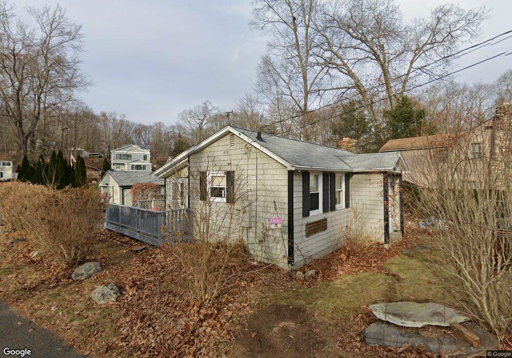
244 Standish Rd Coventry, CT 06238
Estimated Value: $254,000 - $267,000
2
Beds
1
Bath
704
Sq Ft
$370/Sq Ft
Est. Value
About This Home
This home is located at 244 Standish Rd, Coventry, CT 06238 and is currently estimated at $260,598, approximately $370 per square foot. 244 Standish Rd is a home located in Tolland County with nearby schools including Coventry Grammar School, George Hersey Robertson School, and Capt. Nathan Hale School.
Ownership History
Date
Name
Owned For
Owner Type
Purchase Details
Closed on
May 28, 2024
Sold by
Martin Darlene Est and Kelly
Bought by
Kelly Devin
Current Estimated Value
Purchase Details
Closed on
Aug 14, 2014
Sold by
Kelly Myron D
Bought by
Kelly Devin K
Purchase Details
Closed on
Oct 1, 1985
Bought by
Kelly Devin K
Create a Home Valuation Report for This Property
The Home Valuation Report is an in-depth analysis detailing your home's value as well as a comparison with similar homes in the area
Home Values in the Area
Average Home Value in this Area
Purchase History
| Date | Buyer | Sale Price | Title Company |
|---|---|---|---|
| Kelly Devin | -- | None Available | |
| Kelly Devin K | -- | -- | |
| Kelly Devin K | -- | -- | |
| Kelly Devin K | -- | -- |
Source: Public Records
Mortgage History
| Date | Status | Borrower | Loan Amount |
|---|---|---|---|
| Previous Owner | Kelly Devin K | $2,890 | |
| Previous Owner | Kelly Devin K | $40,557 | |
| Previous Owner | Kelly Devin K | $55,000 |
Source: Public Records
Tax History
| Year | Tax Paid | Tax Assessment Tax Assessment Total Assessment is a certain percentage of the fair market value that is determined by local assessors to be the total taxable value of land and additions on the property. | Land | Improvement |
|---|---|---|---|---|
| 2025 | $3,680 | $154,900 | $75,300 | $79,600 |
| 2024 | $3,468 | $104,100 | $62,400 | $41,700 |
| 2023 | $3,304 | $104,100 | $62,400 | $41,700 |
| 2022 | $3,243 | $104,100 | $62,400 | $41,700 |
| 2021 | $3,243 | $104,100 | $62,400 | $41,700 |
| 2020 | $3,245 | $104,100 | $62,400 | $41,700 |
| 2019 | $3,349 | $104,000 | $62,400 | $41,600 |
| 2018 | $3,523 | $109,400 | $62,400 | $47,000 |
| 2017 | $3,501 | $109,400 | $62,400 | $47,000 |
| 2016 | $3,413 | $109,400 | $62,400 | $47,000 |
| 2015 | $3,413 | $109,400 | $62,400 | $47,000 |
| 2014 | $3,459 | $121,500 | $69,000 | $52,500 |
Source: Public Records
Map
Nearby Homes
- 0 Daly Rd Unit 24146464
- 152 Cheney Ln
- 2478 Main St
- 27 Fox Trail
- 0 Hinkel Mae Dr
- 17 Ireland Dr
- 0 Woodland Rd
- 198 Forest Rd
- 864 Boston Turnpike
- 498 Root Rd
- 0 Skinner Hill Rd Unit 24077239
- 55 Whites Hill Rd
- 499 Woodmont Dr
- 550 High St
- 25 Wolf Hill Rd
- 0 Wheeling Rd Unit 24116879
- 37 Wolf Hill Lot (#40) Rd
- 37 Wolf Hill Rd Unit Lot 40
- 395 Grant Hill (Mill Race Drive) Lot #21 Rd
- 395 Grant Hill Rd Unit Lot21
Your Personal Tour Guide
Ask me questions while you tour the home.