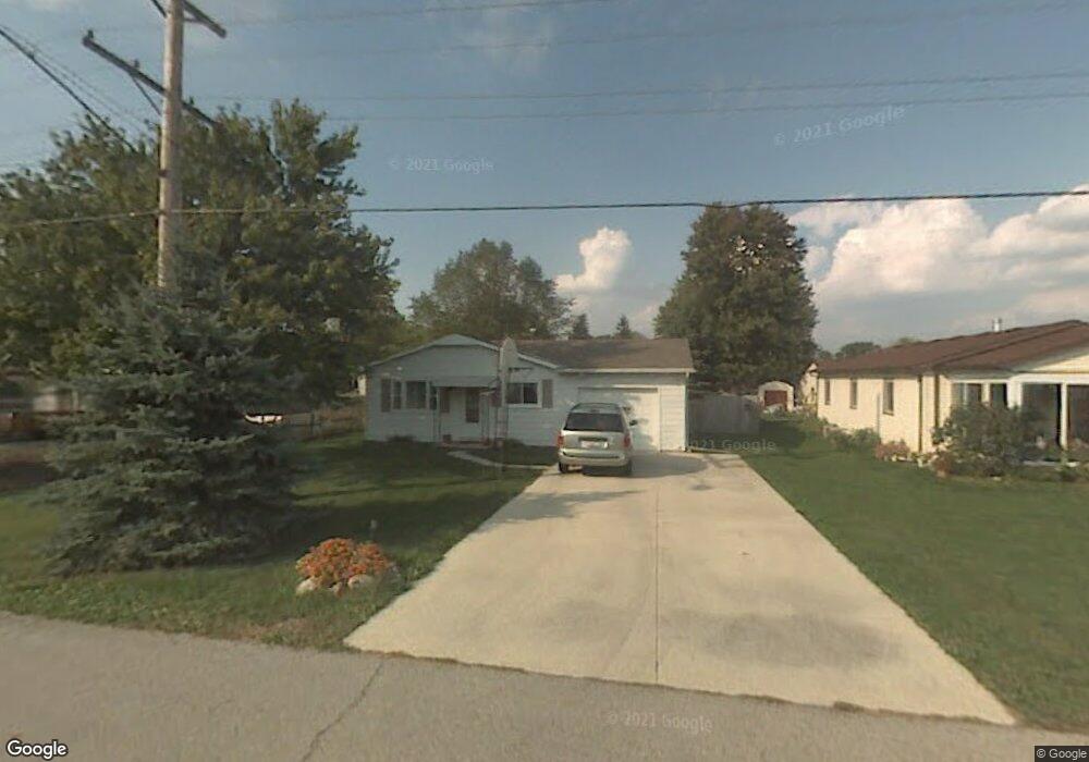
244 W Hissong Ave Fostoria, OH 44830
Estimated Value: $87,000 - $113,713
3
Beds
1
Bath
864
Sq Ft
$122/Sq Ft
Est. Value
About This Home
This home is located at 244 W Hissong Ave, Fostoria, OH 44830 and is currently estimated at $105,428, approximately $122 per square foot. 244 W Hissong Ave is a home with nearby schools including Fostoria Intermediate Elementary School and Fostoria Junior/Senior High School.
Ownership History
Date
Name
Owned For
Owner Type
Purchase Details
Closed on
Mar 6, 2001
Sold by
Helms Edith J
Bought by
Shaver Brian E
Current Estimated Value
Purchase Details
Closed on
Jan 5, 2001
Bought by
Helms Edith J
Purchase Details
Closed on
Aug 30, 1994
Bought by
Secretary Of Housing & Urban
Purchase Details
Closed on
Mar 15, 1994
Sold by
Reynolds William J
Bought by
Secretary Of Housing & Urban
Purchase Details
Closed on
Jul 1, 1991
Purchase Details
Closed on
Jun 1, 1989
Create a Home Valuation Report for This Property
The Home Valuation Report is an in-depth analysis detailing your home's value as well as a comparison with similar homes in the area
Home Values in the Area
Average Home Value in this Area
Purchase History
| Date | Buyer | Sale Price | Title Company |
|---|---|---|---|
| Shaver Brian E | $50,000 | -- | |
| Helms Edith J | $50,000 | -- | |
| Secretary Of Housing & Urban | -- | -- | |
| Secretary Of Housing & Urban | -- | -- | |
| -- | $35,000 | -- | |
| -- | $30,000 | -- |
Source: Public Records
Tax History Compared to Growth
Tax History
| Year | Tax Paid | Tax Assessment Tax Assessment Total Assessment is a certain percentage of the fair market value that is determined by local assessors to be the total taxable value of land and additions on the property. | Land | Improvement |
|---|---|---|---|---|
| 2024 | $696 | $13,470 | $2,120 | $11,350 |
| 2023 | $704 | $13,470 | $2,120 | $11,350 |
| 2022 | $639 | $10,950 | $2,290 | $8,660 |
| 2021 | $647 | $10,950 | $2,290 | $8,660 |
| 2020 | $650 | $10,952 | $2,293 | $8,659 |
| 2019 | $610 | $10,119 | $2,118 | $8,001 |
| 2018 | $622 | $10,119 | $2,118 | $8,001 |
| 2017 | $636 | $10,119 | $2,118 | $8,001 |
| 2016 | $660 | $11,977 | $2,338 | $9,639 |
| 2015 | $648 | $11,977 | $2,338 | $9,639 |
| 2014 | $616 | $11,977 | $2,338 | $9,639 |
| 2013 | $722 | $12,996 | $2,541 | $10,455 |
Source: Public Records
Map
Nearby Homes
- 0 Bradner St
- 514 E Lytle St
- 461 W Lytle St
- 461 W Lytle St Unit 145
- 461 W Lytle St Unit 106
- 8 Christopher Dr
- 0 W South Route 12
- 73 Christopher Dr
- 77 Barcelona Dr
- 412 E Center St
- 351 W South St
- 348 W South St
- 0 Bugner St Unit 6131864
- 321 Mcdougal St
- 11598 W Township Road 114 County Rd
- 203 N Union St
- 509 College Ave
- 540 N Poplar St
- 520 N Union St
- 481 Beverly Dr
- 248 W Hissong Ave
- 0 Hissong Ave
- 205 E Clark St
- 1457 N Township Road 21
- 211 E Clark St
- 1437 N Township Road 21
- 1415 S Poplar St
- 1427 N Township Road 21
- 1100 S Poplar St
- 1415 N Township Road 21
- 208 E Clark St
- 216 E Clark St
- 1405 S Poplar St
- 12459 W Wagner St
- 212 E Clark St
- 220 E Clark St
- 165 E Clark St
- 165 E Clark St
- 214 E Clark St
- 206 E Clark St