Estimated Value: $665,000 - $1,002,319
3
Beds
2
Baths
1,515
Sq Ft
$530/Sq Ft
Est. Value
About This Home
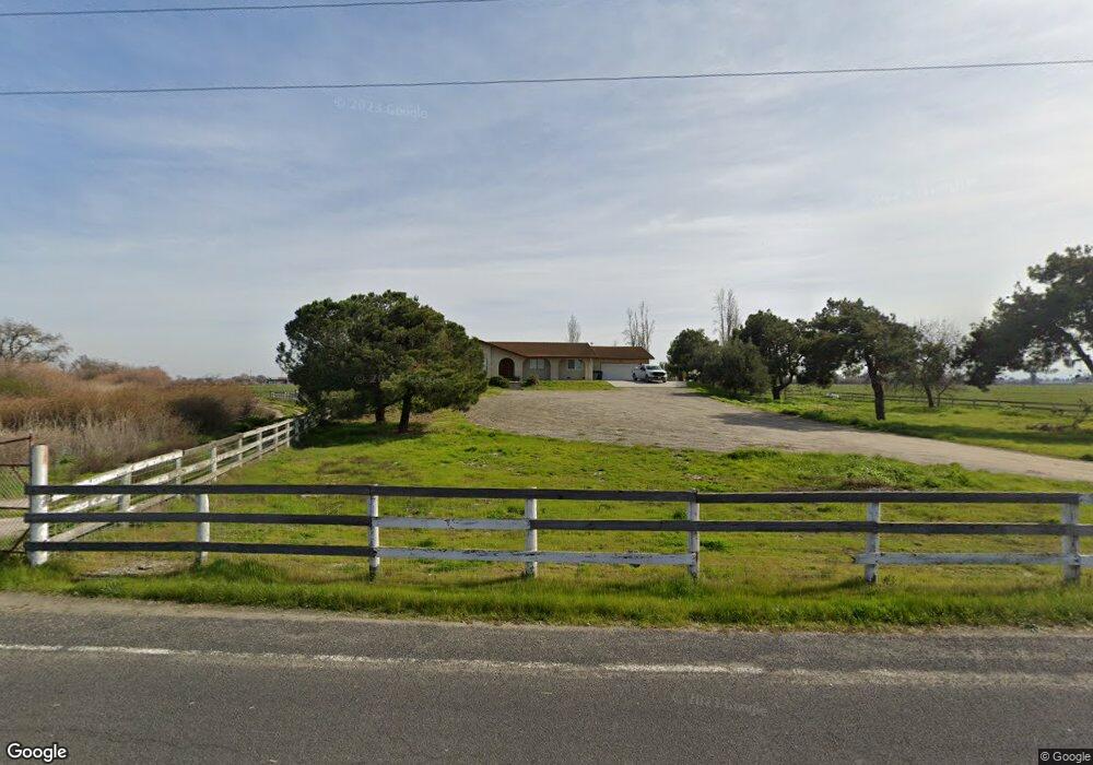
This home is located at 2440 Mancuso Rd, Tracy, CA 95304 and is currently estimated at $803,440, approximately $530 per square foot. 2440 Mancuso Rd is a home located in San Joaquin County with nearby schools including Banta Elementary School, Tracy High School, and Banta Charter School.
Ownership History
Date
Name
Owned For
Owner Type
Purchase Details
Closed on
Oct 7, 2016
Sold by
Gonsalves Stacey
Bought by
Gonsalves Michael J
Current Estimated Value
Home Financials for this Owner
Home Financials are based on the most recent Mortgage that was taken out on this home.
Original Mortgage
$2,518,000
Outstanding Balance
$2,018,649
Interest Rate
3.46%
Mortgage Type
Unknown
Estimated Equity
-$1,215,209
Purchase Details
Closed on
Jun 18, 2015
Sold by
Pombo Ella Antoinette
Bought by
The Ella Antoinette Pombo Revocable Trus
Purchase Details
Closed on
Oct 2, 2012
Sold by
Pombo Ella Antoinette
Bought by
Pombo Ella Antoinette
Create a Home Valuation Report for This Property
The Home Valuation Report is an in-depth analysis detailing your home's value as well as a comparison with similar homes in the area
Purchase History
| Date | Buyer | Sale Price | Title Company |
|---|---|---|---|
| Gonsalves Michael J | -- | Old Republic Title Company | |
| Gonsalves Joseph Anthony | -- | Old Republic Title Company | |
| Gonsalves Joseph Anthony | $2,532,000 | Old Republic Title Company | |
| The Ella Antoinette Pombo Revocable Trus | -- | None Available | |
| Pombo Ella Antoinette | -- | None Available |
Source: Public Records
Mortgage History
| Date | Status | Borrower | Loan Amount |
|---|---|---|---|
| Open | Gonsalves Joseph Anthony | $2,518,000 |
Source: Public Records
Tax History
| Year | Tax Paid | Tax Assessment Tax Assessment Total Assessment is a certain percentage of the fair market value that is determined by local assessors to be the total taxable value of land and additions on the property. | Land | Improvement |
|---|---|---|---|---|
| 2025 | $6,114 | $459,565 | $308,691 | $150,874 |
| 2024 | $6,068 | $467,007 | $319,091 | $147,916 |
| 2023 | $5,847 | $450,659 | $305,643 | $145,016 |
| 2022 | $5,558 | $428,086 | $285,913 | $142,173 |
| 2021 | $4,651 | $406,870 | $267,484 | $139,386 |
| 2020 | $3,655 | $309,208 | $184,903 | $124,305 |
| 2019 | $3,603 | $303,146 | $181,278 | $121,868 |
| 2018 | $3,553 | $297,203 | $177,724 | $119,479 |
| 2017 | $3,483 | $291,379 | $174,242 | $117,137 |
| 2016 | $3,431 | $285,665 | $170,825 | $114,840 |
| 2015 | $3,400 | $281,374 | $168,259 | $113,115 |
| 2014 | $3,339 | $275,864 | $164,964 | $110,900 |
Source: Public Records
Map
Nearby Homes
- 3549 W Canal Blvd
- 4151 W Canal Blvd
- 3928 Stoneridge Dr
- 4150 Rocky Point Ct
- 18471 Jennings Dr
- 1080 Mariners Dr
- 18481 Keswick Dr
- 1557 Huntington Way
- 1787 Branson Ct
- 1734 Cranbrook Ct
- 18311 Tioga Dr
- 720 Channel Dr
- 1737 Cranbrook Ct
- 4399 Aplicella Ct Unit 75
- 4399 Aplicella Ct Unit 58
- 4399 Aplicella Ct Unit 67
- 4399 Aplicella Ct Unit 32
- 18200 Broadmoor Way
- 1391 Crystal Dr
- 18744 Back Bay Dr
- 2600 Mancuso Rd
- 2222 Mancuso Rd
- 2466 W Canal Blvd
- 2221 W Canal Blvd
- 2880 Mancuso Rd Unit 16022416
- 3102 W Berry Ave
- 3135 W Canal Blvd
- 3101 W Berry Ave
- 3133 W Berry Ave
- 2800 Mancuso Rd
- 3100 Mancuso Rd
- 2201 S Manthey Rd
- 3051 W Toleri Rd
- 3165 W Canal Blvd
- 3177 W Berry Ave
- 0 Toleri Unit 15058247
- 3454 W Berry Ave
- 3356 W 11th St
- 2770 Mancuso Rd
- 3492 W Berry Ave
Your Personal Tour Guide
Ask me questions while you tour the home.