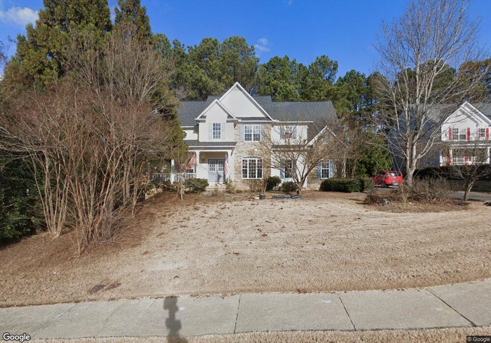
2440 Queensboro Ln Unit 1 Buford, GA 30518
Estimated Value: $472,012 - $580,000
4
Beds
4
Baths
2,808
Sq Ft
$187/Sq Ft
Est. Value
About This Home
This home is located at 2440 Queensboro Ln Unit 1, Buford, GA 30518 and is currently estimated at $524,503, approximately $186 per square foot. 2440 Queensboro Ln Unit 1 is a home located in Gwinnett County with nearby schools including White Oak Elementary School, Lanier Middle School, and Lanier High School.
Ownership History
Date
Name
Owned For
Owner Type
Purchase Details
Closed on
Jun 15, 2004
Sold by
Olson Richard S
Bought by
Ayotte Timothy R and Ayotte Kyong
Current Estimated Value
Home Financials for this Owner
Home Financials are based on the most recent Mortgage that was taken out on this home.
Original Mortgage
$40,485
Outstanding Balance
$10,507
Interest Rate
6.25%
Mortgage Type
Unknown
Estimated Equity
$513,996
Purchase Details
Closed on
May 29, 2003
Sold by
Rick Olson Homes Inc
Bought by
Olson Richard S
Home Financials for this Owner
Home Financials are based on the most recent Mortgage that was taken out on this home.
Original Mortgage
$244,500
Interest Rate
5.68%
Mortgage Type
New Conventional
Create a Home Valuation Report for This Property
The Home Valuation Report is an in-depth analysis detailing your home's value as well as a comparison with similar homes in the area
Home Values in the Area
Average Home Value in this Area
Purchase History
| Date | Buyer | Sale Price | Title Company |
|---|---|---|---|
| Ayotte Timothy R | $269,900 | -- | |
| Olson Richard S | -- | -- |
Source: Public Records
Mortgage History
| Date | Status | Borrower | Loan Amount |
|---|---|---|---|
| Open | Ayotte Timothy R | $40,485 | |
| Open | Ayotte Timothy R | $215,920 | |
| Previous Owner | Olson Richard S | $244,500 |
Source: Public Records
Tax History Compared to Growth
Tax History
| Year | Tax Paid | Tax Assessment Tax Assessment Total Assessment is a certain percentage of the fair market value that is determined by local assessors to be the total taxable value of land and additions on the property. | Land | Improvement |
|---|---|---|---|---|
| 2024 | $5,664 | $190,000 | $35,200 | $154,800 |
| 2023 | $5,664 | $196,000 | $35,200 | $160,800 |
| 2022 | $5,226 | $164,040 | $22,000 | $142,040 |
| 2021 | $4,517 | $126,680 | $22,000 | $104,680 |
| 2020 | $4,546 | $126,680 | $22,000 | $104,680 |
| 2019 | $4,191 | $117,280 | $18,000 | $99,280 |
| 2018 | $4,197 | $117,280 | $18,000 | $99,280 |
| 2016 | $3,734 | $102,000 | $18,000 | $84,000 |
| 2015 | $3,594 | $96,960 | $18,000 | $78,960 |
| 2014 | -- | $92,800 | $18,000 | $74,800 |
Source: Public Records
Map
Nearby Homes
- 2416 Sterling Manor Dr
- 5995 Lake Windsor Pkwy Unit 1
- 5735 Lake Windsor Pkwy
- 2482 Windchase Ct
- 6265 Lake Windsor Pkwy
- 5871 Dolvin Ln
- 5984 Dolvin Ln
- 5571 Shadburn Ferry Rd
- 5697 Frontier Walk Ln
- 6708 Bass Cir
- 5600 Creek Dale Way
- 5601 Creek Dale Way
- 5839 Lakeshore Dr
- 5820 Elm Tree Dr Unit 1
- 6030 Chimney Springs Rd
- 2430 Queensboro Ln
- 2450 Queensboro Ln Unit 1
- 2450 Queensboro Ln
- 2437 Sterling Manor Dr
- 2420 Queensboro Ln
- 5561 Shadburn Ferry Rd
- W Shadburn Ferry Rd
- 2447 Sterling Manor Dr
- 2417 Sterling Manor Dr
- 5885 Lake Windsor Pkwy
- 5915 Lake Windsor Pkwy
- 2457 Sterling Manor Dr
- 0 Sterling Manor Dr Unit 8196237
- 0 Sterling Manor Dr Unit 7488609
- 0 Sterling Manor Dr
- 5889 Shadburn Ferry Rd
- 5875 Lake Windsor Pkwy Unit 147
- 5875 Lake Windsor Pkwy Unit 1
- 5875 Lake Windsor Pkwy
- 2456 Sterling Manor Dr Unit 1