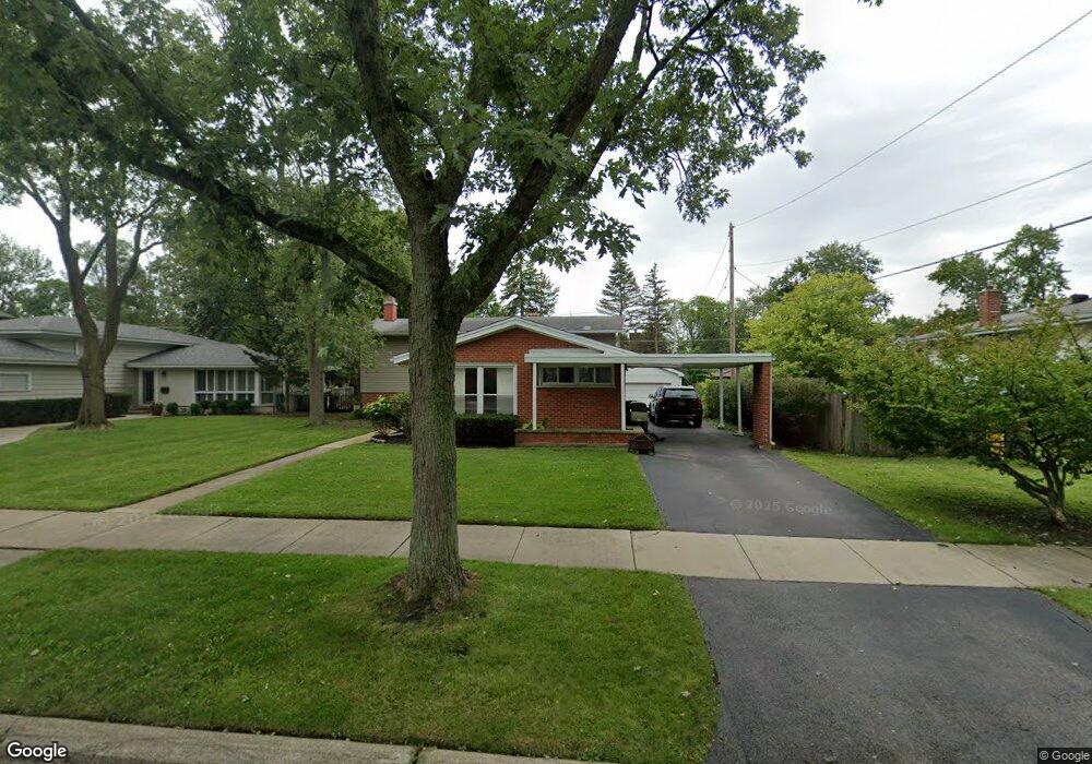
2441 Maple Ave Northbrook, IL 60062
Estimated Value: $477,000 - $778,000
3
Beds
2
Baths
1,247
Sq Ft
$488/Sq Ft
Est. Value
About This Home
This home is located at 2441 Maple Ave, Northbrook, IL 60062 and is currently estimated at $608,455, approximately $487 per square foot. 2441 Maple Ave is a home located in Cook County with nearby schools including Westmoor Elementary School, Northbrook Junior High School, and Glenbrook North High School.
Ownership History
Date
Name
Owned For
Owner Type
Purchase Details
Closed on
Oct 16, 2025
Sold by
Macmillin David and Macmillin Rebecca
Bought by
Macmillin David E
Current Estimated Value
Purchase Details
Closed on
Jun 30, 2021
Sold by
Sorial George H and Sorial Susan M
Bought by
Macmillin David and Macmillin Rebecca
Home Financials for this Owner
Home Financials are based on the most recent Mortgage that was taken out on this home.
Original Mortgage
$315,000
Interest Rate
3.37%
Mortgage Type
New Conventional
Purchase Details
Closed on
Apr 29, 2003
Sold by
Boyd Anna May
Bought by
Sorial George H and Sorial Susan M
Home Financials for this Owner
Home Financials are based on the most recent Mortgage that was taken out on this home.
Original Mortgage
$264,000
Interest Rate
5.86%
Mortgage Type
Balloon
Create a Home Valuation Report for This Property
The Home Valuation Report is an in-depth analysis detailing your home's value as well as a comparison with similar homes in the area
Home Values in the Area
Average Home Value in this Area
Purchase History
| Date | Buyer | Sale Price | Title Company |
|---|---|---|---|
| Macmillin David E | -- | None Listed On Document | |
| Macmillin David | $420,000 | First American Title | |
| Sorial George H | $330,000 | Metropolitan Title Co | |
| Sorial George H | $330,000 | Metropolitan Title Co |
Source: Public Records
Mortgage History
| Date | Status | Borrower | Loan Amount |
|---|---|---|---|
| Previous Owner | Macmillin David | $315,000 | |
| Previous Owner | Sorial George H | $264,000 |
Source: Public Records
Tax History
| Year | Tax Paid | Tax Assessment Tax Assessment Total Assessment is a certain percentage of the fair market value that is determined by local assessors to be the total taxable value of land and additions on the property. | Land | Improvement |
|---|---|---|---|---|
| 2025 | $12,108 | $47,063 | $12,188 | $34,875 |
| 2024 | $12,108 | $53,000 | $12,675 | $40,325 |
| 2023 | $11,744 | $53,000 | $12,675 | $40,325 |
| 2022 | $11,744 | $53,000 | $12,675 | $40,325 |
| 2021 | $6,255 | $28,368 | $10,237 | $18,131 |
| 2020 | $6,185 | $28,368 | $10,237 | $18,131 |
| 2019 | $6,001 | $31,174 | $10,237 | $20,937 |
| 2018 | $5,804 | $28,218 | $9,018 | $19,200 |
| 2017 | $6,180 | $30,466 | $9,018 | $21,448 |
| 2016 | $6,001 | $30,466 | $9,018 | $21,448 |
| 2015 | $5,373 | $25,301 | $7,556 | $17,745 |
| 2014 | $5,633 | $27,458 | $7,556 | $19,902 |
| 2013 | $5,446 | $27,458 | $7,556 | $19,902 |
Source: Public Records
Map
Nearby Homes
- 2444 Oak Ave
- 2335 Maple Ave
- 1331 Pfingsten Rd
- 2117 Illinois Rd
- 2700 Crabtree Ln
- 1943 Sunnyside Cir
- 1060 Cedar Ln
- 847 Division St
- 1817 Somerset Ln Unit 24
- 1041 Cedar Ln
- 1021 Cedar Ln
- 1904 Somerset Ln Unit 48
- 1772 Lancaster Way
- 3075 Keystone Rd
- 2348 Ash Ln
- 818 Bach St
- 1914 Farnsworth Ln Unit 208
- 1814 Illinois Rd
- 6 the Court of Lagoon View
- 1255 Shermer Rd
Your Personal Tour Guide
Ask me questions while you tour the home.