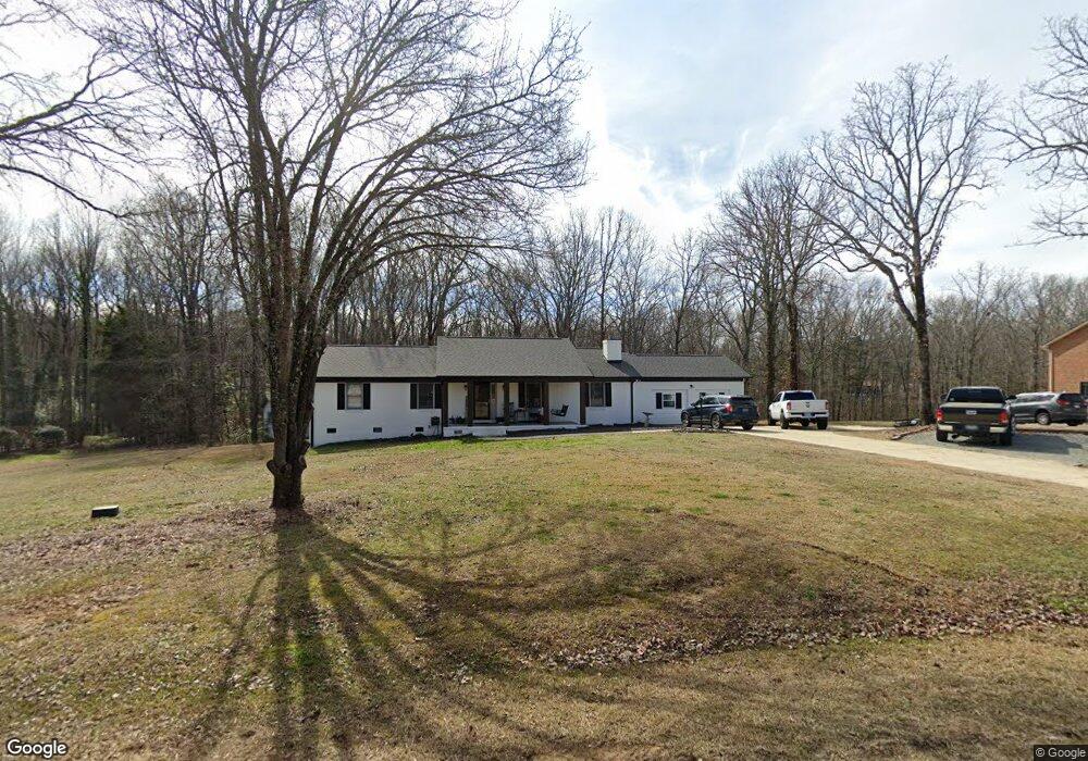
2441 Moss Tree Ct Rock Hill, SC 29730
Estimated Value: $312,815 - $470,000
--
Bed
--
Bath
1,608
Sq Ft
$239/Sq Ft
Est. Value
About This Home
This home is located at 2441 Moss Tree Ct, Rock Hill, SC 29730 and is currently estimated at $383,954, approximately $238 per square foot. 2441 Moss Tree Ct is a home located in York County with nearby schools including Independence Elementary School, Castle Heights Middle School, and Rock Hill High School.
Ownership History
Date
Name
Owned For
Owner Type
Purchase Details
Closed on
Mar 30, 2022
Sold by
Mcdaniel Jeffrey L
Bought by
Lesslie Kara Mcdaniel and Lesslie Robert Ellis
Current Estimated Value
Purchase Details
Closed on
Nov 17, 2014
Sold by
Mcdaniel Properties Of Rock Hill Llc
Bought by
Mcdaniel Jeffrey L
Purchase Details
Closed on
Dec 30, 2012
Sold by
Estate Of Willie Morgan Mcdaniel
Bought by
Mcdaniel Paul L and Mcdaniel Paul Lyle
Purchase Details
Closed on
May 1, 2012
Sold by
Mcdaniel Jeffrey L and Mcdaniel Freddie Eugene
Bought by
Mcdaniel Properties Of Rock Hill Llc
Create a Home Valuation Report for This Property
The Home Valuation Report is an in-depth analysis detailing your home's value as well as a comparison with similar homes in the area
Home Values in the Area
Average Home Value in this Area
Purchase History
| Date | Buyer | Sale Price | Title Company |
|---|---|---|---|
| Lesslie Kara Mcdaniel | -- | None Listed On Document | |
| Mcdaniel Jeffrey L | $154,000 | -- | |
| Mcdaniel Paul L | -- | -- | |
| Mcdaniel Properties Of Rock Hill Llc | -- | -- | |
| Mcdaniel Jeffrey L | -- | -- |
Source: Public Records
Tax History Compared to Growth
Tax History
| Year | Tax Paid | Tax Assessment Tax Assessment Total Assessment is a certain percentage of the fair market value that is determined by local assessors to be the total taxable value of land and additions on the property. | Land | Improvement |
|---|---|---|---|---|
| 2024 | $1,742 | $12,410 | $1,120 | $11,290 |
| 2023 | $1,787 | $12,410 | $1,120 | $11,290 |
| 2022 | $3,432 | $9,936 | $1,231 | $8,705 |
| 2021 | -- | $9,936 | $1,231 | $8,705 |
| 2020 | $3,338 | $9,936 | $0 | $0 |
| 2019 | $2,993 | $8,640 | $0 | $0 |
| 2018 | $2,931 | $8,640 | $0 | $0 |
| 2017 | $2,805 | $8,640 | $0 | $0 |
| 2016 | $2,716 | $8,640 | $0 | $0 |
| 2014 | $389 | $8,640 | $1,740 | $6,900 |
| 2013 | $389 | $7,650 | $1,740 | $5,910 |
Source: Public Records
Map
Nearby Homes
- 141 Edenvale Rd
- 2510 Firetower Rd
- 161 Billy Claude Cir
- 2488 Catawba Church Rd
- 631 Anderson Rd S
- 1580 Anderson Rd S
- 281 Schoolside Dr
- 172 Neely Store Rd
- Tract A Porter Rd
- Tract 4 Porter Rd
- 611 Pondway Downs
- 508 Bridgestone Ln
- 623 Neelys Creek Rd
- 3339 Lesslie Hwy Unit 2
- 1527 Meadow Glen Ln
- 739 Springdale Rd
- 835 Holdcroft Ln
- 1903 Manning Place
- 1277 Christopher Cir
- 1343 Christopher Cir
- 2429 Moss Tree Ct
- 2459 Moss Tree Ct
- 2430 Moss Tree Ct
- 2446 Moss Tree Ct
- 2458 Moss Tree Ct
- 2545 Juniper Ln
- 2414 Moss Tree Ct
- 2481 Moss Tree Ct
- 2470 Moss Tree Ct
- 2539 Juniper Ln
- 2454 Ferguson Dr
- 2555 Juniper Ln
- 2470 Ferguson Dr
- 2482 Moss Tree Ct
- 2402 Moss Tree Ct
- 456 Isom Estate Dr
- 2511 Juniper Ln
- 2567 Juniper Ln
- 2551 Juniper Ln
- 2461 Ferguson Dr