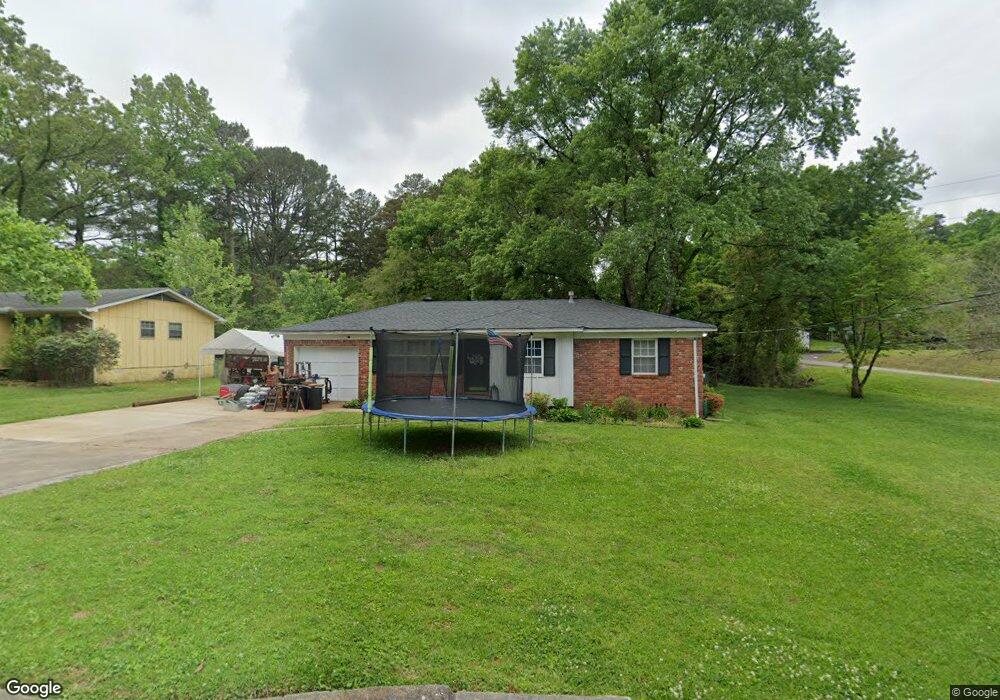
2444 Debbie Dr Center Point, AL 35215
Estimated Value: $130,966 - $162,000
3
Beds
1
Bath
1,030
Sq Ft
$144/Sq Ft
Est. Value
About This Home
This home is located at 2444 Debbie Dr, Center Point, AL 35215 and is currently estimated at $147,992, approximately $143 per square foot. 2444 Debbie Dr is a home located in Jefferson County with nearby schools including Bryant Park Elementary School, Clay-Chalkville Middle School, and Clay-Chalkville High School.
Ownership History
Date
Name
Owned For
Owner Type
Purchase Details
Closed on
Mar 27, 2009
Sold by
Gregory Wesley R
Bought by
Sprayberry Philip W
Current Estimated Value
Home Financials for this Owner
Home Financials are based on the most recent Mortgage that was taken out on this home.
Original Mortgage
$84,343
Outstanding Balance
$53,860
Interest Rate
5.13%
Mortgage Type
FHA
Estimated Equity
$94,132
Purchase Details
Closed on
May 29, 2002
Sold by
Dollins Michael Elgin and Dollins Kathleen Diane
Bought by
Parsons Pamella S
Home Financials for this Owner
Home Financials are based on the most recent Mortgage that was taken out on this home.
Original Mortgage
$74,450
Interest Rate
6.92%
Purchase Details
Closed on
May 10, 2002
Sold by
Frost Robert H
Bought by
Gregory Wesley R
Home Financials for this Owner
Home Financials are based on the most recent Mortgage that was taken out on this home.
Original Mortgage
$74,450
Interest Rate
6.92%
Create a Home Valuation Report for This Property
The Home Valuation Report is an in-depth analysis detailing your home's value as well as a comparison with similar homes in the area
Home Values in the Area
Average Home Value in this Area
Purchase History
| Date | Buyer | Sale Price | Title Company |
|---|---|---|---|
| Sprayberry Philip W | $85,900 | None Available | |
| Parsons Pamella S | $144,796 | -- | |
| Gregory Wesley R | $78,400 | -- |
Source: Public Records
Mortgage History
| Date | Status | Borrower | Loan Amount |
|---|---|---|---|
| Open | Sprayberry Philip W | $84,343 | |
| Previous Owner | Gregory Wesley R | $74,450 |
Source: Public Records
Tax History Compared to Growth
Tax History
| Year | Tax Paid | Tax Assessment Tax Assessment Total Assessment is a certain percentage of the fair market value that is determined by local assessors to be the total taxable value of land and additions on the property. | Land | Improvement |
|---|---|---|---|---|
| 2024 | $518 | $11,600 | -- | -- |
| 2022 | $461 | $9,380 | $2,100 | $7,280 |
| 2021 | $418 | $8,540 | $2,100 | $6,440 |
| 2020 | $392 | $8,070 | $2,100 | $5,970 |
| 2019 | $392 | $8,080 | $0 | $0 |
| 2018 | $378 | $7,820 | $0 | $0 |
| 2017 | $378 | $7,820 | $0 | $0 |
| 2016 | $300 | $7,040 | $0 | $0 |
| 2015 | $336 | $7,760 | $0 | $0 |
| 2014 | $384 | $7,440 | $0 | $0 |
| 2013 | $384 | $7,440 | $0 | $0 |
Source: Public Records
Map
Nearby Homes
- 5589 Matt Aaron Ln
- 2416 Debbie Dr
- 5540 Matt Aaron Ln
- 2415 Ormond Dr
- 2608 Gable Ct
- 1725 Gable Ct
- 5105 Marie Cir
- 4964 Kerri Ln
- 4968 Kerri Ln
- California Plan at Kerri Lane Estates
- Colorado Plan at Kerri Lane Estates
- Alabama Plan at Kerri Lane Estates
- Charleston Plan at Kerri Lane Estates
- Arizona Plan at Kerri Lane Estates
- 4992 Kerri Ln
- 4988 Kerri Ln
- 5251 Sterling Glen Dr
- 5104 Alex Way
- 5019 Darlene Dr
- 2304 Applewood Dr
- 2440 Debbie Dr
- 2449 Debbie Dr
- 2447 Ormond Dr
- 2445 Debbie Dr
- 1012 25th Ave NE
- 2436 Debbie Dr
- 2441 Debbie Dr
- 1016 25th Ave NE
- 2443 Ormond Dr
- 2437 Debbie Dr
- 1020 25th Ave NE
- 2500 Willowood Cir
- 2439 Ormond Dr
- 2505 Willowood Cir
- 5584 Matt Aaron Ln
- 5590 Matt Aaron Ln
- 5576 Matt Aaron Ln
- 2433 Debbie Dr
- 1024 25th Ave NE
- 5580 Matt Aaron Ln