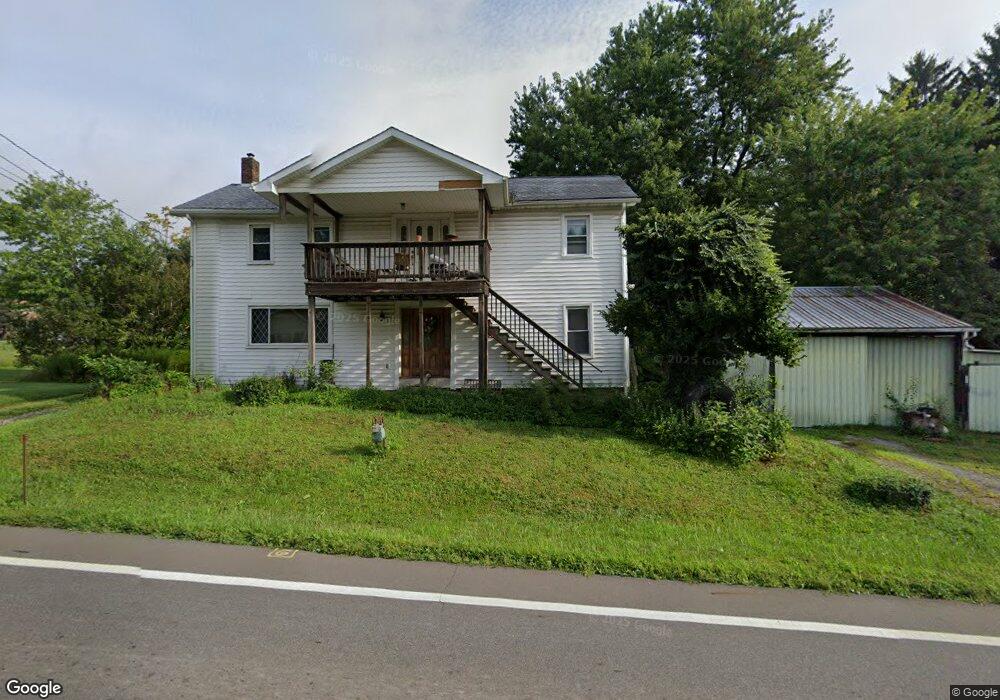
2444 W South Range Rd North Lima, OH 44452
Estimated Value: $100,000 - $285,000
3
Beds
2
Baths
1,936
Sq Ft
$96/Sq Ft
Est. Value
About This Home
This home is located at 2444 W South Range Rd, North Lima, OH 44452 and is currently estimated at $185,659, approximately $95 per square foot. 2444 W South Range Rd is a home located in Mahoning County with nearby schools including South Range Elementary School, South Range Middle School, and South Range High School.
Ownership History
Date
Name
Owned For
Owner Type
Purchase Details
Closed on
Oct 22, 2004
Sold by
Brady Carolyn L and Brady Robert V
Bought by
Gorcheff David A and Gorcheff Patricia F
Current Estimated Value
Home Financials for this Owner
Home Financials are based on the most recent Mortgage that was taken out on this home.
Original Mortgage
$48,500
Interest Rate
5.85%
Mortgage Type
Purchase Money Mortgage
Purchase Details
Closed on
Oct 7, 2002
Sold by
Graffius Rhonda L
Bought by
Brady Carolyn L
Purchase Details
Closed on
Jun 21, 1972
Bought by
Gorcheff Thomas P
Create a Home Valuation Report for This Property
The Home Valuation Report is an in-depth analysis detailing your home's value as well as a comparison with similar homes in the area
Purchase History
| Date | Buyer | Sale Price | Title Company |
|---|---|---|---|
| Gorcheff David A | $63,000 | -- | |
| Brady Carolyn L | $58,500 | -- | |
| Gorcheff Thomas P | -- | -- |
Source: Public Records
Mortgage History
| Date | Status | Borrower | Loan Amount |
|---|---|---|---|
| Previous Owner | Gorcheff David A | $48,500 |
Source: Public Records
Tax History
| Year | Tax Paid | Tax Assessment Tax Assessment Total Assessment is a certain percentage of the fair market value that is determined by local assessors to be the total taxable value of land and additions on the property. | Land | Improvement |
|---|---|---|---|---|
| 2025 | $2,146 | $41,380 | $3,180 | $38,200 |
| 2024 | $2,108 | $41,380 | $3,180 | $38,200 |
| 2023 | $2,115 | $41,380 | $3,180 | $38,200 |
| 2022 | $1,044 | $27,350 | $2,930 | $24,420 |
| 2021 | $1,056 | $27,350 | $2,930 | $24,420 |
| 2020 | $1,061 | $27,350 | $2,930 | $24,420 |
| 2019 | $854 | $23,280 | $2,930 | $20,350 |
| 2018 | $843 | $23,280 | $2,930 | $20,350 |
| 2017 | $840 | $23,280 | $2,930 | $20,350 |
| 2016 | $571 | $18,370 | $2,350 | $16,020 |
| 2015 | $561 | $18,370 | $2,350 | $16,020 |
| 2014 | $567 | $18,370 | $2,350 | $16,020 |
| 2013 | $563 | $18,370 | $2,350 | $16,020 |
Source: Public Records
Map
Nearby Homes
- 11695 Basinger Rd
- 12977 South Ave
- 1016 W Pine Lake Rd
- 11160 Detwiler Rd
- 12157 Columbiana Canfield Rd
- 950 Country Manor Dr
- 11541 South Ave
- 110 Longview Cir
- 0 Sharrott Rd Unit 5174987
- 9501 New Buffalo Rd
- 0 W Middletown Rd
- 13627 Market St
- 455 Via Avellino
- 268 S Bayshore Dr
- 331 Windjammer Dr Unit 1
- 39 Village Ct Unit 39
- 9264 Sharrott Rd Unit 1001
- 9264 Sharrott Rd Unit 104
- Rosewood Plan at Courtyards at Stonegate
- Lot 36 Berklee Dr
- 00 S Range Rd
- 2443 W South Range Rd
- 0 W South Range Rd Unit 5032414
- 0 W South Range Rd Unit 4396518
- 2418 W South Range Rd
- 2417 W South Range Rd
- 2459 W South Range Rd
- 2390 W South Range Rd
- 12025 New Buffalo Rd
- 11953 New Buffalo Rd
- 2360 W South Range Rd
- 12045 New Buffalo Rd
- 12026 New Buffalo Rd
- 2526 W South Range Rd
- 11940 New Buffalo Rd
- 12046 New Buffalo Rd
- 12049 New Buffalo Rd
- 11927 New Buffalo Rd
- 12071 New Buffalo Rd
- 2538 W South Range Rd
Your Personal Tour Guide
Ask me questions while you tour the home.