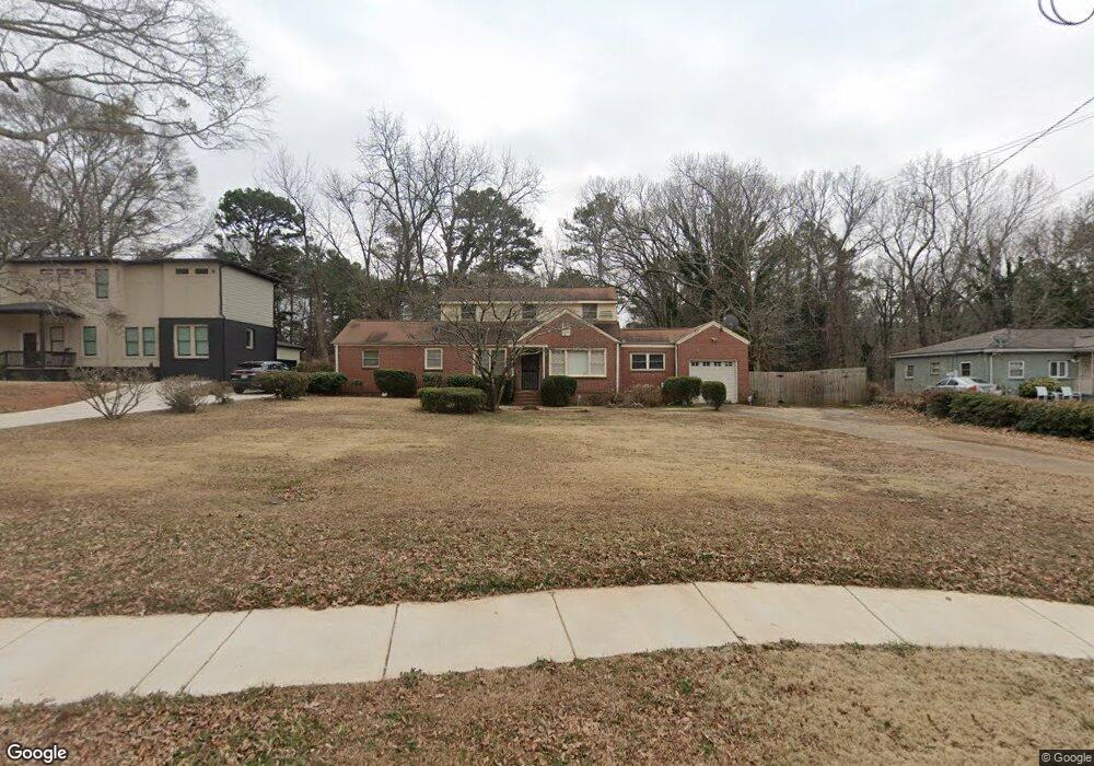
2445 Mcafee Rd Decatur, GA 30032
Estimated Value: $301,066 - $396,000
3
Beds
2
Baths
2,175
Sq Ft
$162/Sq Ft
Est. Value
About This Home
This home is located at 2445 Mcafee Rd, Decatur, GA 30032 and is currently estimated at $353,267, approximately $162 per square foot. 2445 Mcafee Rd is a home located in DeKalb County with nearby schools including Toney Elementary School, Columbia Middle School, and Columbia High School.
Ownership History
Date
Name
Owned For
Owner Type
Purchase Details
Closed on
May 13, 2004
Sold by
Smith Jack
Bought by
Eubanks Olin
Current Estimated Value
Home Financials for this Owner
Home Financials are based on the most recent Mortgage that was taken out on this home.
Original Mortgage
$84,075
Outstanding Balance
$39,868
Interest Rate
5.77%
Mortgage Type
New Conventional
Estimated Equity
$313,399
Create a Home Valuation Report for This Property
The Home Valuation Report is an in-depth analysis detailing your home's value as well as a comparison with similar homes in the area
Home Values in the Area
Average Home Value in this Area
Purchase History
| Date | Buyer | Sale Price | Title Company |
|---|---|---|---|
| Eubanks Olin | $88,500 | -- |
Source: Public Records
Mortgage History
| Date | Status | Borrower | Loan Amount |
|---|---|---|---|
| Open | Eubanks Olin | $84,075 |
Source: Public Records
Tax History
| Year | Tax Paid | Tax Assessment Tax Assessment Total Assessment is a certain percentage of the fair market value that is determined by local assessors to be the total taxable value of land and additions on the property. | Land | Improvement |
|---|---|---|---|---|
| 2025 | $515 | $120,640 | $20,000 | $100,640 |
| 2024 | $510 | $82,880 | $20,000 | $62,880 |
| 2023 | $510 | $71,120 | $13,200 | $57,920 |
Source: Public Records
Map
Nearby Homes
- 2453 Mellville Ave
- 2425 Mellville Ave
- 2390 Mellville Ave
- 2369 Mcafee Rd
- 2024 Collier Cir W
- 2037 W Collier Cir
- 2352 Marion Cir
- 2437 Hillside Ave
- 2076 Windy Hill Rd
- 2340 Cresta Dr
- 2522 Brentwood Ct
- 2361 Collier Dr
- 2191 Greystone Way
- 2569 Northview Ave
- 2294 Collier Dr
- 2554 Brentwood Rd
- 678 Quillian Ave
- 672 Quillian Ave
- 2442 Lynn Iris Dr
- 2103 Keheley Dr
- 2453 Mcafee Rd
- 2435 Mcafee Rd
- 2461 Mcafee Rd
- 2423 5 Macafee Rd
- 2026 Collier Cir W
- 2423 Mcafee Rd
- 2444 Mcafee Rd
- 2448 Mcafee Rd
- 2434 Mcafee Rd
- 2452 Mcafee Rd
- 2428 Mcafee Rd
- 2469 Mcafee Rd
- 2458 Mcafee Rd
- 1998 Normal St
- 2424 Mcafee Rd Unit 3
- 1999 Normal St
- 2464 Mcafee Rd
- 1994 Normal St
- 2418 Mcafee Rd
- 2477 Mcafee Rd
Your Personal Tour Guide
Ask me questions while you tour the home.