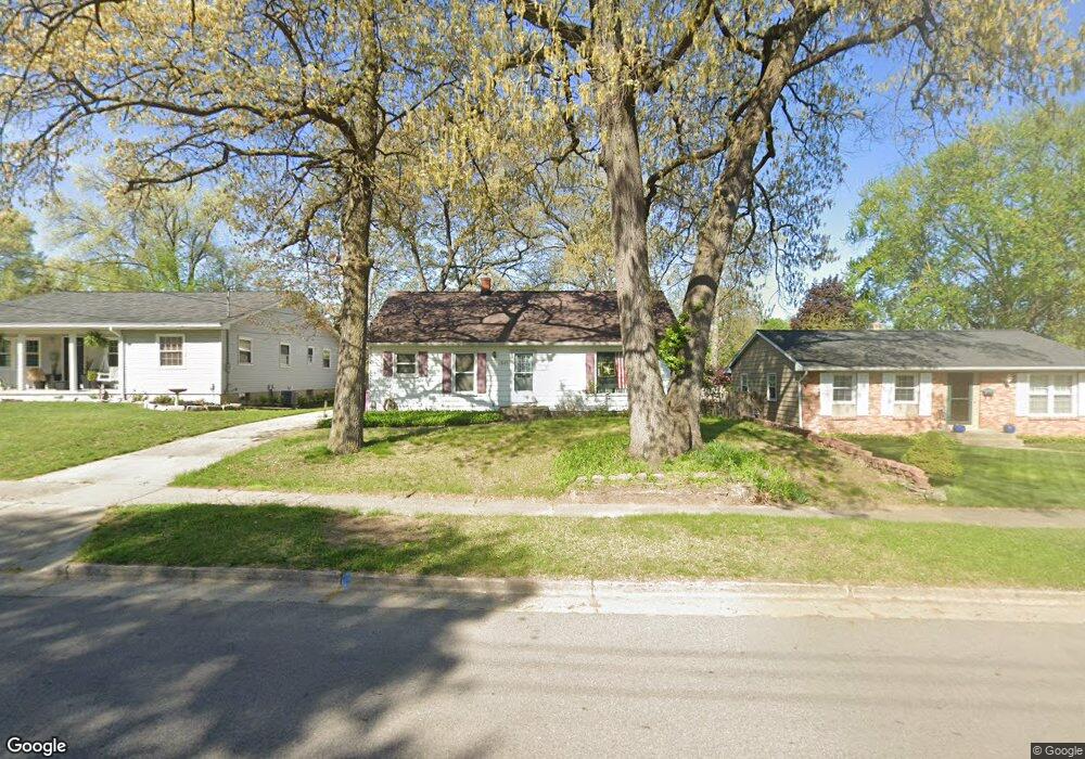
2445 Michael Ave SW Wyoming, MI 49509
Urbandale NeighborhoodEstimated Value: $281,000 - $308,870
4
Beds
2
Baths
2,173
Sq Ft
$136/Sq Ft
Est. Value
About This Home
This home is located at 2445 Michael Ave SW, Wyoming, MI 49509 and is currently estimated at $294,468, approximately $135 per square foot. 2445 Michael Ave SW is a home located in Kent County with nearby schools including Oriole Park Elementary School, Wyoming Intermediate School, and Parkview Elementary School.
Ownership History
Date
Name
Owned For
Owner Type
Purchase Details
Closed on
May 12, 2006
Sold by
Miller Craig E and Miller Regina M
Bought by
Velderman Robert and Velderman Melissa
Current Estimated Value
Home Financials for this Owner
Home Financials are based on the most recent Mortgage that was taken out on this home.
Original Mortgage
$127,000
Outstanding Balance
$81,043
Interest Rate
8.25%
Mortgage Type
Fannie Mae Freddie Mac
Estimated Equity
$213,426
Purchase Details
Closed on
Mar 28, 2000
Purchase Details
Closed on
Jul 8, 1994
Purchase Details
Closed on
Oct 23, 1986
Create a Home Valuation Report for This Property
The Home Valuation Report is an in-depth analysis detailing your home's value as well as a comparison with similar homes in the area
Home Values in the Area
Average Home Value in this Area
Purchase History
| Date | Buyer | Sale Price | Title Company |
|---|---|---|---|
| Velderman Robert | $127,000 | None Available | |
| -- | $105,000 | -- | |
| -- | $78,000 | -- | |
| -- | $52,000 | -- |
Source: Public Records
Mortgage History
| Date | Status | Borrower | Loan Amount |
|---|---|---|---|
| Open | Velderman Robert | $127,000 |
Source: Public Records
Tax History Compared to Growth
Tax History
| Year | Tax Paid | Tax Assessment Tax Assessment Total Assessment is a certain percentage of the fair market value that is determined by local assessors to be the total taxable value of land and additions on the property. | Land | Improvement |
|---|---|---|---|---|
| 2025 | $2,162 | $146,700 | $0 | $0 |
| 2024 | $2,162 | $132,800 | $0 | $0 |
| 2023 | $2,235 | $102,400 | $0 | $0 |
| 2022 | $2,059 | $94,200 | $0 | $0 |
| 2021 | $2,011 | $88,000 | $0 | $0 |
| 2020 | $1,835 | $79,700 | $0 | $0 |
| 2019 | $1,966 | $70,800 | $0 | $0 |
| 2018 | $1,930 | $64,100 | $0 | $0 |
| 2017 | $1,880 | $55,600 | $0 | $0 |
| 2016 | $1,814 | $49,200 | $0 | $0 |
| 2015 | $1,794 | $49,200 | $0 | $0 |
| 2013 | -- | $46,100 | $0 | $0 |
Source: Public Records
Map
Nearby Homes
- 2517 Newstead Ave SW
- 2621 Doncaster Ave SW
- 2713 Madelyn Dr SW
- 818 Aldon St SW
- 2620 Riley Ave SW
- 2101 Godfrey Ave SW
- 2107 Huizen Ave SW
- 886 Belfield St SW Unit 7
- 2151 Banner Dr SW Unit F
- 2140 Banner Dr SW
- 2746 Tennyson Dr SW
- 2185 Clyde Park Ave SW
- 2050 Arnold Ave SW
- 1955 Hendricks Ave SW
- 922 Burton St SW
- 1946 Martindale Ave SW
- 1260 Cricklewood St SW
- 2541 Noel Ave SW
- 1917 Osmer Ave SW
- 1945 Delwood Ave SW
- 2451 Michael Ave SW
- 2439 Michael Ave SW
- 2457 Michael Ave SW
- 2433 Michael Ave SW
- 2448 de Hoop Ave SW
- 2460 de Hoop Ave SW
- 2442 de Hoop Ave SW
- 2463 Michael Ave SW
- 2425 Michael Ave SW
- 2466 de Hoop Ave SW
- 2448 Michael Ave SW
- 2436 de Hoop Ave SW
- 2454 Michael Ave SW
- 2436 Michael Ave SW
- 2504 de Hoop Ave SW
- 2503 Michael Ave SW
- 2460 Michael Ave SW
- 2419 Michael Ave SW
- 2428 Michael Ave SW
- 2430 de Hoop Ave SW