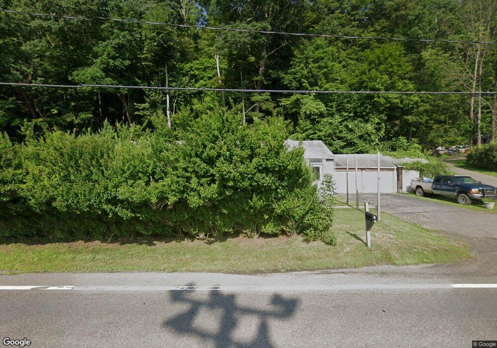
2445 State Route 12 Unit NYS Chenango Forks, NY 13746
Estimated Value: $116,000 - $171,721
2
Beds
2
Baths
1,092
Sq Ft
$122/Sq Ft
Est. Value
About This Home
This home is located at 2445 State Route 12 Unit NYS, Chenango Forks, NY 13746 and is currently estimated at $133,680, approximately $122 per square foot. 2445 State Route 12 Unit NYS is a home located in Broome County with nearby schools including Chenango Forks Elementary School, Chenango Forks Middle School, and Chenango Forks High School.
Ownership History
Date
Name
Owned For
Owner Type
Purchase Details
Closed on
Mar 22, 2017
Sold by
Bank Of America Na
Bought by
Phillips William Michael
Current Estimated Value
Purchase Details
Closed on
Aug 12, 1998
Sold by
Ronk Orville P
Bought by
Maxwell Ann M
Purchase Details
Closed on
Aug 26, 1997
Create a Home Valuation Report for This Property
The Home Valuation Report is an in-depth analysis detailing your home's value as well as a comparison with similar homes in the area
Home Values in the Area
Average Home Value in this Area
Purchase History
| Date | Buyer | Sale Price | Title Company |
|---|---|---|---|
| Phillips William Michael | $37,500 | None Available | |
| Maxwell Ann M | $50,000 | -- | |
| -- | $61,332 | -- |
Source: Public Records
Tax History Compared to Growth
Tax History
| Year | Tax Paid | Tax Assessment Tax Assessment Total Assessment is a certain percentage of the fair market value that is determined by local assessors to be the total taxable value of land and additions on the property. | Land | Improvement |
|---|---|---|---|---|
| 2024 | $3,061 | $56,100 | $11,000 | $45,100 |
| 2023 | $3,098 | $56,100 | $11,000 | $45,100 |
| 2022 | $2,999 | $56,100 | $11,000 | $45,100 |
| 2021 | $2,965 | $56,100 | $11,000 | $45,100 |
| 2020 | $2,923 | $56,100 | $11,000 | $45,100 |
| 2019 | -- | $56,100 | $11,000 | $45,100 |
| 2018 | $2,773 | $56,100 | $11,000 | $45,100 |
| 2017 | $2,755 | $56,100 | $11,000 | $45,100 |
| 2016 | $2,090 | $56,100 | $11,000 | $45,100 |
| 2015 | -- | $56,100 | $11,000 | $45,100 |
| 2014 | -- | $56,100 | $11,000 | $45,100 |
Source: Public Records
Map
Nearby Homes
- 6667 State Route 79
- 142 Marshman Rd
- 15 River Ln
- 120 Steed Rd
- 94 Richards Rd
- 197 Port Rd
- 35 Woodland Dr
- 243 Jeffrey Dr
- 1092 State Route 369
- 1 Asbury Ave
- 101 Palmer Hill Rd
- 57 Edelweiss Ln
- 343 Palmer Hill Rd
- 446 Conklin Hill Rd
- 404 Ballyhack Rd
- 330 Palmer Hill Rd
- 15 Peer St
- 105 Poplar Hill Rd
- 63 E Thomas St
- 11 Frederick Rd
- 2437 New York 12
- 2437 State Highway 12
- 2436 State Route 12 Unit NYS
- 2451 New York 12
- 2451 Nys Route 12
- 2451 State Highway 12
- 2428 State Route 12 Unit NYS
- 2428 State Route 12
- 2428 Nys 12
- 2456 State Route 12 Unit NYS
- 2456 State Route 12
- 2465 State Route 12 Unit NYS
- 2424 State Route 12 Unit NYS
- 2468 State Route 12 Unit NYS
- 2421 State Route 12 Unit NYS
- 2420 State Route 12 Unit NYS
- 2466 State Route 12 Unit NYS
- 2454 State Route 12 Unit NYS
- 2411 New York 12
- 2412 State Route 12 Unit NYS