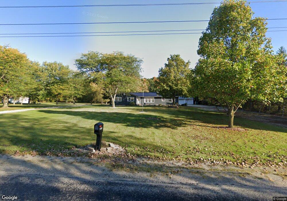
2445 W 1100 N-90 Markle, IN 46770
Estimated Value: $256,000 - $323,000
3
Beds
3
Baths
1,288
Sq Ft
$221/Sq Ft
Est. Value
About This Home
This home is located at 2445 W 1100 N-90, Markle, IN 46770 and is currently estimated at $284,399, approximately $220 per square foot. 2445 W 1100 N-90 is a home located in Wells County with nearby schools including Norwell High School.
Ownership History
Date
Name
Owned For
Owner Type
Purchase Details
Closed on
Jul 2, 2020
Sold by
Norris Amber T and Pratt Amber T
Bought by
Sorg Logan Robert and Sorg Kristin Nicole
Current Estimated Value
Home Financials for this Owner
Home Financials are based on the most recent Mortgage that was taken out on this home.
Original Mortgage
$197,979
Outstanding Balance
$175,555
Interest Rate
3.1%
Mortgage Type
New Conventional
Estimated Equity
$108,844
Purchase Details
Closed on
Feb 20, 2008
Sold by
Schaper Ray E
Bought by
Schaper Jane E
Home Financials for this Owner
Home Financials are based on the most recent Mortgage that was taken out on this home.
Original Mortgage
$117,000
Interest Rate
5.51%
Mortgage Type
New Conventional
Purchase Details
Closed on
Feb 14, 2000
Sold by
Vanmeter Ronald D and Vanmeter Em
Bought by
Schaper Ray E and Schaper Jane E
Create a Home Valuation Report for This Property
The Home Valuation Report is an in-depth analysis detailing your home's value as well as a comparison with similar homes in the area
Home Values in the Area
Average Home Value in this Area
Purchase History
| Date | Buyer | Sale Price | Title Company |
|---|---|---|---|
| Sorg Logan Robert | -- | None Available | |
| Schaper Jane E | -- | None Available | |
| Schaper Ray E | $120,000 | -- |
Source: Public Records
Mortgage History
| Date | Status | Borrower | Loan Amount |
|---|---|---|---|
| Open | Sorg Logan Robert | $197,979 | |
| Previous Owner | Schaper Jane E | $117,000 |
Source: Public Records
Tax History Compared to Growth
Tax History
| Year | Tax Paid | Tax Assessment Tax Assessment Total Assessment is a certain percentage of the fair market value that is determined by local assessors to be the total taxable value of land and additions on the property. | Land | Improvement |
|---|---|---|---|---|
| 2024 | $1,419 | $250,600 | $47,100 | $203,500 |
| 2023 | $1,391 | $251,500 | $34,100 | $217,400 |
| 2022 | $1,138 | $206,900 | $28,400 | $178,500 |
| 2021 | $1,041 | $193,700 | $28,400 | $165,300 |
| 2020 | $767 | $168,300 | $28,400 | $139,900 |
| 2019 | $720 | $156,000 | $28,400 | $127,600 |
| 2018 | $509 | $123,300 | $19,600 | $103,700 |
| 2017 | $415 | $122,000 | $19,600 | $102,400 |
| 2016 | $412 | $120,200 | $18,700 | $101,500 |
| 2014 | $401 | $116,500 | $17,900 | $98,600 |
| 2013 | -- | $124,400 | $17,300 | $107,100 |
Source: Public Records
Map
Nearby Homes
- 2501 W 1100 N
- 11136 N 200 W
- 11130 N 300 W
- 17820 N Wayne St
- 16902 Prine Rd
- 1800 W 950 N-90
- 2405 W 900 N
- 10930 Yoder Rd
- 9002 W Yoder Rd
- TBD W 900 N
- TBD W Yoder Rd
- 500 W 800 N-90
- 000 Feighner Rd
- 15855 Feighner Rd
- 13011 Hamilton Rd
- 10937 Carob Thorn Trail
- 11099 Carob Thorn Trail
- 13815 Branstrator Rd
- 11132 Carob Thorn Trail
- TBD Hamilton Rd
- 2445 W 1100 N
- 2419 W 1100 N-90 Unit 90
- 2493 W 1100 N-90 Unit 90
- 2277 W 1100 N
- 2277 W 1100 N-90
- 2313 W 1100 N-90 Unit 90
- 2326 W 1100 N-90 Unit 90
- 2501 W 1100 N-90 Unit 90
- 2214 W 1100 N-90 Unit 90
- 2119 W 1100 N-90
- 2195 W 1100 N-90 Unit 90
- 2162 W 1100 N-90 Unit 90
- 2098 W 1100 N-90 Unit 90
- 11400 N 200 W
- 11340 N 200 W
- 11184 N 200 W
- 10758 N 200 W-90 Unit 90
- 11195 N 200 W
- 2920 W 1100 N-90
- 2920 W 1100 N