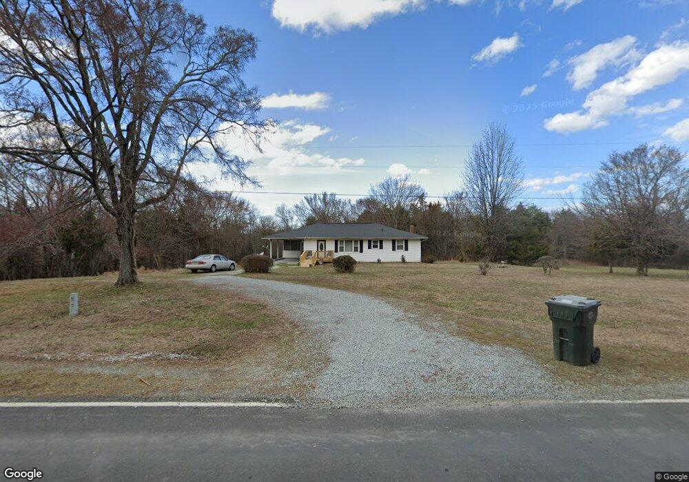
2445 Zion Level Church Rd Semora, NC 27343
Estimated Value: $113,284 - $648,000
--
Bed
1
Bath
1,280
Sq Ft
$272/Sq Ft
Est. Value
About This Home
This home is located at 2445 Zion Level Church Rd, Semora, NC 27343 and is currently estimated at $347,821, approximately $271 per square foot. 2445 Zion Level Church Rd is a home located in Person County with nearby schools including Person High School.
Ownership History
Date
Name
Owned For
Owner Type
Purchase Details
Closed on
Sep 3, 2024
Sold by
Whitlock Mamie Alice
Bought by
Whitlock Mamie Alice and Whitlock Monica Lenette
Current Estimated Value
Purchase Details
Closed on
Apr 23, 2023
Sold by
Whitlock Monica Lenette
Bought by
Whitlock Mamie Alice
Purchase Details
Closed on
Mar 17, 2023
Sold by
Whitlock Mamie Alice
Bought by
Whitlock Mamie Alice and Whitlock Monica Lenette
Purchase Details
Closed on
May 1, 2020
Sold by
Cunningham Alice R
Bought by
Whitlock Mamie Alice
Purchase Details
Closed on
Aug 24, 1963
Bought by
Cunningham Sterling and Cunningham Alice R
Create a Home Valuation Report for This Property
The Home Valuation Report is an in-depth analysis detailing your home's value as well as a comparison with similar homes in the area
Home Values in the Area
Average Home Value in this Area
Purchase History
| Date | Buyer | Sale Price | Title Company |
|---|---|---|---|
| Whitlock Mamie Alice | -- | None Listed On Document | |
| Whitlock Mamie Alice | -- | None Listed On Document | |
| Whitlock Mamie Alice | -- | -- | |
| Whitlock Mamie Alice | -- | None Available | |
| Cunningham Sterling | -- | -- |
Source: Public Records
Tax History Compared to Growth
Tax History
| Year | Tax Paid | Tax Assessment Tax Assessment Total Assessment is a certain percentage of the fair market value that is determined by local assessors to be the total taxable value of land and additions on the property. | Land | Improvement |
|---|---|---|---|---|
| 2025 | $604 | $134,067 | $0 | $0 |
| 2024 | $519 | $66,419 | $0 | $0 |
| 2023 | $519 | $66,419 | $0 | $0 |
| 2022 | $517 | $66,419 | $0 | $0 |
| 2021 | $502 | $66,419 | $0 | $0 |
| 2020 | $413 | $54,459 | $0 | $0 |
| 2019 | $419 | $54,459 | $0 | $0 |
| 2018 | $393 | $54,459 | $0 | $0 |
| 2017 | $387 | $54,459 | $0 | $0 |
| 2016 | $387 | $54,459 | $0 | $0 |
| 2015 | $387 | $54,459 | $0 | $0 |
| 2014 | $387 | $54,459 | $0 | $0 |
Source: Public Records
Map
Nearby Homes
- 0 Rock Pointe Dr Unit 10091076
- 232 Hardy Hollow Rd
- 454 Southpoint Trail
- Lot 54 Pinesborough Estates Rd
- Tbd Quail Roost Dr
- 734 Crystal Forest Dr
- 600 Fox Lair Trail
- 976 Estate Rd
- 214 Crystal Bay Ln
- 173 Lawrence Barker Rd
- Lot D Swallowtail Dr
- 195 Lynn Smith Rd
- Lot 7 Lynn Smith Rd
- 197 Barefoot Landing Ln
- 276 Beech Dr
- 28 Greenway Dr
- 36 Red Bud Ln
- 8589 McGhees Mill Rd
- 1879 Riverend Ln
- 528 Beech Dr
- 2515 Zion Level Church Rd
- 9 Jeff Rd
- 5 Paulas Ln
- 6 Paulas Ln
- 3 Paulas Ln
- 0 Waters Edge Ln
- 0 Rock Point Dr Unit 1795460
- 000 Rock Pointe Dr
- 000 Rock Pointe Dr Unit B
- 0 Rock Point Dr Unit 1 TR1795460
- 14 Waters Edge Ln
- 0 Paulas Ln Unit TR1759457
- 2651 Zion Level Church Rd
- Tbd Rock Pointe Dr
- 0 Rock Pointe Dr Unit 10009126
- 0 Rock Pointe Dr Unit 1642006
- Lot #1 Rock Pointe Dr
- 0 Rock Pointe Dr Unit B TR1803546
- 0 Rock Pointe Dr Unit 1 1642006
- 0 Rock Pointe Dr Unit B