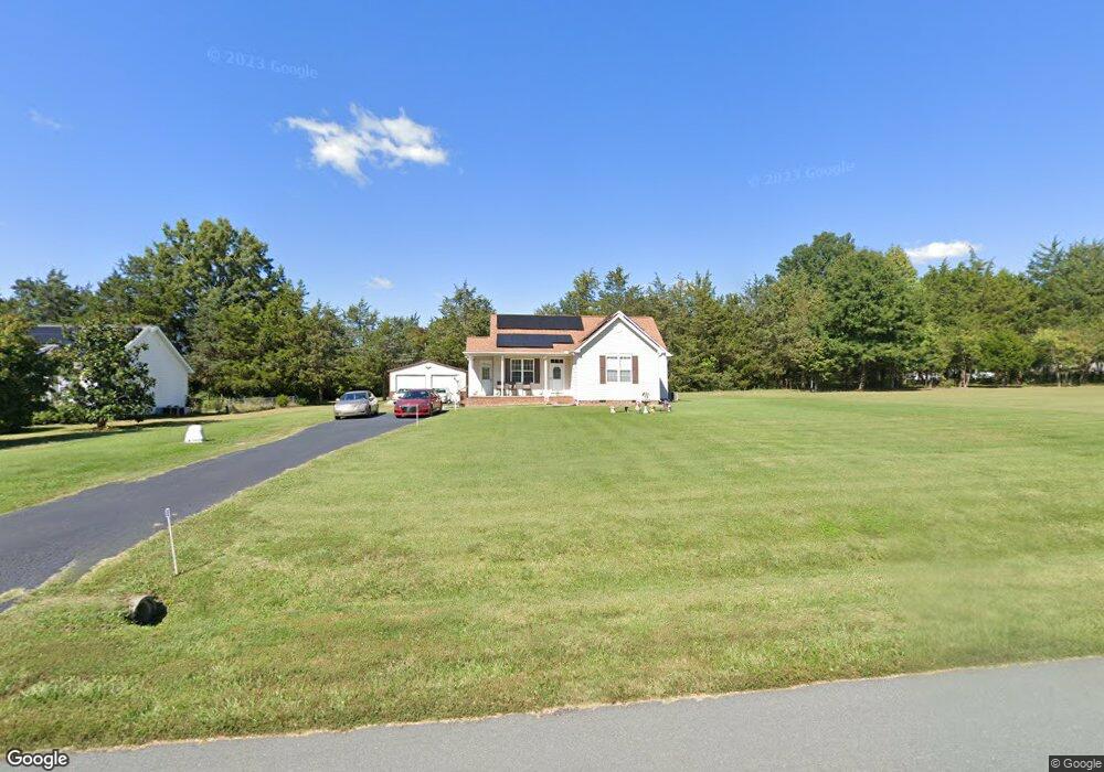
2446 Foxfire Ln Burlington, NC 27217
Estimated Value: $286,427 - $349,000
3
Beds
2
Baths
1,280
Sq Ft
$239/Sq Ft
Est. Value
About This Home
This home is located at 2446 Foxfire Ln, Burlington, NC 27217 and is currently estimated at $305,607, approximately $238 per square foot. 2446 Foxfire Ln is a home located in Alamance County with nearby schools including Pleasant Grove Elementary School, Woodlawn Middle School, and Eastern Alamance High School.
Ownership History
Date
Name
Owned For
Owner Type
Purchase Details
Closed on
May 13, 2004
Sold by
Longbeen Builders Inc
Bought by
Holeman Cousin Tawanda
Current Estimated Value
Home Financials for this Owner
Home Financials are based on the most recent Mortgage that was taken out on this home.
Original Mortgage
$99,000
Outstanding Balance
$46,384
Interest Rate
5.49%
Mortgage Type
New Conventional
Estimated Equity
$259,223
Create a Home Valuation Report for This Property
The Home Valuation Report is an in-depth analysis detailing your home's value as well as a comparison with similar homes in the area
Home Values in the Area
Average Home Value in this Area
Purchase History
| Date | Buyer | Sale Price | Title Company |
|---|---|---|---|
| Holeman Cousin Tawanda | $124,000 | -- |
Source: Public Records
Mortgage History
| Date | Status | Borrower | Loan Amount |
|---|---|---|---|
| Open | Holeman Cousin Tawanda | $99,000 |
Source: Public Records
Tax History Compared to Growth
Tax History
| Year | Tax Paid | Tax Assessment Tax Assessment Total Assessment is a certain percentage of the fair market value that is determined by local assessors to be the total taxable value of land and additions on the property. | Land | Improvement |
|---|---|---|---|---|
| 2025 | $1,571 | $264,425 | $31,658 | $232,767 |
| 2024 | $1,460 | $264,425 | $31,658 | $232,767 |
| 2023 | $1,362 | $264,425 | $31,658 | $232,767 |
| 2022 | $1,025 | $133,773 | $30,150 | $103,623 |
| 2021 | $1,012 | $133,773 | $30,150 | $103,623 |
| 2020 | $1,025 | $133,773 | $30,150 | $103,623 |
| 2019 | $1,030 | $133,773 | $30,150 | $103,623 |
| 2018 | $0 | $133,773 | $30,150 | $103,623 |
| 2017 | $905 | $133,773 | $30,150 | $103,623 |
| 2016 | $964 | $141,824 | $30,150 | $111,674 |
| 2015 | $931 | $141,824 | $30,150 | $111,674 |
| 2014 | -- | $141,824 | $30,150 | $111,674 |
Source: Public Records
Map
Nearby Homes
- 3345 Fleming Graham Rd
- 3295 Fleming Graham Rd
- 3263 Fleming Graham Rd
- 2634 William Allen Rd
- 2619 William Allen Rd
- 2513 William Allen Rd
- Lot 14 Crumpton Trail
- Lot 15 Crumpton Trail
- 2819 John Lewis Rd
- 2848 John Lewis Rd
- 2830 Barnett Rd
- 3082 Cascade Dr
- 2200 State Highway 49
- 4378 State Highway 49
- 219 Pillow Ln
- 0 Haith Fuller Trail
- 134 Pillow Ln
- 119 Gideon Place
- 3610 Barnett Rd
- 2436 Foxfire Ln
- L17 Foxfire Ln
- L12 Foxfire Ln
- 3104 Blue Moon Trail
- 3116 Blue Moon Trail
- L13 Foxfire Ln
- L14 Foxfire Ln
- L6 Foxfire Ln
- L29 Foxfire Ln
- L16 Foxfire Ln
- L15 Foxfire Ln
- L31 Foxfire Ln
- L4 Foxfire Ln
- 110 Foxfire Ln
- L18 Foxfire Ln
- L22 Foxfire Ln
- L20 Foxfire Ln
- L11 Foxfire Ln
- L23 Foxfire Ln
- L24 Foxfire Ln