Estimated Value: $331,000 - $436,000
2
Beds
1
Bath
742
Sq Ft
$511/Sq Ft
Est. Value
About This Home
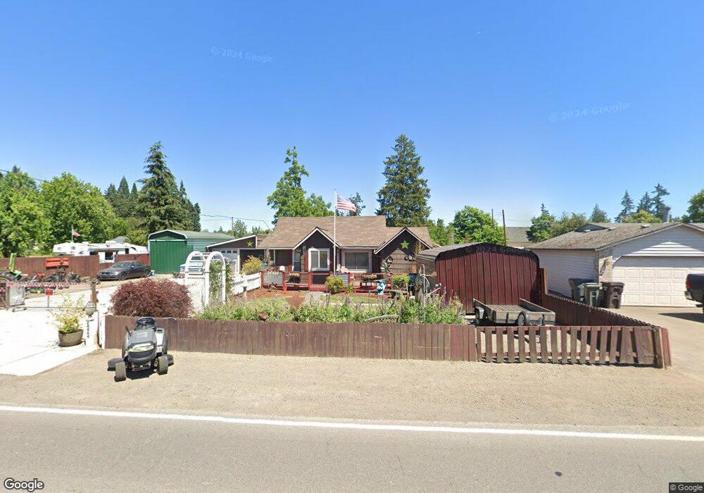
This home is located at 24464 S Barlow Rd, Canby, OR 97013 and is currently estimated at $379,532, approximately $511 per square foot. 24464 S Barlow Rd is a home located in Clackamas County with nearby schools including Josefa L. Sambrano Elementary School, Baker Prairie Middle School, and Canby High School.
Ownership History
Date
Name
Owned For
Owner Type
Purchase Details
Closed on
Jun 27, 2003
Sold by
Larson Robert L
Bought by
Norris Silas B and Norris Bernadette A
Current Estimated Value
Purchase Details
Closed on
Mar 29, 2001
Sold by
Keyser William V and Keyser Susan E
Bought by
Norris Silas B and Norris Bernadette A
Home Financials for this Owner
Home Financials are based on the most recent Mortgage that was taken out on this home.
Original Mortgage
$113,400
Interest Rate
7.19%
Purchase Details
Closed on
Jul 30, 1997
Sold by
Barnett Danny L and Barnett Suzett C
Bought by
Keyser William and Keyser Susan E
Create a Home Valuation Report for This Property
The Home Valuation Report is an in-depth analysis detailing your home's value as well as a comparison with similar homes in the area
Home Values in the Area
Average Home Value in this Area
Purchase History
| Date | Buyer | Sale Price | Title Company |
|---|---|---|---|
| Norris Silas B | -- | -- | |
| Norris Silas B | -- | -- | |
| Norris Silas B | -- | -- | |
| Norris Silas B | $85,000 | Transnation Title Insurance | |
| Keyser William | $70,000 | Chicago Title Insurance Co |
Source: Public Records
Mortgage History
| Date | Status | Borrower | Loan Amount |
|---|---|---|---|
| Previous Owner | Norris Silas B | $113,400 |
Source: Public Records
Tax History Compared to Growth
Tax History
| Year | Tax Paid | Tax Assessment Tax Assessment Total Assessment is a certain percentage of the fair market value that is determined by local assessors to be the total taxable value of land and additions on the property. | Land | Improvement |
|---|---|---|---|---|
| 2025 | $2,108 | $141,484 | -- | -- |
| 2024 | $2,049 | $137,364 | -- | -- |
| 2023 | $2,049 | $133,364 | $0 | $0 |
| 2022 | $1,876 | $129,480 | $0 | $0 |
| 2021 | $1,804 | $125,709 | $0 | $0 |
| 2020 | $1,776 | $122,048 | $0 | $0 |
| 2019 | $1,684 | $118,494 | $0 | $0 |
| 2018 | $1,649 | $115,043 | $0 | $0 |
| 2017 | $1,609 | $111,692 | $0 | $0 |
| 2016 | $1,554 | $108,439 | $0 | $0 |
| 2015 | $1,499 | $105,281 | $0 | $0 |
| 2014 | $1,456 | $102,215 | $0 | $0 |
Source: Public Records
Map
Nearby Homes
- 6869 S Knights Bridge Rd
- 6815 S Knights Bridge Rd
- 916 NW 2nd Ave
- 1339 S Baywood Ct
- 1655 S Elm St Unit 2
- 1655 S Elm St
- 1655 S Elm St Unit 302
- 850 NW 3rd Ave
- 812 NW 3rd Ave
- 1198 SW 1st Ave
- 589 NW 3rd Ave
- 442 NW 4th Ave
- 978 N Alder St
- 1400 S Elm St Unit 91
- 431 SW 3rd Ave
- 476 SW 15th Ave
- 442 SW 15th Ave Unit 15
- 448 SW 15th Ave Unit 14
- 452 SW 15th Ave Unit 13
- 960 N Aspen Ct
- 24480 S Barlow Rd
- 207 N Main St
- 24410 S Barlow Rd
- 24486 S Barlow Rd
- 203 N Main St
- 24475 S Barlow Rd
- 24400 S Barlow Rd
- 24483 S Barlow Rd
- 111 N Main St
- 109 E 2nd St
- 205 N Maple St
- 24524 S Barlow Rd
- 109 N Main St
- 24546 S Barlow Rd
- 207 N Maple St
- 110 N Main St
- 105 N Main St
- 106 E 2nd St
- 209 N Maple St
- 24501 S Barlow Rd