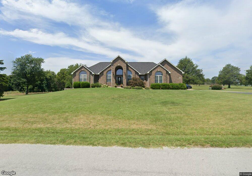
2447 S Farm Road 111 Springfield, MO 65802
Estimated Value: $433,000 - $651,000
3
Beds
2
Baths
2,496
Sq Ft
$223/Sq Ft
Est. Value
About This Home
This home is located at 2447 S Farm Road 111, Springfield, MO 65802 and is currently estimated at $557,062, approximately $223 per square foot. 2447 S Farm Road 111 is a home located in Greene County with nearby schools including Price Elementary School, Republic Middle School, and Republic High School.
Ownership History
Date
Name
Owned For
Owner Type
Purchase Details
Closed on
May 24, 2006
Sold by
Datema Kenneth N and Datema Ken N
Bought by
Ragsdale David E and Ragsdale Patricia D
Current Estimated Value
Home Financials for this Owner
Home Financials are based on the most recent Mortgage that was taken out on this home.
Original Mortgage
$261,275
Outstanding Balance
$152,700
Interest Rate
6.56%
Mortgage Type
Construction
Estimated Equity
$404,362
Purchase Details
Closed on
Apr 24, 2006
Sold by
Datema Kenneth N and Datema Sandra
Bought by
Brickey Marty and Brickey Christine
Home Financials for this Owner
Home Financials are based on the most recent Mortgage that was taken out on this home.
Original Mortgage
$261,275
Outstanding Balance
$152,700
Interest Rate
6.56%
Mortgage Type
Construction
Estimated Equity
$404,362
Create a Home Valuation Report for This Property
The Home Valuation Report is an in-depth analysis detailing your home's value as well as a comparison with similar homes in the area
Home Values in the Area
Average Home Value in this Area
Purchase History
| Date | Buyer | Sale Price | Title Company |
|---|---|---|---|
| Ragsdale David E | -- | Lincoln Evans Land Title Co | |
| Brickey Marty | -- | Lincoln Evans Land Title Co |
Source: Public Records
Mortgage History
| Date | Status | Borrower | Loan Amount |
|---|---|---|---|
| Open | Ragsdale David E | $261,275 |
Source: Public Records
Tax History Compared to Growth
Tax History
| Year | Tax Paid | Tax Assessment Tax Assessment Total Assessment is a certain percentage of the fair market value that is determined by local assessors to be the total taxable value of land and additions on the property. | Land | Improvement |
|---|---|---|---|---|
| 2025 | $4,041 | $78,800 | $9,410 | $69,390 |
| 2024 | $4,041 | $71,010 | $7,510 | $63,500 |
| 2023 | $3,961 | $71,010 | $7,510 | $63,500 |
| 2022 | $3,563 | $63,280 | $7,510 | $55,770 |
| 2021 | $3,563 | $63,280 | $7,510 | $55,770 |
| 2020 | $3,187 | $61,130 | $7,510 | $53,620 |
| 2019 | $3,175 | $61,130 | $7,510 | $53,620 |
| 2018 | $2,955 | $55,200 | $7,510 | $47,690 |
| 2017 | $2,934 | $55,200 | $7,510 | $47,690 |
| 2016 | $2,961 | $55,200 | $7,510 | $47,690 |
| 2015 | $2,959 | $55,200 | $7,510 | $47,690 |
| 2014 | $2,985 | $55,120 | $7,510 | $47,610 |
Source: Public Records
Map
Nearby Homes
- 000 W Farm Road 148
- 1707 S Farm Road 115
- 1883 S Farm Road 107
- 1895 S Lullwood Ave
- 1898 S Lullwood Ave
- 4914 W University St
- 4596 W Greenridge St
- Tbd W Farm Road 148
- 4662 W University St
- 2031 S Pebble Ridge Rd
- 000 W Farm Road 156
- 5033 W Skyler Dr
- 4652 Blackfoot Dr
- 4487 W University St
- 4641 Blackfoot Dr
- 1128 S Brecklyn Rd
- 5610 W Sugar Pine Dr
- 1166 S Broadview Ave
- 1161 S Broadview Ave
- 5441 Basswood Ct W
- 2446 S Farm Road 111
- 2349 S Farm Road 111
- 2545 S Farm Road 111
- 2348 S Farm Road 111
- ??? Farm Rd 154
- 2544 S Farm Road 111
- 5401 W Farm Road 156
- ?? Farm Road 154
- 5279 W Farm Road 156
- 2251 S Farm Road 111
- 5314 W Farm Road 156
- 2605 S Maple Leaf Ln
- 2250 S Farm Road 111
- 5294 W Farm Road 156
- 5618 W Ruben Ln
- 2649 S Maple Leaf Ln
- 5547 W Farm Road 156
- 5218 W Farm Road 156
- 5620 W Ruben Ln
- 5508 W Farm Road 156