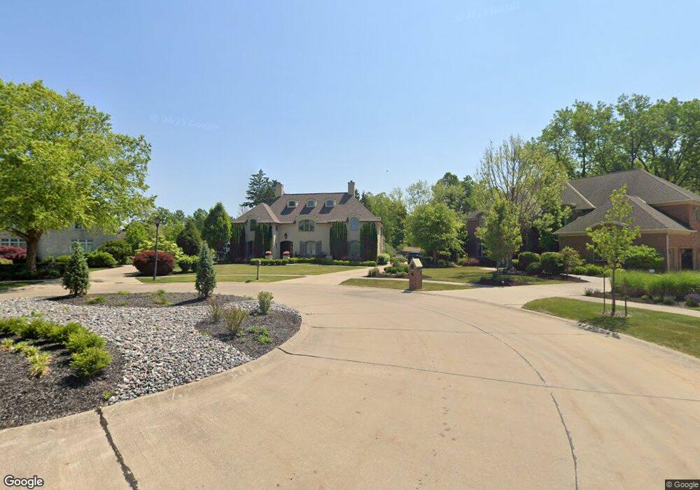
24484 Annie Ln Westlake, OH 44145
Estimated Value: $844,000 - $1,112,000
5
Beds
4
Baths
4,573
Sq Ft
$223/Sq Ft
Est. Value
About This Home
This home is located at 24484 Annie Ln, Westlake, OH 44145 and is currently estimated at $1,018,078, approximately $222 per square foot. 24484 Annie Ln is a home with nearby schools including Dover Intermediate School, Lee Burneson Middle School, and Westlake High School.
Ownership History
Date
Name
Owned For
Owner Type
Purchase Details
Closed on
Apr 1, 2025
Sold by
Valore Dean M
Bought by
Ferguson Anna B
Current Estimated Value
Purchase Details
Closed on
Jul 18, 2011
Sold by
Westlake Land Developers Inc
Bought by
Valore Dean M and Ferguson Anna B
Home Financials for this Owner
Home Financials are based on the most recent Mortgage that was taken out on this home.
Original Mortgage
$609,000
Interest Rate
3.75%
Mortgage Type
Balloon
Create a Home Valuation Report for This Property
The Home Valuation Report is an in-depth analysis detailing your home's value as well as a comparison with similar homes in the area
Home Values in the Area
Average Home Value in this Area
Purchase History
| Date | Buyer | Sale Price | Title Company |
|---|---|---|---|
| Ferguson Anna B | -- | None Listed On Document | |
| Valore Dean M | $927,500 | Northstar Title Agency |
Source: Public Records
Mortgage History
| Date | Status | Borrower | Loan Amount |
|---|---|---|---|
| Previous Owner | Valore Dean M | $609,000 |
Source: Public Records
Tax History Compared to Growth
Tax History
| Year | Tax Paid | Tax Assessment Tax Assessment Total Assessment is a certain percentage of the fair market value that is determined by local assessors to be the total taxable value of land and additions on the property. | Land | Improvement |
|---|---|---|---|---|
| 2024 | $15,030 | $317,275 | $48,720 | $268,555 |
| 2023 | $18,349 | $331,140 | $40,950 | $290,190 |
| 2022 | $18,055 | $331,135 | $40,950 | $290,185 |
| 2021 | $18,078 | $331,140 | $40,950 | $290,190 |
| 2020 | $19,319 | $324,630 | $40,150 | $284,480 |
| 2019 | $18,733 | $927,500 | $114,700 | $812,800 |
| 2018 | $18,817 | $324,630 | $40,150 | $284,480 |
| 2017 | $20,606 | $334,360 | $45,120 | $289,240 |
| 2016 | $20,495 | $334,360 | $45,120 | $289,240 |
| 2015 | $20,271 | $334,360 | $45,120 | $289,240 |
| 2014 | $20,271 | $324,630 | $43,790 | $280,840 |
Source: Public Records
Map
Nearby Homes
- 24500 Westwood Rd
- 24502 Cornerstone
- 24363 Smith Ave
- 24407 Westwood Rd
- 24336 Smith Ave
- 24315 Hedgewood Ave
- 24225 Stonehedge Dr
- 24696 Framingham Dr
- 25615 Hidden Acres Dr
- 1851 King James Pkwy Unit 114
- 25716 Westwood Rd
- 25715 Westwood Rd
- 2021 King James Pkwy Unit 222
- 2353 W Hedgewood Dr
- 1931 King James Pkwy Unit 427
- 2993 Columbia Rd
- 24757 Meadow Ln
- 1930 King James Pkwy Unit 205
- 25360 Hall Dr
- 2375 Clague Rd
- 24485 Annie Ln
- 24492 Annie Ln
- 2456 Brantwood Dr
- 2468 Brantwood Dr
- 24493 Annie Ln
- 2448 Brantwood Dr
- 2492 Brantwood Dr
- S/L 27 Brantwood
- 24501 Annie Ln
- 2504 Brantwood Dr
- 26 Brantwood Dr
- 27 Brantwood Dr
- 2431 Cornerstone
- 2427 Cornerstone
- 2432 Brantwood Dr
- 2516 Brantwood Dr
- 24502 Westwood Rd
- 2423 Cornerstone
- 2403 Brantwood Dr
- 24509 Annie Ln