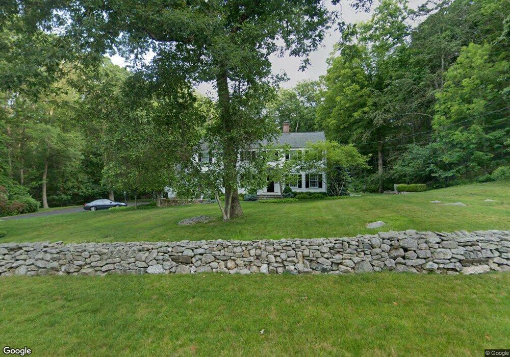
245 Bridle Path Ln New Canaan, CT 06840
Estimated Value: $2,173,890 - $2,581,000
4
Beds
4
Baths
3,549
Sq Ft
$681/Sq Ft
Est. Value
About This Home
This home is located at 245 Bridle Path Ln, New Canaan, CT 06840 and is currently estimated at $2,417,723, approximately $681 per square foot. 245 Bridle Path Ln is a home located in Fairfield County with nearby schools including West Elementary School, Saxe Middle School, and New Canaan High School.
Ownership History
Date
Name
Owned For
Owner Type
Purchase Details
Closed on
Nov 12, 2024
Sold by
Maass William R and Maass Shelagh M
Bought by
William R Maass Ret and Shelagh M Maass Ret
Current Estimated Value
Purchase Details
Closed on
Oct 24, 1985
Bought by
Maass William R
Create a Home Valuation Report for This Property
The Home Valuation Report is an in-depth analysis detailing your home's value as well as a comparison with similar homes in the area
Home Values in the Area
Average Home Value in this Area
Purchase History
| Date | Buyer | Sale Price | Title Company |
|---|---|---|---|
| William R Maass Ret | -- | None Available | |
| William R Maass Ret | -- | None Available | |
| Maass William R | $399,500 | -- |
Source: Public Records
Mortgage History
| Date | Status | Borrower | Loan Amount |
|---|---|---|---|
| Previous Owner | Maass William R | $250,000 | |
| Previous Owner | Maass William R | $417,000 | |
| Previous Owner | Maass William R | $495,000 |
Source: Public Records
Tax History Compared to Growth
Tax History
| Year | Tax Paid | Tax Assessment Tax Assessment Total Assessment is a certain percentage of the fair market value that is determined by local assessors to be the total taxable value of land and additions on the property. | Land | Improvement |
|---|---|---|---|---|
| 2025 | $17,738 | $1,062,810 | $632,800 | $430,010 |
| 2024 | $17,154 | $1,062,810 | $632,800 | $430,010 |
| 2023 | $16,368 | $864,220 | $648,620 | $215,600 |
| 2022 | $15,876 | $864,220 | $648,620 | $215,600 |
| 2021 | $15,694 | $864,220 | $648,620 | $215,600 |
| 2020 | $15,694 | $864,220 | $648,620 | $215,600 |
| 2019 | $15,763 | $864,220 | $648,620 | $215,600 |
| 2018 | $16,541 | $975,310 | $597,030 | $378,280 |
| 2017 | $16,258 | $975,310 | $597,030 | $378,280 |
| 2016 | $15,907 | $975,310 | $597,030 | $378,280 |
| 2015 | $15,595 | $975,310 | $597,030 | $378,280 |
| 2014 | $15,156 | $975,310 | $597,030 | $378,280 |
Source: Public Records
Map
Nearby Homes
- 470 Frogtown Rd Unit Lot 1
- 276 Greenley Rd
- 474 Ponus Ridge
- 298 Greenley Rd
- 197 Park St Unit 13
- 317 Park St
- 202 Weed St
- 42 Forest St Unit A
- 15 Burtis Ave Unit Townhome D
- 15 Burtis Ave Unit West Penthouse B
- 15 Burtis Ave Unit East Penthouse C
- 15 Burtis Ave Unit Townhome A
- 15 Burtis Ave Unit East Plaza 203
- 204 Parade Hill Rd
- 50 Harrison Ave
- 60 East Ave
- 64 East Ave
- 113 Skyview Ln
- 25 Gower Rd
- 357 Jelliff Mill Rd
- 79 Llewellyn Dr
- 23 Llewellyn Dr
- 197 Bridle Path Ln
- 15 Carriage Ln
- 232 Bridle Path Ln
- 114 Llewellyn Dr
- 24 Llewellyn Dr
- 18 Carriage Ln
- 231 Frogtown Rd
- 103 Llewellyn Dr
- 87 Llewellyn Dr
- 189 Bridle Path Ln
- 255 Frogtown Rd
- 216 Bridle Path Ln
- 89 Llewellyn Dr
- 37 Carriage Ln
- 198 Bridle Path Ln
- 28 Carriage Ln
- 209 Frogtown Rd
- 38 Carriage Ln