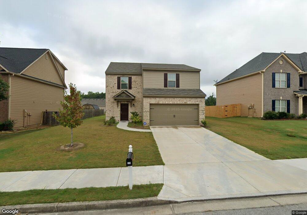
245 Caledonian Cir Dallas, GA 30132
Estimated Value: $292,726 - $331,000
3
Beds
3
Baths
1,601
Sq Ft
$195/Sq Ft
Est. Value
About This Home
This home is located at 245 Caledonian Cir, Dallas, GA 30132 and is currently estimated at $311,432, approximately $194 per square foot. 245 Caledonian Cir is a home located in Paulding County with nearby schools including Northside Elementary School, Lena Mae Moses Middle School, and North Paulding High School.
Ownership History
Date
Name
Owned For
Owner Type
Purchase Details
Closed on
Aug 19, 2021
Sold by
Opendoor Property J Llc
Bought by
Ah4r Properties Two Llc
Current Estimated Value
Purchase Details
Closed on
Jun 28, 2021
Sold by
Tanksley Latoya
Bought by
Opendoor Property J Llc
Purchase Details
Closed on
Aug 13, 2018
Sold by
Lgi Homes Georgia Llc
Bought by
Tanksley Latoya and Tanksley Bernice
Home Financials for this Owner
Home Financials are based on the most recent Mortgage that was taken out on this home.
Original Mortgage
$175,659
Interest Rate
4.5%
Mortgage Type
VA
Purchase Details
Closed on
Jan 29, 2013
Sold by
Dozier Properties Llc
Bought by
Scorpion Real Estate Co V Llc
Create a Home Valuation Report for This Property
The Home Valuation Report is an in-depth analysis detailing your home's value as well as a comparison with similar homes in the area
Home Values in the Area
Average Home Value in this Area
Purchase History
| Date | Buyer | Sale Price | Title Company |
|---|---|---|---|
| Ah4r Properties Two Llc | $294,000 | -- | |
| Opendoor Property J Llc | $263,400 | -- | |
| Tanksley Latoya | $178,900 | -- | |
| Scorpion Real Estate Co V Llc | $84,700 | -- |
Source: Public Records
Mortgage History
| Date | Status | Borrower | Loan Amount |
|---|---|---|---|
| Previous Owner | Tanksley Latoya | $175,659 |
Source: Public Records
Tax History Compared to Growth
Tax History
| Year | Tax Paid | Tax Assessment Tax Assessment Total Assessment is a certain percentage of the fair market value that is determined by local assessors to be the total taxable value of land and additions on the property. | Land | Improvement |
|---|---|---|---|---|
| 2024 | $2,884 | $115,940 | $12,000 | $103,940 |
| 2023 | $3,122 | $119,760 | $12,000 | $107,760 |
| 2022 | $2,773 | $106,360 | $12,000 | $94,360 |
| 2021 | $2,226 | $76,600 | $10,000 | $66,600 |
| 2020 | $2,079 | $70,000 | $10,000 | $60,000 |
| 2019 | $2,101 | $69,720 | $10,000 | $59,720 |
| 2018 | $941 | $31,240 | $10,000 | $21,240 |
| 2017 | $244 | $8,000 | $8,000 | $0 |
| 2016 | $218 | $7,200 | $7,200 | $0 |
| 2015 | $185 | $6,000 | $6,000 | $0 |
| 2014 | $51 | $1,600 | $1,600 | $0 |
| 2013 | -- | $1,600 | $1,600 | $0 |
Source: Public Records
Map
Nearby Homes
- 749 Scotland Dr
- 219 Aberdeen Way
- 439 Scotland Dr
- 38 Kelso Way
- 89 Dundee Crossing
- 428 Snote Jones Rd
- LOT 1 Snote Jones Rd
- LOT 2 Snote Jones Rd
- 00 Snote Jones Rd
- 0 Snote Jones Rd Unit 10480976
- 18 Mountain Ct
- 272 Kades Cove Dr
- 103 Beautyberry Ln
- Hayden Plan at Sheffield Highlands
- Green Plan at Sheffield Highlands
- Cali Plan at Sheffield Highlands
- Harbor Plan at Sheffield Highlands
- Flora Plan at Sheffield Highlands
- 0 Cartersville Hwy Unit 7572531
- 231 Caledonian Cir
- 257 Caledonian Cir
- 608 Scotland Dr
- 620 Scotland Dr
- 269 Caledonian Cir
- 219 Caledonian Cir
- 596 Scotland Dr
- 269 Caldedonian Cir
- 590 Scotland Dr
- 636 Scotland Dr
- 277 Caledonian Cir
- 208 Caledonian Cir
- 274 Caledonian Cir
- 207 Caledonian Cir
- 574 Scotland Dr
- 650 Scotland Dr
- 564 Scotland Dr
- 294 Caledonian Cir
- 291 Caledonian Cir
- 611 Scotland Dr