Estimated Value: $225,000 - $233,000
3
Beds
2
Baths
1,255
Sq Ft
$183/Sq Ft
Est. Value
About This Home
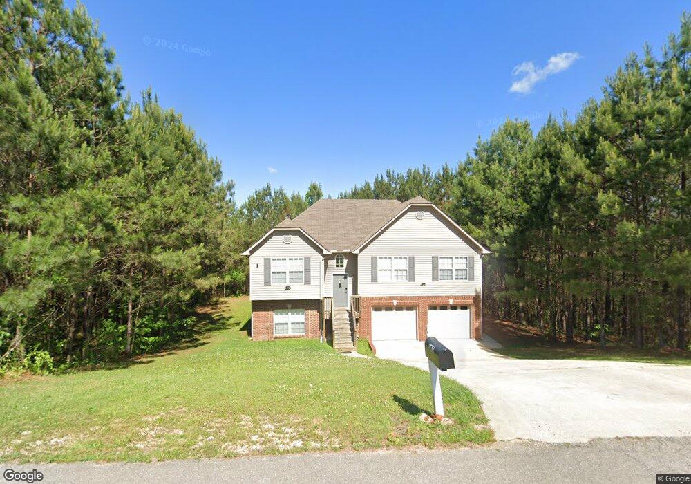
This home is located at 245 Dust Ridge Rd Unit 71, Moody, AL 35004 and is currently estimated at $229,397, approximately $182 per square foot. 245 Dust Ridge Rd Unit 71 is a home located in St. Clair County with nearby schools including Moody Elementary School, Moody Middle School, and Moody High School.
Ownership History
Date
Name
Owned For
Owner Type
Purchase Details
Closed on
Mar 14, 2022
Sold by
Rausch Coleman Homes Birmingham Llc
Bought by
Resicap Alabama Owner Llc
Current Estimated Value
Purchase Details
Closed on
Feb 25, 2022
Sold by
Rausch Coleman Homes Birmingham Llc
Bought by
Resicap Alabama Owner Llc
Purchase Details
Closed on
Dec 29, 2021
Sold by
Rausch Coleman Homes Birmingham Llc
Bought by
Resicap Alabama Owner Llc
Purchase Details
Closed on
Nov 23, 2021
Sold by
Rausch Coleman Homes Birmingham Llc
Bought by
Resicap Alabama Owner Llc
Purchase Details
Closed on
Aug 10, 2021
Sold by
Riggins Carson
Bought by
Resicap Alabama Owner Llc
Purchase Details
Closed on
Mar 11, 2013
Sold by
The United States Department Of Housing
Bought by
Riggins Carson
Home Financials for this Owner
Home Financials are based on the most recent Mortgage that was taken out on this home.
Original Mortgage
$71,260
Interest Rate
3.57%
Mortgage Type
New Conventional
Purchase Details
Closed on
Jan 9, 2013
Sold by
Bank Of America N A
Bought by
The Secretary Of Hud
Purchase Details
Closed on
Jul 26, 2012
Sold by
Smith Patrick L and Smith Holly C
Bought by
Bank Of America N A
Purchase Details
Closed on
Mar 24, 2009
Sold by
Four Star Investments Inc
Bought by
Smith Patrick I and Smith Holly C
Home Financials for this Owner
Home Financials are based on the most recent Mortgage that was taken out on this home.
Original Mortgage
$128,872
Interest Rate
5.14%
Mortgage Type
FHA
Create a Home Valuation Report for This Property
The Home Valuation Report is an in-depth analysis detailing your home's value as well as a comparison with similar homes in the area
Home Values in the Area
Average Home Value in this Area
Purchase History
| Date | Buyer | Sale Price | Title Company |
|---|---|---|---|
| Resicap Alabama Owner Llc | $212,240 | J L Hartman Pc | |
| Resicap Alabama Owner Llc | $204,850 | None Listed On Document | |
| Resicap Alabama Owner Llc | $210,300 | J L Hartman Pc | |
| Resicap Alabama Owner Llc | $207,280 | Joshua L Hartman J L Hartman P | |
| Resicap Alabama Owner Llc | $210,000 | Smith Closing & Title Llc | |
| Riggins Carson | $91,260 | None Available | |
| The Secretary Of Hud | $138,226 | None Available | |
| Bank Of America N A | $138,226 | None Available | |
| Smith Patrick I | $131,250 | None Available |
Source: Public Records
Mortgage History
| Date | Status | Borrower | Loan Amount |
|---|---|---|---|
| Previous Owner | Riggins Carson | $71,260 | |
| Previous Owner | Smith Patrick I | $128,872 |
Source: Public Records
Tax History Compared to Growth
Tax History
| Year | Tax Paid | Tax Assessment Tax Assessment Total Assessment is a certain percentage of the fair market value that is determined by local assessors to be the total taxable value of land and additions on the property. | Land | Improvement |
|---|---|---|---|---|
| 2024 | $1,118 | $31,052 | $5,200 | $25,852 |
| 2023 | $1,118 | $31,052 | $5,200 | $25,852 |
| 2022 | $947 | $26,294 | $5,200 | $21,094 |
| 2021 | $426 | $26,294 | $5,200 | $21,094 |
| 2020 | $451 | $13,850 | $2,600 | $11,250 |
| 2019 | $447 | $13,744 | $2,600 | $11,144 |
| 2018 | $403 | $12,520 | $0 | $0 |
| 2017 | $403 | $12,520 | $0 | $0 |
| 2016 | $396 | $12,320 | $0 | $0 |
| 2015 | $403 | $12,320 | $0 | $0 |
| 2014 | $403 | $12,540 | $0 | $0 |
Source: Public Records
Map
Nearby Homes
- 5953 Old Acton Rd
- 5618 Old Acton Rd
- 15 Stevens Cove Dr
- The Redmont I 1 Plan at Steven's Cove
- The Benton 1 Plan at Steven's Cove
- The Florabelle II 1 Plan at Steven's Cove
- The Marlin 1 Plan at Steven's Cove
- 35 Stevens Cove Dr
- 45 Stevens Cove Dr
- 220 Virginia Way Unit 69
- 230 Virginia Way Unit 68
- 130 Stevens Cove Dr
- 260 Virginia Way Unit 65
- 270 Virginia Way Unit 64
- 280 Virginia Way Unit 63
- 290 Virginia Way Unit 62
- 300 Virginia Way Unit 61
- 310 Virginia Way Unit 60
- 1090 Brookhaven Dr
- 1150 Brookhaven Dr
- 245 Dust Ridge Rd
- 0 Dust Ridge Rd Unit 73 839612
- 0 Dust Ridge Rd Unit 72 839607
- 0 Dust Ridge Rd Unit 70 839602
- 0 Dust Ridge Rd Unit 69 839601
- 0 Dust Ridge Rd Unit 68 839598
- 0 Dust Ridge Rd Unit 67 839595
- 0 Dust Ridge Rd Unit 66 839594
- 0 Dust Ridge Rd Unit 62 839592
- 0 Dust Ridge Rd Unit 64 839591
- 0 Dust Ridge Rd Unit 63 839590
- 0 Dust Ridge Rd Unit 62 839588
- 0 Dust Ridge Rd Unit 60 839586
- 0 Dust Ridge Rd Unit 61 839585
- 0 Dust Ridge Rd Unit 59 839575
- 0 Dust Ridge Rd Unit Lot 59 901454
- 0 Dust Ridge Rd Unit Lot 58 901453
- 0 Dust Ridge Rd Unit Lot 57 901452
- 0 Dust Ridge Rd Unit Lot 56 901450
- 0 Dust Ridge Rd Unit Lot 55 901449