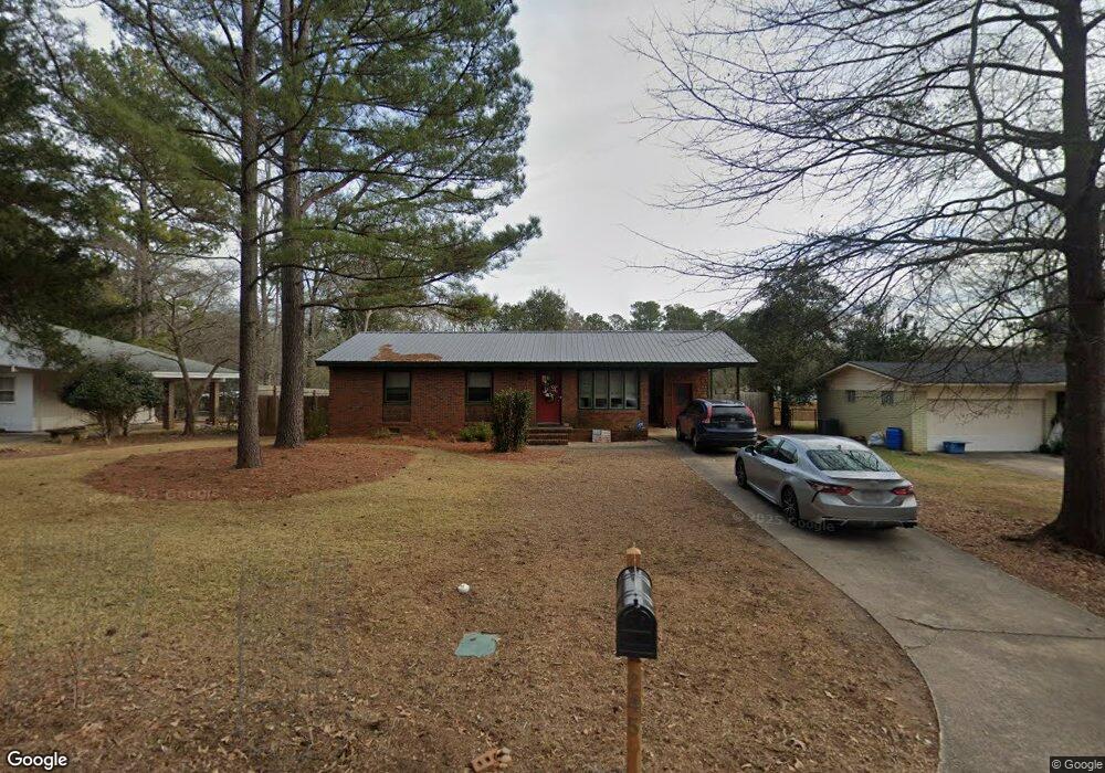
245 Ferncliff Dr Athens, GA 30606
Forest Heights NeighborhoodEstimated Value: $339,000 - $363,000
--
Bed
--
Bath
1,622
Sq Ft
$214/Sq Ft
Est. Value
About This Home
This home is located at 245 Ferncliff Dr, Athens, GA 30606 and is currently estimated at $347,371, approximately $214 per square foot. 245 Ferncliff Dr is a home located in Clarke County with nearby schools including Oglethorpe Avenue Elementary School, Burney-Harris-Lyons Middle School, and Clarke Central High School.
Ownership History
Date
Name
Owned For
Owner Type
Purchase Details
Closed on
Feb 21, 2022
Sold by
Hooper James B
Bought by
Bird Nest Holdings Llc
Current Estimated Value
Purchase Details
Closed on
Jan 23, 2019
Sold by
Matheson Iain B C
Bought by
Hooper James B and Hooper Laura
Home Financials for this Owner
Home Financials are based on the most recent Mortgage that was taken out on this home.
Original Mortgage
$76,000
Interest Rate
4.5%
Mortgage Type
New Conventional
Create a Home Valuation Report for This Property
The Home Valuation Report is an in-depth analysis detailing your home's value as well as a comparison with similar homes in the area
Home Values in the Area
Average Home Value in this Area
Purchase History
| Date | Buyer | Sale Price | Title Company |
|---|---|---|---|
| Bird Nest Holdings Llc | -- | -- | |
| Hooper James B | $95,000 | -- |
Source: Public Records
Mortgage History
| Date | Status | Borrower | Loan Amount |
|---|---|---|---|
| Previous Owner | Hooper James B | $76,000 |
Source: Public Records
Tax History Compared to Growth
Tax History
| Year | Tax Paid | Tax Assessment Tax Assessment Total Assessment is a certain percentage of the fair market value that is determined by local assessors to be the total taxable value of land and additions on the property. | Land | Improvement |
|---|---|---|---|---|
| 2025 | $4,261 | $137,224 | $18,000 | $119,224 |
| 2024 | $4,261 | $127,998 | $18,000 | $109,998 |
| 2023 | $4,000 | $122,550 | $14,000 | $108,550 |
| 2022 | $3,025 | $94,834 | $14,000 | $80,834 |
| 2021 | $2,844 | $84,388 | $14,000 | $70,388 |
| 2020 | $1,752 | $76,028 | $14,000 | $62,028 |
| 2019 | $912 | $47,235 | $12,000 | $35,235 |
| 2018 | $892 | $45,779 | $11,200 | $34,579 |
| 2017 | $789 | $38,405 | $11,200 | $27,205 |
| 2016 | $767 | $36,804 | $9,600 | $27,204 |
| 2015 | $689 | $31,271 | $8,000 | $23,271 |
| 2014 | $667 | $29,633 | $8,000 | $21,633 |
Source: Public Records
Map
Nearby Homes
- 225 Sherwood Dr
- 330 Stoneland Dr
- 809 Forest Heights Dr
- 135 Tara Way
- 205 Tremont Cir
- 347 Hampton Park Dr
- 105 Westchester Dr Unit A8
- 105 Westchester Dr Unit A8
- 105 Westchester Dr Unit E5
- 607 Creekside Ct
- 275 Westchester Cir
- 145 Heyward Allen Pkwy
- 140 Breckenridge Ln
- 107 Berkeshire Ct
- 104 Westchester Cir Unit 4
- 185 Landor Dr
- 119 E Surry Ct
- 243 Ferncliff Dr
- 235 Ferncliff Dr
- 255 Ferncliff Dr
- 130 Holly Ln
- 140 Holly Ln
- 265 Ferncliff Dr
- 240 Ferncliff Dr
- 120 Holly Ln
- 234 Ferncliff Dr
- 215 Ferncliff Dr
- 150 Holly Ln
- 275 Ferncliff Dr
- 230 Ferncliff Dr
- 270 Ferncliff Dr
- 110 Holly Ln
- 220 Robinhood Ct
- 125 Holly Ln
- 135 Holly Ln
- 220 Ferncliff Dr
- 205 Ferncliff Dr