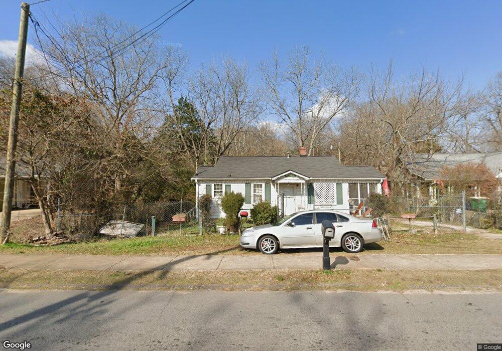
245 First St Athens, GA 30601
Chicopee-Dudley NeighborhoodEstimated Value: $224,171 - $296,000
--
Bed
--
Bath
802
Sq Ft
$318/Sq Ft
Est. Value
About This Home
This home is located at 245 First St, Athens, GA 30601 and is currently estimated at $255,293, approximately $318 per square foot. 245 First St is a home located in Clarke County with nearby schools including Howard B. Stroud Elementary School, Coile Middle School, and Cedar Shoals High School.
Ownership History
Date
Name
Owned For
Owner Type
Purchase Details
Closed on
Aug 8, 2001
Sold by
Wooten Maeonie
Bought by
Wooten Maeonie Frances Brown and Wooten Zelm
Current Estimated Value
Purchase Details
Closed on
Jun 28, 1999
Sold by
Housing & Economic Leadership Partners
Bought by
Wooten Maeonie
Purchase Details
Closed on
Jul 21, 1997
Sold by
Mcmullan R A
Bought by
Housing & Economic Leadership Partners
Create a Home Valuation Report for This Property
The Home Valuation Report is an in-depth analysis detailing your home's value as well as a comparison with similar homes in the area
Home Values in the Area
Average Home Value in this Area
Purchase History
| Date | Buyer | Sale Price | Title Company |
|---|---|---|---|
| Wooten Maeonie Frances Brown | -- | -- | |
| Wooten Maeonie | $47,000 | -- | |
| Housing & Economic Leadership Partners | $40,000 | -- |
Source: Public Records
Tax History Compared to Growth
Tax History
| Year | Tax Paid | Tax Assessment Tax Assessment Total Assessment is a certain percentage of the fair market value that is determined by local assessors to be the total taxable value of land and additions on the property. | Land | Improvement |
|---|---|---|---|---|
| 2025 | $2,529 | $81,442 | $26,000 | $55,442 |
| 2024 | $2,529 | $78,658 | $26,000 | $52,658 |
| 2023 | $2,458 | $73,128 | $24,000 | $49,128 |
| 2022 | $1,874 | $58,749 | $18,000 | $40,749 |
| 2021 | $1,139 | $49,947 | $17,000 | $32,947 |
| 2020 | $1,086 | $46,100 | $17,000 | $29,100 |
| 2019 | $1,054 | $43,140 | $17,000 | $26,140 |
| 2018 | $1,005 | $39,589 | $17,000 | $22,589 |
| 2017 | $944 | $37,814 | $17,000 | $20,814 |
| 2016 | $921 | $37,123 | $17,000 | $20,123 |
| 2015 | $869 | $35,544 | $17,000 | $18,544 |
| 2014 | $850 | $34,953 | $17,000 | $17,953 |
Source: Public Records
Map
Nearby Homes
- 185 First St
- 320 First St
- 318 First St
- 178 First St
- 560 Rosa Nell Howard St
- 239 Madison Heights
- 132 N Poplar St
- 126 S Poplar St
- 235 Arch St
- 320 Vine St
- 118 Ruth Dr Unit 130
- 118 Ruth Dr Unit 140
- 118 Ruth Dr Unit 310
- 118 Ruth Dr Unit 610
- 211 North Ave Unit 1333
- 225 Oak St Unit LOT 103
- 225 Oak St Unit 104
- 225 Oak St Unit 108