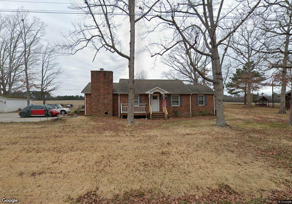
245 Greystone Rd Henderson, NC 27537
Estimated Value: $176,000 - $201,634
2
Beds
1
Bath
1,550
Sq Ft
$124/Sq Ft
Est. Value
About This Home
This home is located at 245 Greystone Rd, Henderson, NC 27537 and is currently estimated at $192,159, approximately $123 per square foot. 245 Greystone Rd is a home located in Vance County with nearby schools including Carver Elementary School, Henderson Middle School, and Vance County High School.
Ownership History
Date
Name
Owned For
Owner Type
Purchase Details
Closed on
Aug 7, 2019
Sold by
Reid Teresa C and Reid Alan R
Bought by
Genas Morell A
Current Estimated Value
Home Financials for this Owner
Home Financials are based on the most recent Mortgage that was taken out on this home.
Original Mortgage
$96,969
Outstanding Balance
$84,979
Interest Rate
3.73%
Mortgage Type
USDA
Estimated Equity
$107,180
Purchase Details
Closed on
Mar 4, 2005
Sold by
Hale James E and Hale Gail G
Bought by
Roberson Teresa C
Home Financials for this Owner
Home Financials are based on the most recent Mortgage that was taken out on this home.
Original Mortgage
$75,000
Interest Rate
5.6%
Create a Home Valuation Report for This Property
The Home Valuation Report is an in-depth analysis detailing your home's value as well as a comparison with similar homes in the area
Purchase History
| Date | Buyer | Sale Price | Title Company |
|---|---|---|---|
| Genas Morell A | $97,000 | None Available | |
| Roberson Teresa C | $75,000 | -- |
Source: Public Records
Mortgage History
| Date | Status | Borrower | Loan Amount |
|---|---|---|---|
| Open | Genas Morell A | $96,969 | |
| Previous Owner | Roberson Teresa C | $75,000 |
Source: Public Records
Tax History
| Year | Tax Paid | Tax Assessment Tax Assessment Total Assessment is a certain percentage of the fair market value that is determined by local assessors to be the total taxable value of land and additions on the property. | Land | Improvement |
|---|---|---|---|---|
| 2025 | $761 | $153,070 | $17,400 | $135,670 |
| 2024 | $1,323 | $153,070 | $17,400 | $135,670 |
| 2023 | $660 | $55,152 | $6,750 | $48,402 |
| 2022 | $660 | $55,152 | $6,750 | $48,402 |
| 2021 | $540 | $55,152 | $6,750 | $48,402 |
| 2020 | $657 | $55,152 | $6,750 | $48,402 |
| 2019 | $652 | $55,152 | $6,750 | $48,402 |
| 2018 | $515 | $55,152 | $6,750 | $48,402 |
| 2017 | $620 | $55,152 | $6,750 | $48,402 |
| 2016 | $620 | $55,152 | $6,750 | $48,402 |
| 2015 | $562 | $69,010 | $7,418 | $61,592 |
| 2014 | $679 | $69,010 | $7,418 | $61,592 |
Source: Public Records
Map
Nearby Homes
- 148 Baptist Church Rd
- 48 S Grace Way Ln
- 0 E Wagon Rd Unit 24732447
- 0 N Nc 39 Hwy Unit 10131448
- 0 N Nc 39 Hwy Unit 10147453
- 539 Vincent Hoyle Rd
- 5354 Satterwhite Point Rd
- 124 Virginia Dare Ln
- 1135 Peninsula Ln
- 2105 Newton Dairy Rd
- 000 Mabry Mill Rd
- 0 Mabry Mill Rd
- 1829 Stewart Farm Rd
- 119 Fox Pond Rd
- 1284 Railroad St
- 417 Sunnyview Rd
- 1727 Pinecrest Rd
- 691-693 Boddie St
- 1157 Franklin Ln
- 228 Crozier St Unit 228/230
- 251 Greystone Rd
- 195 Greystone Rd
- 196 Greystone Rd
- 214 Greystone Rd
- 246 Greystone Rd
- 155 Greystone Rd
- 271 Greystone Rd
- 180 Greystone Rd
- 166 Greystone Rd
- 278 Greystone Rd
- 327 Greystone Rd
- 134 Greystone Rd
- 385 Greystone Rd
- 346 Greystone Rd
- 360 Greystone Rd
- 71 Rogers Land
- 388 Greystone Rd
- 351 Brookston Rd
- 274 Brookston Rd
- 90 Brookston Rd
Your Personal Tour Guide
Ask me questions while you tour the home.