Estimated Value: $75,000 - $97,000
3
Beds
2
Baths
1,438
Sq Ft
$59/Sq Ft
Est. Value
About This Home
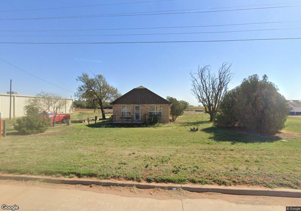
This home is located at 245 Highway 44, Foss, OK 73647 and is currently estimated at $84,222, approximately $58 per square foot. 245 Highway 44 is a home with nearby schools including Will Rogers Elementary School and Burns Flat-Dill City High School.
Ownership History
Date
Name
Owned For
Owner Type
Purchase Details
Closed on
Nov 7, 2025
Sold by
Farmers Cooperative Exchange
Bought by
Lonestar Gin Lp
Current Estimated Value
Home Financials for this Owner
Home Financials are based on the most recent Mortgage that was taken out on this home.
Original Mortgage
$445,300
Outstanding Balance
$445,300
Interest Rate
6.3%
Mortgage Type
Credit Line Revolving
Estimated Equity
-$361,078
Purchase Details
Closed on
Apr 15, 2019
Sold by
Hansen Richard P
Bought by
Hansen Richard P and Hansen Living Trust
Purchase Details
Closed on
Mar 3, 2016
Sold by
Dugosh Travis and Dugosh Laurel
Bought by
Richard P Hansen Living Trust
Purchase Details
Closed on
Jul 11, 2006
Sold by
Carylon Ronald and Carylon Morgan
Bought by
Jerry Jim and Jerry Metz
Create a Home Valuation Report for This Property
The Home Valuation Report is an in-depth analysis detailing your home's value as well as a comparison with similar homes in the area
Home Values in the Area
Average Home Value in this Area
Purchase History
| Date | Buyer | Sale Price | Title Company |
|---|---|---|---|
| Lonestar Gin Lp | $3,000 | Atlas Title | |
| Hansen Richard P | -- | None Available | |
| Richard P Hansen Living Trust | -- | Atlas Title | |
| Jerry Jim | $24,000 | -- |
Source: Public Records
Mortgage History
| Date | Status | Borrower | Loan Amount |
|---|---|---|---|
| Open | Lonestar Gin Lp | $445,300 |
Source: Public Records
Tax History Compared to Growth
Tax History
| Year | Tax Paid | Tax Assessment Tax Assessment Total Assessment is a certain percentage of the fair market value that is determined by local assessors to be the total taxable value of land and additions on the property. | Land | Improvement |
|---|---|---|---|---|
| 2025 | $445 | $5,436 | $285 | $5,151 |
| 2024 | $445 | $5,959 | $285 | $5,674 |
| 2023 | $423 | $5,675 | $285 | $5,390 |
| 2022 | $444 | $5,484 | $285 | $5,199 |
| 2021 | $600 | $7,542 | $285 | $7,257 |
| 2020 | $600 | $7,543 | $285 | $7,258 |
| 2019 | $593 | $7,543 | $285 | $7,258 |
| 2018 | $600 | $7,545 | $285 | $7,260 |
| 2017 | $604 | $7,545 | $285 | $7,260 |
| 2016 | $607 | $7,546 | $285 | $7,261 |
| 2015 | $579 | $7,307 | $285 | $7,022 |
| 2014 | $579 | $7,308 | $285 | $7,023 |
Source: Public Records
Map
Nearby Homes
- 306 Potomac Rd
- 207 Pioneer Way
- 107 Cimarron Rd
- 412 Cherokee Trail Unit B
- 204 Elaine Dr
- 21238 Highway 73
- 114 N Rambo
- 101 Claude St
- 409 S McDonald St
- 0 I-40 Frontage Road 26 Acres
- 0 I-40 Frontage 37 Acres
- 0 Clinton Lake Road 38 Acres Rd Unit 1194486
- 12004 N 2110 Rd
- 409 W 5th St
- 21508 S Frontage Rd
- 705 S 6th St
- 11117 N 2073 Rd
- 105 E Walk
- 0 E 1220 Rd
- 11909 N 2220 Rd