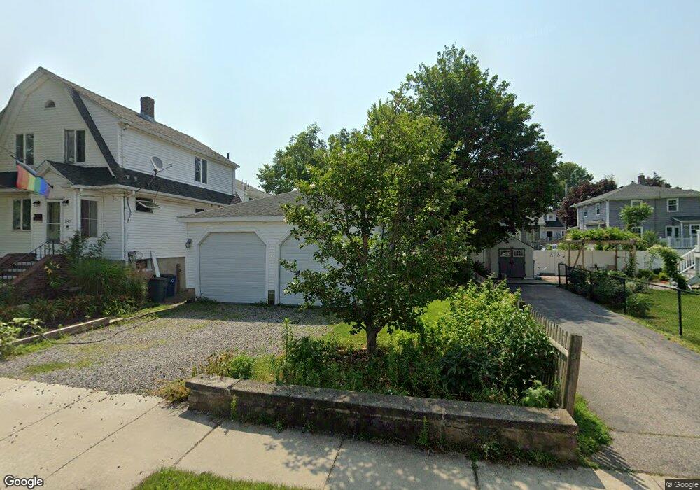
245 Hollis Ave Quincy, MA 02171
North Quincy NeighborhoodEstimated Value: $713,000 - $804,000
2
Beds
1
Bath
1,356
Sq Ft
$562/Sq Ft
Est. Value
About This Home
This home is located at 245 Hollis Ave, Quincy, MA 02171 and is currently estimated at $761,406, approximately $561 per square foot. 245 Hollis Ave is a home located in Norfolk County with nearby schools including Francis W. Parker Elementary School, Atlantic Middle School, and North Quincy High School.
Ownership History
Date
Name
Owned For
Owner Type
Purchase Details
Closed on
Jul 24, 2019
Sold by
First Winward Rt
Bought by
Nadworny Daniel J
Current Estimated Value
Home Financials for this Owner
Home Financials are based on the most recent Mortgage that was taken out on this home.
Original Mortgage
$427,500
Outstanding Balance
$374,374
Interest Rate
3.8%
Mortgage Type
New Conventional
Estimated Equity
$387,032
Purchase Details
Closed on
Mar 28, 2014
Sold by
Brangiforte William F
Bought by
First Winward Rt
Create a Home Valuation Report for This Property
The Home Valuation Report is an in-depth analysis detailing your home's value as well as a comparison with similar homes in the area
Home Values in the Area
Average Home Value in this Area
Purchase History
| Date | Buyer | Sale Price | Title Company |
|---|---|---|---|
| Nadworny Daniel J | $450,000 | -- | |
| First Winward Rt | -- | -- |
Source: Public Records
Mortgage History
| Date | Status | Borrower | Loan Amount |
|---|---|---|---|
| Open | Nadworny Daniel J | $427,500 |
Source: Public Records
Tax History Compared to Growth
Tax History
| Year | Tax Paid | Tax Assessment Tax Assessment Total Assessment is a certain percentage of the fair market value that is determined by local assessors to be the total taxable value of land and additions on the property. | Land | Improvement |
|---|---|---|---|---|
| 2025 | $8,035 | $696,900 | $415,100 | $281,800 |
| 2024 | $7,744 | $687,100 | $415,100 | $272,000 |
| 2023 | $6,868 | $617,100 | $377,400 | $239,700 |
| 2022 | $6,606 | $551,400 | $316,300 | $235,100 |
| 2021 | $6,469 | $532,900 | $316,300 | $216,600 |
| 2020 | $6,352 | $511,000 | $310,200 | $200,800 |
| 2019 | $6,403 | $510,200 | $311,700 | $198,500 |
| 2018 | $6,533 | $489,700 | $309,800 | $179,900 |
| 2017 | $6,371 | $449,600 | $281,600 | $168,000 |
| 2016 | $5,941 | $413,700 | $256,000 | $157,700 |
| 2015 | $5,384 | $368,800 | $223,000 | $145,800 |
| 2014 | $5,139 | $345,800 | $223,000 | $122,800 |
Source: Public Records
Map
Nearby Homes
- 6 Warwick St
- 58 Bayfield Rd S
- 297 Billings St
- 201 Billings St
- 85 E Squantum St Unit 10
- 38 Walker St
- 25 Hummock Rd
- 101 Beach St
- 522 Hancock St
- 175 Quincy Shore Dr Unit B24
- 17 Holmes St Unit 2
- 17 Holmes St Unit 4
- 212 Quincy Shore Dr
- 11 Earle St
- 91 Atlantic St
- 148 Quincy Shore Dr Unit 43
- 138 Quincy Shore Dr Unit 170
- 68 Atlantic St
- 116 Crabtree Rd
- 90 Shore Ave
- 245 Hollis Ave Unit 245
- 237 Hollis Ave
- 571 Quincy Shore Dr
- 575 Quincy Shore Dr
- 30 Herbert Rd
- 28 Herbert Rd
- 577 Quincy Shore Dr
- 561 Quincy Shore Dr
- 231 Hollis Ave
- 236 Hollis Ave
- 236 Hollis Ave Unit 1
- 22 Herbert Rd
- 232 Hollis Ave
- 557 Quincy Shore Dr
- 585 Quincy Shore Dr
- 230 Hollis Ave
- 227 Hollis Ave
- 45 Milton Rd
- 41 Milton Rd
- 23 Herbert Rd