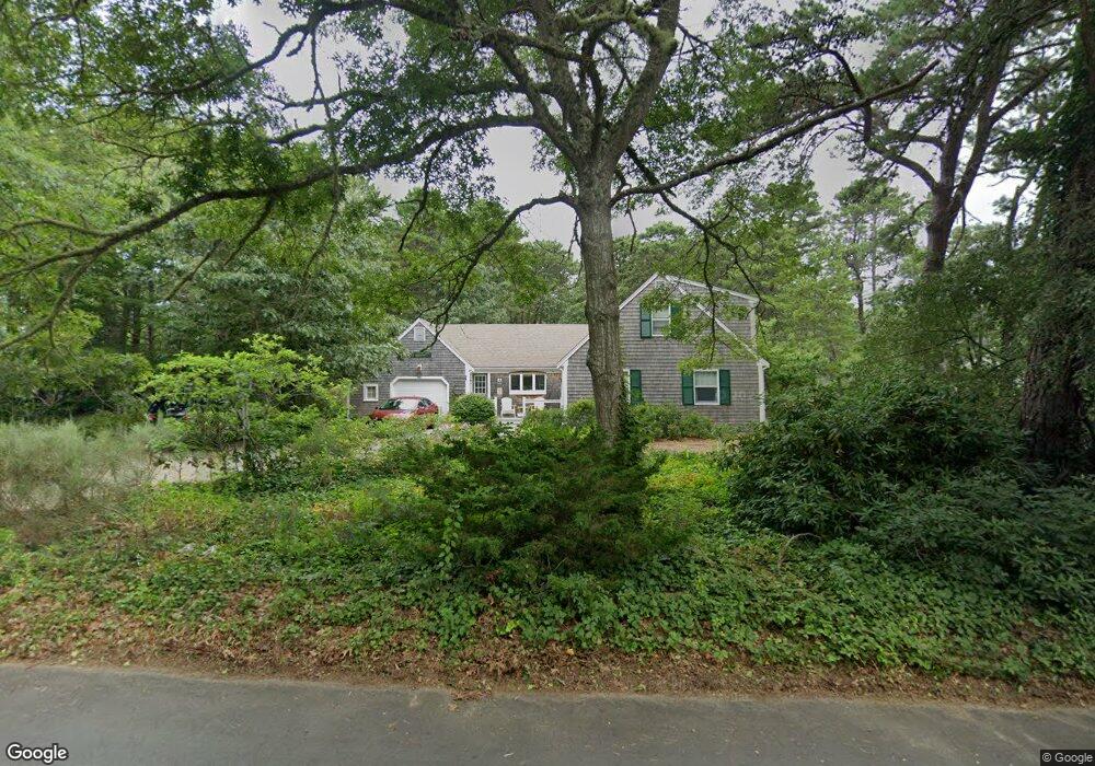
245 Ireland Way Eastham, MA 02642
Estimated Value: $822,282 - $906,000
4
Beds
2
Baths
1,501
Sq Ft
$583/Sq Ft
Est. Value
About This Home
This home is located at 245 Ireland Way, Eastham, MA 02642 and is currently estimated at $875,571, approximately $583 per square foot. 245 Ireland Way is a home located in Barnstable County with nearby schools including Eastham Elementary School, Nauset Regional Middle School, and Nauset Regional High School.
Ownership History
Date
Name
Owned For
Owner Type
Purchase Details
Closed on
Mar 30, 2004
Sold by
Nelson Kenneth P and Nelson Mary Ellen
Bought by
Nelson Kenneth P and Nelson Mary Ellen
Current Estimated Value
Purchase Details
Closed on
Apr 26, 2002
Sold by
Julius J Deangelis Tr and Deangelis Virginia R
Bought by
245 Ireland Way Nt and Nelson Kenneth P
Home Financials for this Owner
Home Financials are based on the most recent Mortgage that was taken out on this home.
Original Mortgage
$240,000
Interest Rate
7.05%
Mortgage Type
Purchase Money Mortgage
Create a Home Valuation Report for This Property
The Home Valuation Report is an in-depth analysis detailing your home's value as well as a comparison with similar homes in the area
Home Values in the Area
Average Home Value in this Area
Purchase History
| Date | Buyer | Sale Price | Title Company |
|---|---|---|---|
| Nelson Kenneth P | -- | -- | |
| 245 Ireland Way Nt | $392,500 | -- |
Source: Public Records
Mortgage History
| Date | Status | Borrower | Loan Amount |
|---|---|---|---|
| Previous Owner | 245 Ireland Way Nt | $240,000 |
Source: Public Records
Tax History Compared to Growth
Tax History
| Year | Tax Paid | Tax Assessment Tax Assessment Total Assessment is a certain percentage of the fair market value that is determined by local assessors to be the total taxable value of land and additions on the property. | Land | Improvement |
|---|---|---|---|---|
| 2025 | $6,294 | $816,400 | $269,700 | $546,700 |
| 2024 | $5,603 | $799,300 | $261,800 | $537,500 |
| 2023 | $5,142 | $710,200 | $242,400 | $467,800 |
| 2022 | $4,754 | $554,100 | $216,500 | $337,600 |
| 2021 | $4,620 | $503,300 | $196,700 | $306,600 |
| 2020 | $4,427 | $507,700 | $220,900 | $286,800 |
| 2019 | $4,176 | $506,200 | $224,200 | $282,000 |
| 2018 | $4,104 | $491,500 | $217,700 | $273,800 |
| 2017 | $3,806 | $481,800 | $213,400 | $268,400 |
| 2016 | $3,147 | $423,000 | $185,600 | $237,400 |
| 2015 | $2,929 | $412,500 | $181,900 | $230,600 |
Source: Public Records
Map
Nearby Homes
- 20 White Pines Dr
- 10 Cartway N
- 330 Hay Rd
- 785 State Hwy Unit 9
- 20 Boat Meadow Way
- 385 Bridge Rd
- 993 Intonti Way
- 995 Intonti Way
- 1061 State Hwy Unit 4
- 180 Country Ln
- 320 State Hwy
- 20 Kittiwake Ln
- 59 Bridge Rd
- 150 Old State Hwy Unit Compound
- 25 Twin Rocks Dr
- 30 Cove Rd
- 339 Dyer Prince Rd
- 480 Dyer Prince Rd
- 1875 State Hwy
- 60 Smith Heights Way
- 225 Ireland Way
- 265 Ireland Way
- 255 Ireland Way
- 220 Ireland Way
- 260 Ireland Way
- 30 Governor Brewster Rd
- 20 Governor Brewster Rd
- 285 Ireland Way
- 185 Ireland Way
- 195 Ireland Way
- 30 Gov Brewster Rd
- 190 Ireland Way
- 280 Ireland Way
- 10 Governor Brewster Rd
- 15 Wexford Ln
- 15 Limerick Way
- 320 Ireland Way
- 60 Governor Winslow Dr
- 145 Ireland Way
- 345 Ireland Way