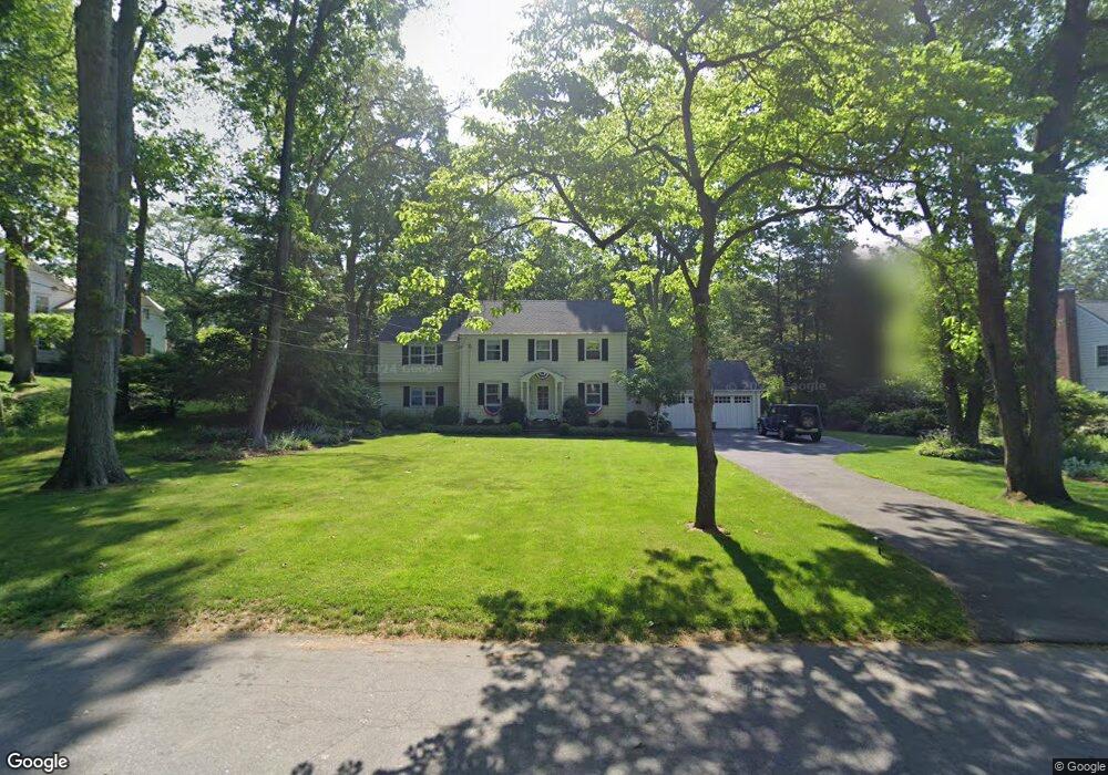
245 N Cedar Rd Fairfield, CT 06824
University NeighborhoodEstimated Value: $1,583,633 - $1,714,000
4
Beds
3
Baths
2,486
Sq Ft
$664/Sq Ft
Est. Value
About This Home
This home is located at 245 N Cedar Rd, Fairfield, CT 06824 and is currently estimated at $1,651,408, approximately $664 per square foot. 245 N Cedar Rd is a home located in Fairfield County with nearby schools including Dwight Elementary School, Roger Ludlowe Middle School, and Fairfield Ludlowe High School.
Ownership History
Date
Name
Owned For
Owner Type
Purchase Details
Closed on
Aug 29, 2008
Sold by
Gosseen Francine
Bought by
Gellert Alexander
Current Estimated Value
Purchase Details
Closed on
Aug 16, 2005
Sold by
Shaffer Kelly
Bought by
Gosseen Francine
Purchase Details
Closed on
Sep 4, 2003
Sold by
Miles Suzanne H
Bought by
Shaffer Kelly and Shaffer Jack
Purchase Details
Closed on
Aug 18, 1999
Sold by
Osborn Mary Z
Bought by
Goldspiel Ira D
Create a Home Valuation Report for This Property
The Home Valuation Report is an in-depth analysis detailing your home's value as well as a comparison with similar homes in the area
Home Values in the Area
Average Home Value in this Area
Purchase History
| Date | Buyer | Sale Price | Title Company |
|---|---|---|---|
| Gellert Alexander | $1,130,000 | -- | |
| Gellert Alexander | $1,130,000 | -- | |
| Gosseen Francine | $1,400,000 | -- | |
| Gosseen Francine | $1,400,000 | -- | |
| Shaffer Kelly | $1,050,000 | -- | |
| Shaffer Kelly | $1,050,000 | -- | |
| Goldspiel Ira D | $495,000 | -- | |
| Goldspiel Ira D | $495,000 | -- |
Source: Public Records
Mortgage History
| Date | Status | Borrower | Loan Amount |
|---|---|---|---|
| Open | Goldspiel Ira D | $555,000 | |
| Closed | Goldspiel Ira D | $732,000 |
Source: Public Records
Tax History
| Year | Tax Paid | Tax Assessment Tax Assessment Total Assessment is a certain percentage of the fair market value that is determined by local assessors to be the total taxable value of land and additions on the property. | Land | Improvement |
|---|---|---|---|---|
| 2025 | $20,477 | $721,280 | $454,650 | $266,630 |
| 2024 | $20,124 | $721,280 | $454,650 | $266,630 |
| 2023 | $19,842 | $721,280 | $454,650 | $266,630 |
| 2022 | $19,648 | $721,280 | $454,650 | $266,630 |
| 2021 | $19,460 | $721,280 | $454,650 | $266,630 |
| 2020 | $18,909 | $705,810 | $450,030 | $255,780 |
| 2019 | $18,909 | $705,810 | $450,030 | $255,780 |
| 2018 | $18,605 | $705,810 | $450,030 | $255,780 |
| 2017 | $17,837 | $690,830 | $450,030 | $240,800 |
| 2016 | $17,134 | $673,260 | $450,030 | $223,230 |
| 2015 | $16,933 | $683,060 | $472,150 | $210,910 |
| 2014 | $16,667 | $683,060 | $472,150 | $210,910 |
Source: Public Records
Map
Nearby Homes
- 360 Duck Farm Rd
- 1353 Mill Plain Rd
- 2683 Bronson Rd
- 148 Millspaugh Dr
- 218 Lower Farm Rd
- 1091 Round Hill Rd
- 647 Bronson Rd
- 688 Hulls Farm Rd
- 53 Hilltop Dr
- 329 Bronson Rd
- 1380 Old Academy Rd
- 110 Queens Grant Dr
- 54 Ridgedale Rd
- 42 Robin Cir
- 28 Mill Hill Rd Unit 28
- 196 Robin Ln
- 1478 Jennings Rd
- 153 Pease Ave
- 20 Ermine St
- 359 Reid St
- 245 N Cedar Rd
- 208 N Cedar Rd
- 217 N Cedar Rd
- 189 N Cedar Rd
- 275 N Cedar Rd
- 240 N Cedar Rd
- 272 N Cedar Rd
- 172 N Cedar Rd
- 172 N Cedar Rd
- 310 N Cedar Rd
- 305 N Cedar Rd
- 159 N Cedar Rd
- 343 N Cedar Rd
- 332 N Cedar Rd
- 130 N Cedar Rd
- 90 N Cedar Rd
- 601 Hill Farm Rd
- 515 Hill Farm Rd
- 555 Hill Farm Rd
- 535 Hill Farm Rd
Your Personal Tour Guide
Ask me questions while you tour the home.