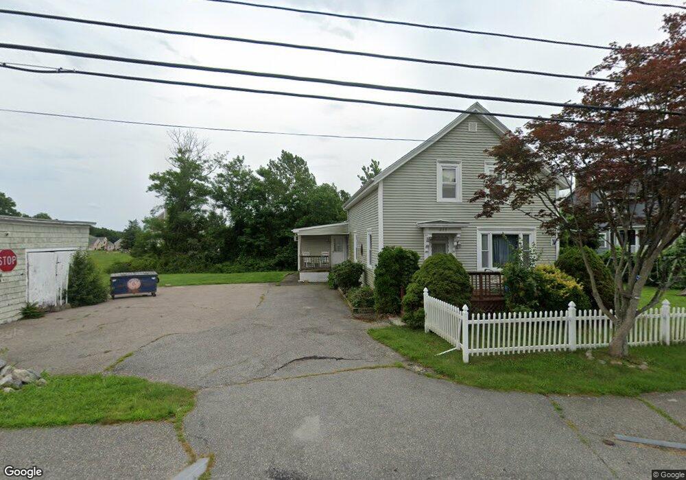
245 Oak St Swansea, MA 02777
West Swansea NeighborhoodEstimated Value: $419,000 - $513,000
5
Beds
1
Bath
1,733
Sq Ft
$279/Sq Ft
Est. Value
About This Home
This home is located at 245 Oak St, Swansea, MA 02777 and is currently estimated at $484,230, approximately $279 per square foot. 245 Oak St is a home located in Bristol County with nearby schools including Joseph Case High School and Swansea Wood School.
Ownership History
Date
Name
Owned For
Owner Type
Purchase Details
Closed on
Feb 22, 2023
Sold by
Barbosa Pamela
Bought by
Barbosa Melanie A and Barbosa Pamela
Current Estimated Value
Purchase Details
Closed on
Aug 10, 1992
Sold by
Urban Agnes and Mcadoo Kathryn M
Bought by
Barbosa Manuel M
Home Financials for this Owner
Home Financials are based on the most recent Mortgage that was taken out on this home.
Original Mortgage
$60,000
Interest Rate
8.4%
Mortgage Type
Purchase Money Mortgage
Create a Home Valuation Report for This Property
The Home Valuation Report is an in-depth analysis detailing your home's value as well as a comparison with similar homes in the area
Home Values in the Area
Average Home Value in this Area
Purchase History
| Date | Buyer | Sale Price | Title Company |
|---|---|---|---|
| Barbosa Melanie A | -- | None Available | |
| Barbosa Manuel M | $75,000 | -- |
Source: Public Records
Mortgage History
| Date | Status | Borrower | Loan Amount |
|---|---|---|---|
| Previous Owner | Barbosa Manuel M | $160,000 | |
| Previous Owner | Barbosa Manuel M | $15,000 | |
| Previous Owner | Barbosa Manuel M | $60,000 |
Source: Public Records
Tax History Compared to Growth
Tax History
| Year | Tax Paid | Tax Assessment Tax Assessment Total Assessment is a certain percentage of the fair market value that is determined by local assessors to be the total taxable value of land and additions on the property. | Land | Improvement |
|---|---|---|---|---|
| 2025 | $4,911 | $412,000 | $179,000 | $233,000 |
| 2024 | $4,916 | $410,000 | $179,000 | $231,000 |
| 2023 | $4,606 | $350,800 | $131,300 | $219,500 |
| 2022 | $4,150 | $288,400 | $119,600 | $168,800 |
| 2021 | $4,161 | $266,200 | $119,600 | $146,600 |
| 2020 | $4,129 | $265,000 | $119,600 | $145,400 |
| 2019 | $3,988 | $257,100 | $107,000 | $150,100 |
| 2018 | $3,783 | $247,600 | $105,300 | $142,300 |
| 2017 | $3,329 | $250,700 | $105,300 | $145,400 |
| 2016 | $2,927 | $216,500 | $97,800 | $118,700 |
| 2015 | $2,823 | $215,000 | $97,800 | $117,200 |
| 2014 | $2,761 | $215,000 | $97,800 | $117,200 |
Source: Public Records
Map
Nearby Homes