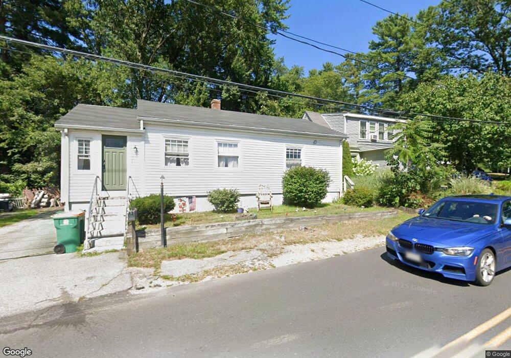
245 Plain St Mansfield, MA 02048
Estimated Value: $412,365 - $557,000
3
Beds
1
Bath
1,050
Sq Ft
$459/Sq Ft
Est. Value
About This Home
This home is located at 245 Plain St, Mansfield, MA 02048 and is currently estimated at $481,841, approximately $458 per square foot. 245 Plain St is a home located in Bristol County with nearby schools including Everett W. Robinson Elementary School, Jordan/Jackson Elementary School, and Harold L. Qualters Middle School.
Ownership History
Date
Name
Owned For
Owner Type
Purchase Details
Closed on
Feb 2, 2010
Sold by
Tavares David J
Bought by
Birman Timothy J
Current Estimated Value
Home Financials for this Owner
Home Financials are based on the most recent Mortgage that was taken out on this home.
Original Mortgage
$171,830
Outstanding Balance
$115,640
Interest Rate
5.37%
Mortgage Type
FHA
Estimated Equity
$366,201
Purchase Details
Closed on
Jul 26, 2004
Sold by
Mcavoy Joann M and Mcavoy Robert
Bought by
Tavares David J
Home Financials for this Owner
Home Financials are based on the most recent Mortgage that was taken out on this home.
Original Mortgage
$208,350
Interest Rate
6.28%
Mortgage Type
Purchase Money Mortgage
Purchase Details
Closed on
Aug 6, 2003
Sold by
Mcavoy Joann M
Bought by
Mcavoy Joann M and Mcavoy Robert
Home Financials for this Owner
Home Financials are based on the most recent Mortgage that was taken out on this home.
Original Mortgage
$145,000
Interest Rate
5.28%
Mortgage Type
Purchase Money Mortgage
Purchase Details
Closed on
Apr 19, 2002
Sold by
Hewes Dgrace T
Bought by
Mcavoy Joann M
Home Financials for this Owner
Home Financials are based on the most recent Mortgage that was taken out on this home.
Original Mortgage
$114,750
Interest Rate
6.85%
Mortgage Type
Purchase Money Mortgage
Create a Home Valuation Report for This Property
The Home Valuation Report is an in-depth analysis detailing your home's value as well as a comparison with similar homes in the area
Home Values in the Area
Average Home Value in this Area
Purchase History
| Date | Buyer | Sale Price | Title Company |
|---|---|---|---|
| Birman Timothy J | $175,000 | -- | |
| Tavares David J | $231,500 | -- | |
| Mcavoy Joann M | -- | -- | |
| Mcavoy Joann M | $135,000 | -- |
Source: Public Records
Mortgage History
| Date | Status | Borrower | Loan Amount |
|---|---|---|---|
| Open | Birman Timothy J | $171,830 | |
| Previous Owner | Tavares David J | $208,350 | |
| Previous Owner | Mcavoy Joann M | $145,000 | |
| Previous Owner | Mcavoy Joann M | $114,750 |
Source: Public Records
Tax History
| Year | Tax Paid | Tax Assessment Tax Assessment Total Assessment is a certain percentage of the fair market value that is determined by local assessors to be the total taxable value of land and additions on the property. | Land | Improvement |
|---|---|---|---|---|
| 2025 | $4,624 | $351,100 | $195,000 | $156,100 |
| 2024 | $4,351 | $322,300 | $195,000 | $127,300 |
| 2023 | $4,309 | $305,800 | $195,000 | $110,800 |
| 2022 | $4,196 | $276,600 | $180,500 | $96,100 |
| 2021 | $2,847 | $265,100 | $160,200 | $104,900 |
| 2020 | $4,023 | $261,900 | $160,200 | $101,700 |
| 2019 | $5,565 | $257,900 | $150,900 | $107,000 |
| 2018 | $3,594 | $230,800 | $136,600 | $94,200 |
| 2017 | $3,488 | $232,200 | $132,600 | $99,600 |
| 2016 | $3,534 | $229,300 | $132,900 | $96,400 |
| 2015 | $3,204 | $206,700 | $126,300 | $80,400 |
Source: Public Records
Map
Nearby Homes
- 24 Maverick Dr
- 25 Munroe Dr
- 25 Shepherd St
- 150 Gilbert St
- 84 Messenger St
- 9 Coach Rd
- 115 Westfield Dr
- 128 Tremont St
- 57 Vine St
- 17 Childs Ln
- 33 Colonial Way
- 14 Claire Ave
- 28 Messenger St
- Lot 5 Jeffrey Dr
- 40 Treasure Island Rd
- Lot 2 Jeffrey Dr
- 16 Treasure Island Rd
- 49 Pheasant Hill Rd
- 12 Houde St
- 46 Mirimichi St
Your Personal Tour Guide
Ask me questions while you tour the home.