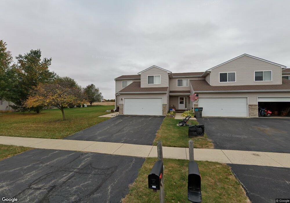
245 Rollin Rd Unit A Somonauk, IL 60552
Estimated Value: $238,000 - $270,000
4
Beds
3
Baths
1,500
Sq Ft
$173/Sq Ft
Est. Value
About This Home
This home is located at 245 Rollin Rd Unit A, Somonauk, IL 60552 and is currently estimated at $258,901, approximately $172 per square foot. 245 Rollin Rd Unit A is a home located in DeKalb County with nearby schools including James R. Wood Elementary School, Somonauk Middle School, and Somonauk High School.
Ownership History
Date
Name
Owned For
Owner Type
Purchase Details
Closed on
Jun 24, 2011
Sold by
Federal National Mortgage Association
Bought by
Denault Daniel J and Denault Kelly
Current Estimated Value
Home Financials for this Owner
Home Financials are based on the most recent Mortgage that was taken out on this home.
Original Mortgage
$106,603
Outstanding Balance
$73,144
Interest Rate
4.53%
Mortgage Type
New Conventional
Estimated Equity
$185,757
Purchase Details
Closed on
Sep 10, 2010
Sold by
Dekalb County Sheriff
Bought by
Federal National Mortgage Association
Purchase Details
Closed on
Apr 22, 2005
Sold by
Casner Peggysue A
Bought by
Campeotto Philip L and Bauer Leah M
Home Financials for this Owner
Home Financials are based on the most recent Mortgage that was taken out on this home.
Original Mortgage
$122,320
Interest Rate
6.75%
Mortgage Type
New Conventional
Create a Home Valuation Report for This Property
The Home Valuation Report is an in-depth analysis detailing your home's value as well as a comparison with similar homes in the area
Home Values in the Area
Average Home Value in this Area
Purchase History
| Date | Buyer | Sale Price | Title Company |
|---|---|---|---|
| Denault Daniel J | $110,000 | -- | |
| Federal National Mortgage Association | -- | -- | |
| Campeotto Philip L | $153,000 | -- |
Source: Public Records
Mortgage History
| Date | Status | Borrower | Loan Amount |
|---|---|---|---|
| Open | Denault Daniel J | $106,603 | |
| Previous Owner | Campeotto Philip L | $122,320 |
Source: Public Records
Tax History Compared to Growth
Tax History
| Year | Tax Paid | Tax Assessment Tax Assessment Total Assessment is a certain percentage of the fair market value that is determined by local assessors to be the total taxable value of land and additions on the property. | Land | Improvement |
|---|---|---|---|---|
| 2024 | $4,466 | $61,672 | $3,142 | $58,530 |
| 2023 | $4,466 | $56,101 | $2,858 | $53,243 |
| 2022 | $4,245 | $51,926 | $2,645 | $49,281 |
| 2021 | $3,978 | $48,606 | $2,476 | $46,130 |
| 2020 | $3,905 | $46,041 | $2,345 | $43,696 |
| 2019 | $3,967 | $43,982 | $2,240 | $41,742 |
| 2018 | $3,751 | $41,430 | $2,110 | $39,320 |
| 2017 | $3,537 | $38,305 | $1,951 | $36,354 |
| 2016 | $3,415 | $36,408 | $1,854 | $34,554 |
| 2015 | -- | $34,347 | $1,749 | $32,598 |
| 2014 | -- | $34,645 | $1,764 | $32,881 |
| 2013 | -- | $35,654 | $1,815 | $33,839 |
Source: Public Records
Map
Nearby Homes
- 215 Morrow St Unit C
- 125 W Lasalle St
- 205 S Gage St
- 215 S Gage St
- 345 E Market St
- 120 Cook Ct
- 644 Karen Dr
- 653 Eunice Cove
- 1217 Lakewood Dr
- 1203 Holiday Dr
- 105 N Depot St
- 437 Holiday Dr
- 1171 Lady Bird Dr
- 980 Prairie View Dr
- 867 & 868 Lake Holiday Dr
- 990 Prairie View Dr
- 1285 Lake Holiday Dr
- 985 Fox Trail Ln
- 1010 Prairie View Dr
- 1020 Prairie View Dr
- 245 Rollin Rd
- 245 Rollin Rd
- 245 Rollin Rd
- 245 Rollin Rd
- 245 Rollin Rd Unit D
- 245 Rollin Rd Unit C
- 235 Rollin Rd
- 235 Rollin Rd
- 235 Rollin Rd
- 235 Rollin Rd
- 235 Rollin Rd Unit B
- 235 Rollin Rd Unit D
- 235 Rollin Rd Unit C
- 255 Rollin Rd
- 265 Rollin Rd
- 275 Rollin Rd
- 285 Rollin Rd
- 295 Rollin Rd
- 465 Graf St
- 445 Graf St