J
Seller's Agent in 2013
Jane Bartholomew, Associate Broker
Classic Properties - Mountainhome

Estimated Value: $325,000 - $425,000
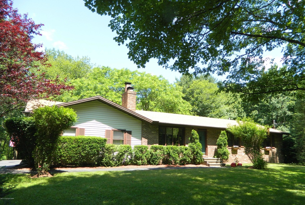
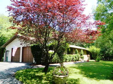
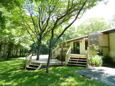
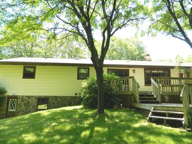
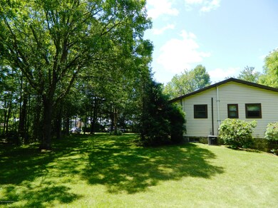
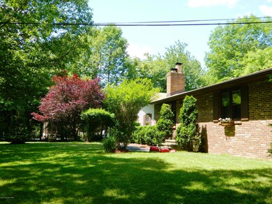
Great 4 Bedroom 3 Bath House. Brick, stone and vinyl exterior. Two wooded and landscaped acres. Really well kept and shows pride of ownership. Formal Dining Room with sliders to two decks. Stone Fireplace in Living. Wooden Doors and Moldings. Brick Fireplace in Family Room. Master Suite with tile bath. Main bath in hallway between the other two bedrooms. Third full bath on lower level off the family/recreation room. Unfinished portion of basement has cement floor shelving for storage, a utility sink and door to the backyard. Two deck areas. Overside two-car garage and fully paved driveway. Great Location...close to highways, shopping, gourmet dining, golfing, fishing, hiking, skiing and all of the amenities the Pocono Mountains has to offer. Two miles from Mt. Airy Lodge.
Last Agent to Sell the Property
Jane Bartholomew, Associate Broker
Classic Properties - Mountainhome License #AB050483L Listed on: 06/21/2013
| Date | Buyer | Sale Price | Title Company |
|---|---|---|---|
| Truskowski Andrew S | $175,000 | None Available | |
| Ferraz Jorge | -- | None Available |
| Date | Status | Borrower | Loan Amount |
|---|---|---|---|
| Open | Truskowski Andrew S | $136,500 |
| Date | Event | Price | List to Sale | Price per Sq Ft |
|---|---|---|---|---|
| 09/27/2013 09/27/13 | Sold | $175,000 | -2.2% | $75 / Sq Ft |
| 08/06/2013 08/06/13 | Pending | -- | -- | -- |
| 06/21/2013 06/21/13 | For Sale | $179,000 | -- | $76 / Sq Ft |
| Year | Tax Paid | Tax Assessment Tax Assessment Total Assessment is a certain percentage of the fair market value that is determined by local assessors to be the total taxable value of land and additions on the property. | Land | Improvement |
|---|---|---|---|---|
| 2025 | $984 | $145,460 | $28,730 | $116,730 |
| 2024 | $766 | $145,460 | $28,730 | $116,730 |
| 2023 | $3,617 | $145,460 | $28,730 | $116,730 |
| 2022 | $3,552 | $145,460 | $28,730 | $116,730 |
| 2021 | $3,552 | $145,460 | $28,730 | $116,730 |
| 2020 | $3,099 | $145,460 | $28,730 | $116,730 |
| 2019 | $5,533 | $25,090 | $3,320 | $21,770 |
| 2018 | $4,122 | $25,090 | $3,320 | $21,770 |
| 2017 | $4,172 | $25,090 | $3,320 | $21,770 |
| 2016 | $728 | $25,090 | $3,320 | $21,770 |
| 2015 | -- | $25,090 | $3,320 | $21,770 |
| 2014 | -- | $25,090 | $3,320 | $21,770 |
J
Seller's Agent in 2013
Jane Bartholomew, Associate Broker
Classic Properties - Mountainhome

Buyer's Agent in 2013
Bet Hays
Realty Executives - Stroudsburg
(570) 236-9082
28 Total Sales
Source: Pocono Mountains Association of REALTORS®
MLS Number: PM-2750
APN: 11.5.1.28-2
Disclaimer: Certain information contained herein is derived from information provided by parties other than Homes.com. All information provided is deemed reliable, but is not guaranteed to be accurate and should be independently verified.
![]() The data relating to real estate for sale on this web site includes listings held by MLS-IDX Participants of the Internet Data Exchange program of the Multiple Listing Service of the Pocono Mountains Association of Realtors®. Listings marked with the Internet Data Exchange logo are not necessarilty the listings of the owner of this web site. All listing data is the copyrighted property of the aforesaid Associations and its MLS-IDX Participants with all rights reserved. The information contained herein is believed to be accurate, but no warranty as such is expressed or implied.
The data relating to real estate for sale on this web site includes listings held by MLS-IDX Participants of the Internet Data Exchange program of the Multiple Listing Service of the Pocono Mountains Association of Realtors®. Listings marked with the Internet Data Exchange logo are not necessarilty the listings of the owner of this web site. All listing data is the copyrighted property of the aforesaid Associations and its MLS-IDX Participants with all rights reserved. The information contained herein is believed to be accurate, but no warranty as such is expressed or implied.