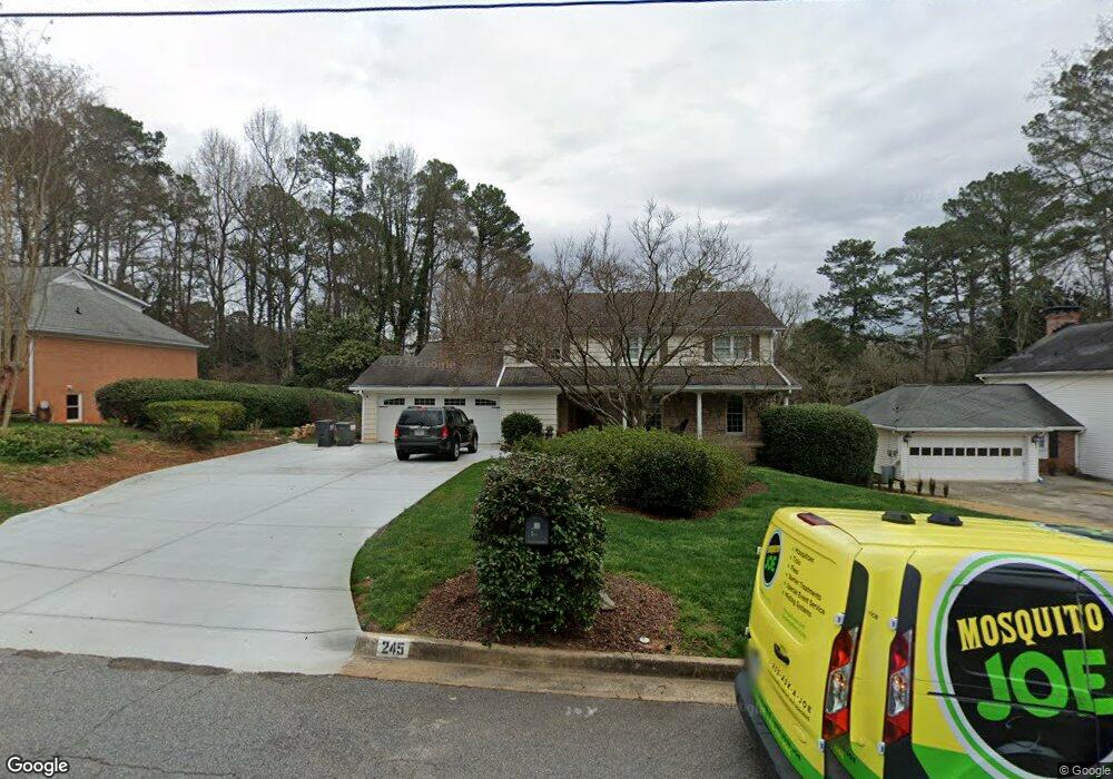
245 Stone Mill Trail NE Atlanta, GA 30328
Estimated Value: $674,000 - $815,000
4
Beds
3
Baths
2,922
Sq Ft
$264/Sq Ft
Est. Value
About This Home
This home is located at 245 Stone Mill Trail NE, Atlanta, GA 30328 and is currently estimated at $770,339, approximately $263 per square foot. 245 Stone Mill Trail NE is a home located in Fulton County with nearby schools including Spalding Drive Elementary School, Sandy Springs Middle School, and North Springs High School.
Ownership History
Date
Name
Owned For
Owner Type
Purchase Details
Closed on
Mar 24, 2006
Sold by
Cunningham Dena D Trust
Bought by
Toole Jason D and Santeiro-Toole Christina
Current Estimated Value
Home Financials for this Owner
Home Financials are based on the most recent Mortgage that was taken out on this home.
Original Mortgage
$31,000
Outstanding Balance
$17,582
Interest Rate
6.23%
Mortgage Type
New Conventional
Estimated Equity
$752,757
Create a Home Valuation Report for This Property
The Home Valuation Report is an in-depth analysis detailing your home's value as well as a comparison with similar homes in the area
Home Values in the Area
Average Home Value in this Area
Purchase History
| Date | Buyer | Sale Price | Title Company |
|---|---|---|---|
| Toole Jason D | $310,000 | -- |
Source: Public Records
Mortgage History
| Date | Status | Borrower | Loan Amount |
|---|---|---|---|
| Open | Toole Jason D | $31,000 |
Source: Public Records
Tax History Compared to Growth
Tax History
| Year | Tax Paid | Tax Assessment Tax Assessment Total Assessment is a certain percentage of the fair market value that is determined by local assessors to be the total taxable value of land and additions on the property. | Land | Improvement |
|---|---|---|---|---|
| 2025 | $5,235 | $265,200 | $82,240 | $182,960 |
| 2023 | $7,492 | $265,440 | $97,200 | $168,240 |
| 2022 | $4,940 | $233,080 | $63,640 | $169,440 |
| 2021 | $4,907 | $228,480 | $67,200 | $161,280 |
| 2020 | $4,933 | $204,120 | $41,600 | $162,520 |
| 2019 | $4,854 | $200,520 | $40,880 | $159,640 |
| 2018 | $5,370 | $195,840 | $39,920 | $155,920 |
| 2017 | $4,806 | $159,200 | $33,400 | $125,800 |
| 2016 | $4,775 | $159,200 | $33,400 | $125,800 |
| 2015 | $4,790 | $159,200 | $33,400 | $125,800 |
| 2014 | $4,694 | $147,680 | $30,960 | $116,720 |
Source: Public Records
Map
Nearby Homes
- 250 Stone Mill Trail NE
- 6825 Sunny Brook Ln NE
- 6771 Sunny Brook Ln NE
- 960 Lost Forest Dr NW
- 6700 Roswell Rd Unit 7D
- 6700 Roswell Rd Unit 24E
- 6700 Roswell Rd Unit 31B
- 6700 Roswell Rd Unit 13A
- 6700 Roswell Rd Unit 33E
- 6700 Roswell Rd Unit 22B
- 6900 Roswell Rd Unit G1
- 6900 Roswell Rd Unit F6
- 6900 Roswell Rd Unit Q26
- 6900 Roswell Rd Unit F8
- 6900 Roswell Rd Unit 7N
- 6900 Roswell Rd Unit 10Q
- 6900 Roswell Rd Unit 5G
- 6900 Roswell Rd Unit G5
- 615 Mark Trail Ct NW
- 255 Stone Mill Trail NE
- 235 Stone Mill Trail NE
- 265 Stone Mill Trail NE
- 225 Stone Mill Trail NE
- 6820 Sunny Brook Ln NE
- 6810 Sunny Brook Ln NE
- 6800 Sunny Brook Ln NE
- 240 Stone Mill Trail NE
- 260 Stone Mill Trail NE
- 275 Stone Mill Trail NE
- 215 Stone Mill Trail NE
- 216 Brook Dr
- 230 Stone Mill Trail NE
- 6840 Sunny Brook Ln NE
- 6815 Wright Rd NE
- 230 Brook Dr
- 0 Brook Dr NE Unit 7407726
- 0 Brook Dr NE Unit 3150200
- 0 Brook Dr NE Unit 8342316
- 0 Brook Dr NE Unit 7245936