Estimated Value: $272,000 - $351,000
3
Beds
2
Baths
1,576
Sq Ft
$189/Sq Ft
Est. Value
About This Home
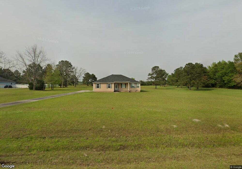
This home is located at 245 Virginia Cir, Cairo, GA 39828 and is currently estimated at $297,848, approximately $188 per square foot. 245 Virginia Cir is a home located in Grady County.
Ownership History
Date
Name
Owned For
Owner Type
Purchase Details
Closed on
Jun 11, 2009
Sold by
Wilson Stuart B
Bought by
Hubbard Nina B
Current Estimated Value
Home Financials for this Owner
Home Financials are based on the most recent Mortgage that was taken out on this home.
Original Mortgage
$169,650
Outstanding Balance
$106,971
Interest Rate
4.79%
Mortgage Type
Construction
Estimated Equity
$190,877
Purchase Details
Closed on
Jun 27, 2007
Sold by
M & S Properties Of Grady
Bought by
Wilson Stuart B and Wilson Kelli L
Purchase Details
Closed on
Jul 7, 2004
Bought by
M & S Properties
Create a Home Valuation Report for This Property
The Home Valuation Report is an in-depth analysis detailing your home's value as well as a comparison with similar homes in the area
Purchase History
| Date | Buyer | Sale Price | Title Company |
|---|---|---|---|
| Hubbard Nina B | $16,000 | -- | |
| Wilson Stuart B | $41,800 | -- | |
| M & S Properties | -- | -- |
Source: Public Records
Mortgage History
| Date | Status | Borrower | Loan Amount |
|---|---|---|---|
| Open | Hubbard Nina B | $169,650 |
Source: Public Records
Tax History
| Year | Tax Paid | Tax Assessment Tax Assessment Total Assessment is a certain percentage of the fair market value that is determined by local assessors to be the total taxable value of land and additions on the property. | Land | Improvement |
|---|---|---|---|---|
| 2025 | $1,816 | $97,882 | $17,416 | $80,466 |
| 2024 | $1,816 | $89,780 | $17,416 | $72,364 |
| 2023 | $1,692 | $56,967 | $3,400 | $53,567 |
| 2022 | $1,692 | $56,967 | $3,400 | $53,567 |
| 2021 | $1,698 | $56,967 | $3,400 | $53,567 |
| 2020 | $1,703 | $56,967 | $3,400 | $53,567 |
| 2019 | $1,703 | $56,967 | $3,400 | $53,567 |
| 2018 | $1,657 | $56,967 | $3,400 | $53,567 |
| 2017 | $1,577 | $56,967 | $3,400 | $53,567 |
| 2016 | $1,343 | $48,202 | $12,000 | $36,202 |
| 2015 | $1,121 | $40,748 | $6,248 | $34,500 |
| 2014 | $1,123 | $40,748 | $6,248 | $34,500 |
| 2013 | -- | $38,678 | $6,248 | $32,430 |
Source: Public Records
Map
Nearby Homes
- 254 Virginia Cir
- 225 Virginia Cir
- 105 Poplar Ln
- 212 Virginia Cir
- 268 Virginia Cir
- 125 Poplar Ln
- 104 Poplar Ln
- 198 Virginia Cir
- 211 Virginia Cir
- 1208 Pierce Chapel Rd
- 116 Poplar Ln
- 1222 Pierce Chapel Rd
- 1198 Pierce Chapel Rd
- 282 Virginia Cir
- 135 Poplar Ln
- 184 Virginia Cir
- 1182 Pierce Chapel Rd
- 189 Virginia Cir
- Lot 9 Pierce Chapel Rd
- 000 Pierce Chapel Rd Unit 8
Your Personal Tour Guide
Ask me questions while you tour the home.