Estimated Value: $131,000 - $202,000
3
Beds
1
Bath
1,196
Sq Ft
$149/Sq Ft
Est. Value
About This Home
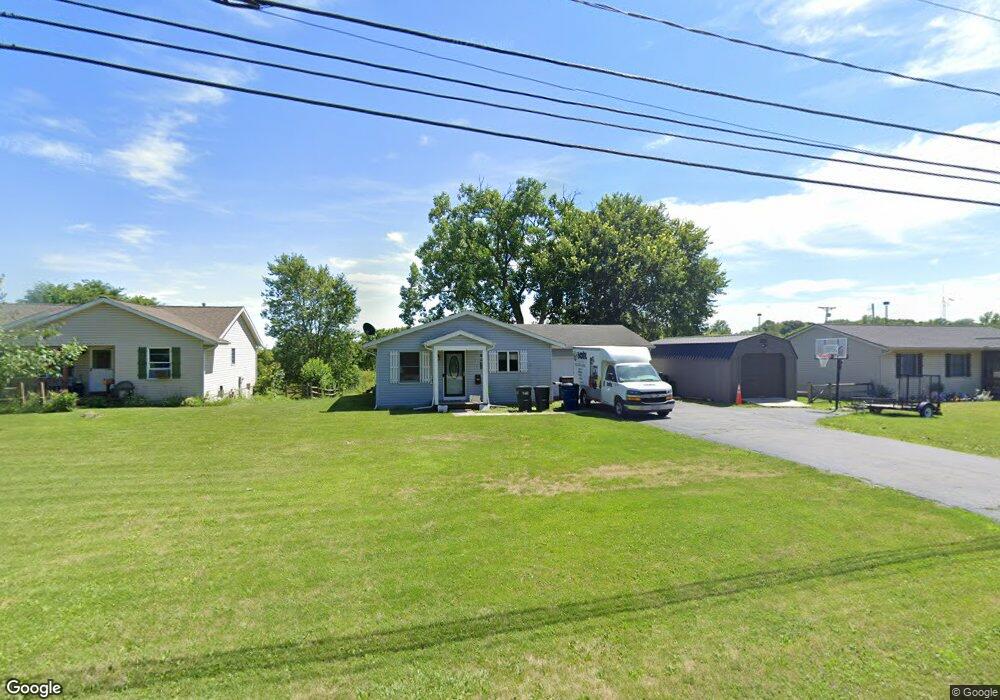
This home is located at 245 W Main St, Delta, OH 43515 and is currently estimated at $178,647, approximately $149 per square foot. 245 W Main St is a home located in Fulton County with nearby schools including Delta Elementary School, Pike-Delta-York Middle School, and Pike-Delta-York High School.
Ownership History
Date
Name
Owned For
Owner Type
Purchase Details
Closed on
May 13, 2010
Sold by
Wilson Lester M
Bought by
Johnson Jessica
Current Estimated Value
Home Financials for this Owner
Home Financials are based on the most recent Mortgage that was taken out on this home.
Original Mortgage
$88,350
Outstanding Balance
$59,938
Interest Rate
5.3%
Mortgage Type
New Conventional
Estimated Equity
$118,709
Purchase Details
Closed on
Apr 9, 1996
Sold by
Stevens Teresa
Bought by
Wilson Lester M and Wilson Maxine R
Purchase Details
Closed on
Jan 12, 1995
Bought by
Stevens Teresa
Home Financials for this Owner
Home Financials are based on the most recent Mortgage that was taken out on this home.
Original Mortgage
$58,800
Interest Rate
9.23%
Mortgage Type
New Conventional
Purchase Details
Closed on
Jan 1, 1990
Bought by
Stevens Teresa
Create a Home Valuation Report for This Property
The Home Valuation Report is an in-depth analysis detailing your home's value as well as a comparison with similar homes in the area
Home Values in the Area
Average Home Value in this Area
Purchase History
| Date | Buyer | Sale Price | Title Company |
|---|---|---|---|
| Johnson Jessica | $93,000 | Attorney | |
| Wilson Lester M | $82,500 | -- | |
| Stevens Teresa | $69,150 | -- | |
| Stevens Teresa | -- | -- |
Source: Public Records
Mortgage History
| Date | Status | Borrower | Loan Amount |
|---|---|---|---|
| Open | Johnson Jessica | $88,350 | |
| Previous Owner | Stevens Teresa | $58,800 |
Source: Public Records
Tax History Compared to Growth
Tax History
| Year | Tax Paid | Tax Assessment Tax Assessment Total Assessment is a certain percentage of the fair market value that is determined by local assessors to be the total taxable value of land and additions on the property. | Land | Improvement |
|---|---|---|---|---|
| 2024 | $2,476 | $58,520 | $9,380 | $49,140 |
| 2023 | $2,476 | $58,520 | $9,380 | $49,140 |
| 2022 | $2,551 | $45,890 | $7,810 | $38,080 |
| 2021 | $2,591 | $45,890 | $7,810 | $38,080 |
| 2020 | $2,622 | $45,890 | $7,810 | $38,080 |
| 2019 | $2,302 | $41,480 | $7,810 | $33,670 |
| 2018 | $2,187 | $41,480 | $7,810 | $33,670 |
| 2017 | $2,159 | $41,480 | $7,810 | $33,670 |
| 2016 | $2,081 | $35,880 | $7,810 | $28,070 |
| 2015 | $1,994 | $35,880 | $7,810 | $28,070 |
| 2014 | $1,990 | $35,880 | $7,810 | $28,070 |
| 2013 | $1,933 | $35,180 | $6,090 | $29,090 |
Source: Public Records
Map
Nearby Homes
- 106 Adrian St
- 308 Monroe St
- 421 Providence St
- 434 Monroe St
- 413 Fernwood St
- 452 Monroe St
- 305 Mckinley St
- 518 Providence St
- 500 Sandalwood Ln
- 600 Fernwood St
- 701 Palmwood St
- 703 Linwood Ave
- 929 Linwood Ave
- 11 Meadow Lane Dr
- 9163 County Road F
- 5390 County Road D
- 7852 County Road C
- 7620 County Road 12
- 7373 County Road 12
- 6854 County Road 3
- 243 W Main St
- 247 W Main St
- 6956 County Road Fg
- 241 W Main St
- 6944 County Road Fg
- 0 Airport Hwy Unit 6020863
- 0 Airport Hwy Unit 5005870
- 0 Airport Hwy Unit 5025051
- 0 Airport Hwy Unit 5045243
- 0 Airport Hwy Unit 5074079
- 0 Airport Hwy Unit 5098990
- 239 W Main St
- 239 W Main St
- 239 W Main St Unit A
- 237 W Main St
- 301 W Main St
- 233 W Main St
- 231 W Main St
- 0 Co Rd Fg Unit 5005869
- 229 W Main St